2020s Maps of Shirley Township, Pennsylvania
Explore 5 historic maps of Shirley Township from the 2020s. These maps offer a rare glimpse into what life looked like during the 2020s — showing old roads, neighborhoods, homes, and landmarks that have changed or disappeared over time.
Whether you're researching your family's past, planning a metal detecting trip, or studying how Shirley Township's landscape evolved across the 2020s, these high-resolution maps are a powerful tool for exploring the history of this region.
- Focus on a specific era: All maps on this page are from the 2020s, giving you a focused view of this time period.
- See what’s changed: Compare century-old streets, trails, and buildings to today's modern landscape using overlays and satellite layers.
- Research with precision: Use these maps for genealogy, historical research, land use analysis, or educational projects.
- View, download, or print: Maps are fully viewable online in high resolution, and can be downloaded or printed for your own records.
Start exploring Shirley Township's history through authentic maps from the 2020s. This is your window into the past.
Shirley Township, PA maps
(5)- 2023 Map of Mount Union, 2023 Print
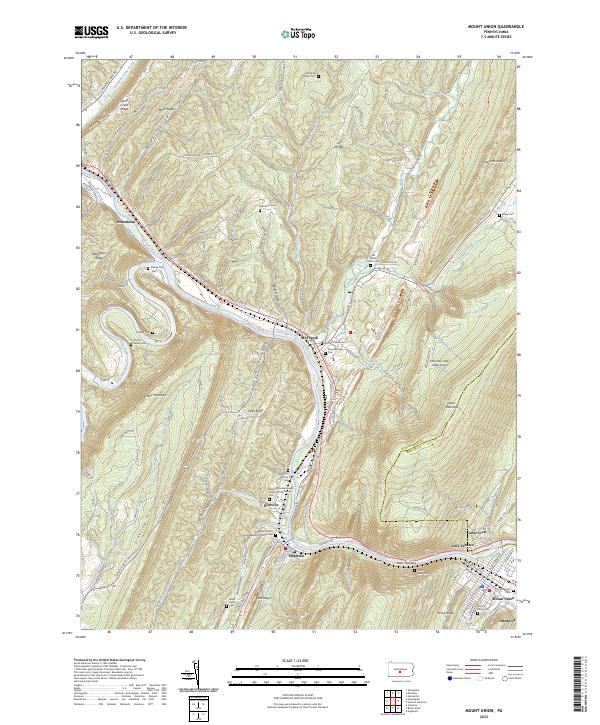 2023 Mount Union2023 Print · USGSThe Juniata River gap at Jacks Narrows defines this central Pennsylvania landscape during the early twenty-first century. Genealogists can trace family footprints at the Old White Church Cem, Hampson Family Cem, and the industrial site at Lucy Furnace.
 - 2023 Map of Aughwick, 2023 Print
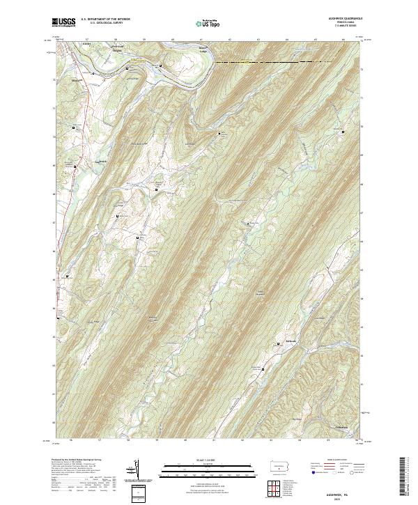 2023 Aughwick2023 Print · USGSHuntingdon County's ridge-and-valley landscape is mapped here in detail, showing the rural communities along the Juniata River and Aughwick Creek. Researchers can locate numerous family burial grounds including McGarvey Cem, Shope Cem, and the Otelia Mennonite Church Cem.
 - 2023 Map of Blairs Mills, 2023 Print
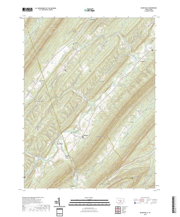 2023 Blairs Mills2023 Print · USGSThe Ridge-and-Valley province of central Pennsylvania appears in high detail, showing the rural communities between Tuscarora Mountain and Shade Mountain. Genealogists can trace early homesteads through burial sites like Upper Tuscarora Presbyterian Cem and Polk Cem near Blairs Mills.
 - 2023 Map of Butler Knob, 2023 Print
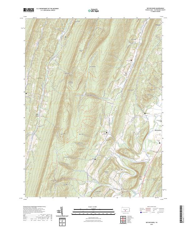 2023 Butler Knob2023 Print · USGSThe ridges and valleys of Huntingdon County are captured here in the early twenty-first century, showing a landscape defined by gaps and agricultural hollows. Genealogists can trace numerous local burial grounds including Dell Family Cem, Ricketts Cem, and Gilboa Cem.
 - 2023 Map of Newton Hamilton, 2023 Print
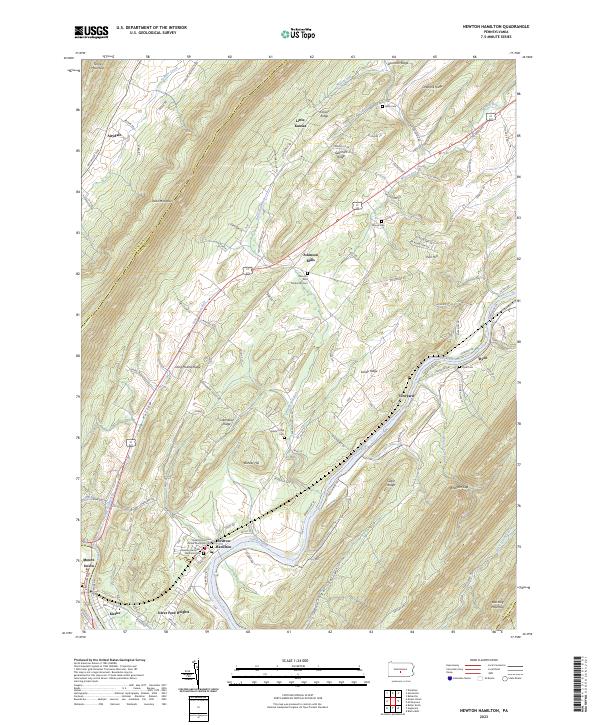 2023 Newton Hamilton2023 Print · USGSThe Juniata River valley in Mifflin County remains a landscape defined by its deep ridges and river-bend settlements in this recent survey. Genealogists can locate family names at the Newton Hamilton Memorial Cem, trace the grounds of Heister's Mill, or explore the rural layout of Atkinson Mills.
End of results
Showing maps 1-5 of 5
Top cities near Shirley Township
- Huntingdon historical maps
- Granville Township historical maps
- Mount Union historical maps
- Lurgan Township historical maps
- Menno Township historical maps
- Metal Township historical maps
See more
Top neighborhoods of Shirley Township
Frequently asked questions
- What are the different types of historical maps available for Shirley Township?
- What is the oldest map of Shirley Township?
- Where can I purchase historical maps of Shirley Township for my home or office?
- Where can I download high-res historical maps of Shirley Township?
- Are there historical topographic maps available for Shirley Township?
- Is there historical aerial imagery available for Shirley Township?
- Where are historical maps of Shirley Township sourced from?