Old Maps of Black Lick Township, Pennsylvania
Explore 25 old maps of Black Lick Township, spanning from 1900 to today. These high-resolution historic maps reveal how streets, neighborhoods, landmarks, and natural features evolved over time — perfect for genealogy, metal detecting, research, and local history exploration.
What you can do with these maps:
- See how Black Lick Township changed over time: Compare historical maps to modern-day views to trace roads, homesites, rail lines & more.
- View detailed metadata: Each map includes creators, publishers, year, scale, and archive source.
- Overlay maps with satellite & LiDAR: Visualize the past alongside modern tools to explore terrain & human change.
- Trusted historical sources: Maps sourced from the USGS, Library of Congress, and other archives.
- Access maps your way: View online, download high-res files, or order prints for personal or research use.
Start exploring old maps of Black Lick Township to uncover forgotten places, hidden landmarks, and the deep history beneath your feet.
Black Lick Township, PA maps
(25)- 1900 Map of Latrobe, 1958 Print
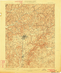
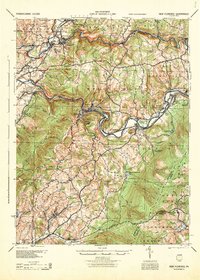
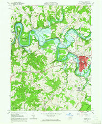
 1900 Latrobe1958 Print · USGSThe industrial heart of Westmoreland County is shown at a pivotal moment when the coal and coke industry was reshaping the land. Genealogists and historians can trace the early layouts of Latrobe, Derry, and Blairsville alongside company towns like Whitney and Baggaley.
 - 1902 Map of Latrobe
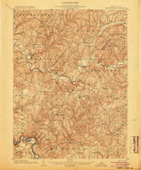
 1902 Latrobe1902 Print · USGSWestmoreland County at the opening of the twentieth century was a powerhouse of the American coal and coke industry. Genealogists and industrial historians can trace the early rail networks of the Main Line and locate landmark sites like the St Vincent Monastery and various Coke Ovens.
 - 1902 Map of Indiana
 1902 Indiana1902 Print · USGSIndiana County at the turn of the century shows a landscape of growing rail towns and rural farmsteads connected by the Pennsylvania Railroad. Researchers can trace ancestral roots through vanished crossroads and early industrial sites like Homer, Mechanicsburg, and Graceton.8 unique versions available
 - 1902 Map of Elders Ridge, 1957 Print
 1902 Elders Ridge1957 Print · USGSWestern Pennsylvania at the turn of the century reveals a landscape of deep valleys and rising industrial rail lines. Genealogists can trace family roots through rural hubs like Brick Church, Elderton, and the namesake village of Elders Ridge.2 unique versions available
 - 1903 Map of Latrobe, 1905 Print
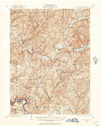
 1903 Latrobe1905 Print · USGSWestmoreland County at the turn of the century reveals a landscape defined by the arrival of heavy industry and the winding Conemaugh River. Genealogists can locate family landmarks from the Coke Ovens at Crabtree to the grounds of St. Vincent.6 unique versions available
 - 1904 Map of Elders Ridge
 1904 Elders Ridge1904 Print · USGSArmstrong and Indiana Counties are shown here during the early 1900s, when the river-and-rail economy dominated the valley floor. Researchers can trace ancestral roots through rural hamlets like Elders Ridge, Cochran Mills, and Shelocta, or follow the Western Pennsylvania Division (P. R. R.) along the Kiskiminitas River.5 unique versions available
 - 1920 Map of New Florence, 1958 Print
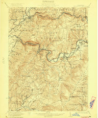
 1920 New Florence1958 Print · USGSThe Conemaugh River valley at the dawn of the 1920s shows a landscape defined by the PENNSYLVANIA RR and industrial coal towns. Genealogists can locate family homesteads near dozens of named country schools like Wallace School or trace the old Lincoln Highway through Armagh.
 - 1921 Map of New Florence
 1921 New Florence1921 Print · USGSWestmoreland and Indiana counties are captured in the early 1920s as industrial rail corridors and the Lincoln Highway begin to modernize the rural landscape. Genealogists can locate family landmarks like Campbell's Mill, the Centerville Huff PO, and several country schools including Robbs School.
 - 1922 Map of New Florence
 1922 New Florence1922 Print · USGSWestern Pennsylvania in the early 1920s shows a landscape of river-carved ridges and busy rail corridors connecting coal and quarry towns. Genealogists can trace family footprints across dozens of rural schools and stations like Lockport Station, Centerville (Huff PO), and Grafton.5 unique versions available
 - 1944 Map of New Florence
 1944 New Florence1944 Print · USGSWestmoreland and Indiana counties during the wartime years reveal a landscape shaped by coal, steam, and rail. Genealogists can trace family footprints in vanished settlements and school districts like Robindale Smokeless PO, Scottglen Sta, and Mahan Sch.
 - 1953 Map of Pittsburgh
 1953 Pittsburgh1953 Print · USGSWestern Pennsylvania's industrial landscape at the start of the fifties shows the steel and rail corridors between Pittsburgh and Altoona. Trace family roots in river towns like Tarentum or follow the Pennsylvania Turnpike across Laurel Hill.
 - 1954 Map of Pittsburgh
 1954 Pittsburgh1954 Print · USGSWestern Pennsylvania in the early fifties remains a powerhouse of heavy industry and vital transit corridors. Genealogists and historians can trace the rail-and-river network connecting Pittsburgh, Johnstown, and Altoona via the Pennsylvania RR and the Lincoln Highway.2 unique versions available
 - 1958 Map of Pittsburgh
 1958 Pittsburgh1958 Print · USGSWestern Pennsylvania in the late fifties shows an industrial heartland defined by the confluence of the Allegheny River and Monongahela River. Researchers can trace the sprawling rail networks of the Pennsylvania RR and find established towns like Butler, Latrobe, and Windber.5 unique versions available
 - 1959 Map of Pittsburgh
 1959 Pittsburgh1959 Print · USGSWestern Pennsylvania in the late fifties is captured here at the height of its industrial era. Genealogists and historians can trace the riverfront growth of Pittsburgh, the rail works at Altoona, and the mountain gaps of Laurel Hill.
 - 1963 Map of Indiana, 1965 Print
 1963 Indiana1965 Print · USGSIndiana County in the early sixties is a landscape shaped by coal mining and a complex rail network. Genealogists and local historians can trace the foundations of Homer City and Lucerne Mines, or locate the Willard Orphanage County Home.4 unique versions available
 - 1964 Map of Pittsburgh
 1964 Pittsburgh1964 Print · USGSWestern Pennsylvania in the late fifties and early sixties shows a landscape of powerful river industries and expanding highways. Genealogists and historians can trace the rail corridors of the Pennsylvania RR through industrial hubs like Johnstown, Altoona, and Nanty Glo.
 - 1964 Map of Bolivar, 1966 Print
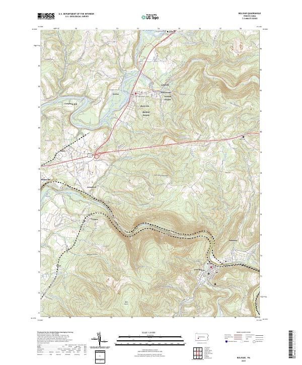
 1964 Bolivar1966 Print · USGSThe Conemaugh River valley in the early sixties shows a landscape defined by industrial extraction and rail transit. Genealogists can locate family names and sites near Black Lick, Josephine, and the Torrance State Hospital.6 unique versions available
 - 1964 Map of Mc Intyre, 1966 Print
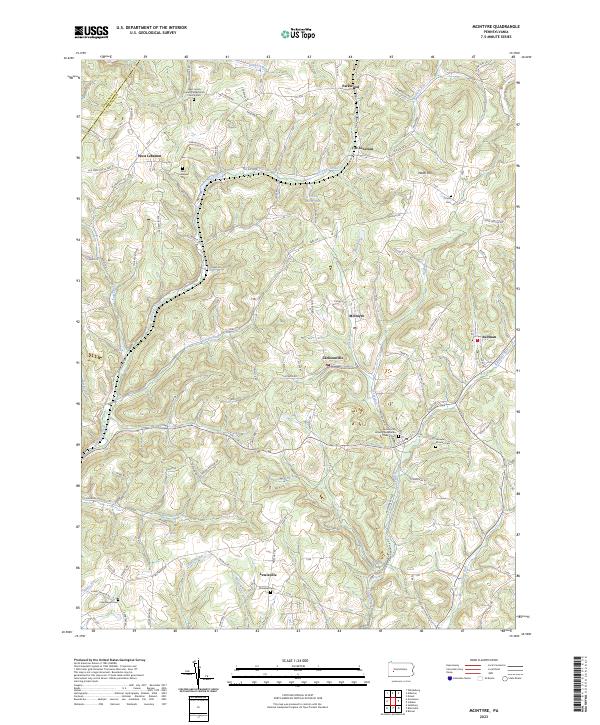
 1964 Mc Intyre1966 Print · USGSIndiana and Armstrong counties in the mid-sixties reveal a landscape defined by coal and gas extraction. Genealogists and historians can trace the rail-linked mining towns of Mc Intyre and Coal Run or locate the West Lebanon Cem and Ebenezer Ch.4 unique versions available
 - 1964 Map of Blairsville, 1966 Print
 1964 Blairsville1966 Print · USGSThe Conemaugh River valley was a hub of transit and industry in the early sixties, where the steel rails of the Pennsylvania Railroad met the coal mines of Derry. Genealogists can trace family names at Livermore Cem or locate old community landmarks like Old Salem Ch and the Torrance State Hospital.5 unique versions available
 - 1983 Map of Indiana
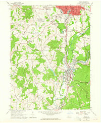
 1983 Indiana1983 Print · USGSWestern Pennsylvania in the early eighties shows a landscape of industrial river towns and expanding university campuses. Genealogists can trace family roots through Lucernemines and Spring Church, or locate ancestors in Oakland Cemetery.
 - 1986 Map of Pittsburgh East
 1986 Pittsburgh East1986 Print · USGSWestern Pennsylvania in the mid-eighties shows a landscape defined by industrial rivers and rising mountain ridges. Trace the dense rail networks of CONRAIL and the Pittsburgh and Lake Erie RR connecting historic centers like Monessen, Jeannette, and Connellsville.3 unique versions available
 - 2023 Map of McIntyre, 2023 Print
 2023 McIntyre2023 Print · USGSIndiana County's coal and rail country is detailed here during the early twenty-first century. Genealogists can trace family roots at Ebenezer Cem or explore the settlements of Jacksonville and West Lebanon.
 - 2023 Map of Bolivar, 2023 Print
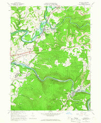
 2023 Bolivar2023 Print · USGSThe Conemaugh River valley at the Indiana and Westmoreland county line reveals a landscape of industrial river towns and steep ridges. Researchers can trace local lineage through the Bolivar Old Town Cem or explore the geography of Black Lick and the Conemaugh Water Gap.
 - 2023 Map of Indiana, 2023 Print
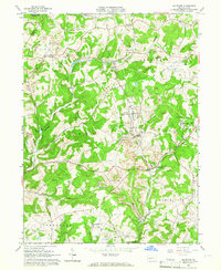
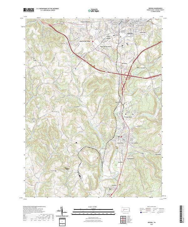 2023 Indiana2023 Print · USGSIndiana and its surrounding mining communities are captured here in the early twenty-first century as the landscape reflects both academic and industrial growth. Genealogists and local historians can trace family locations at Lucerne Mines, Coy Junction, and the Bethel Presbyterian Church Cem.
 - 2023 Map of Blairsville, 2023 Print
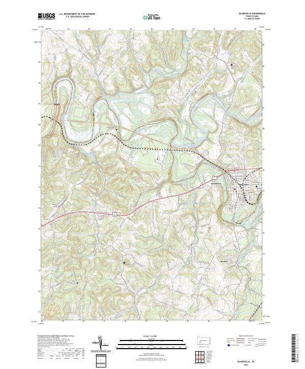 2023 Blairsville2023 Print · USGSThe Conemaugh River valley at the Indiana and Westmoreland county line reveals a landscape of riverfront towns and historic cemeteries. Genealogists can trace family names at Blairsville Cemetery or find smaller settlements like Bairdstown and Brenizer.
End of results
Showing maps 1-25 of 25
Top cities near Black Lick Township
- White historical maps
- Indiana historical maps
- Latrobe historical maps
- Blairsville historical maps
- Rayne Township historical maps
- Derry historical maps
See more
Top neighborhoods of Black Lick Township
Frequently asked questions
- What are the different types of historical maps available for Black Lick Township?
- What is the oldest map of Black Lick Township?
- Where can I purchase historical maps of Black Lick Township for my home or office?
- Where can I download high-res historical maps of Black Lick Township?
- Are there historical topographic maps available for Black Lick Township?
- Is there historical aerial imagery available for Black Lick Township?
- Where are historical maps of Black Lick Township sourced from?