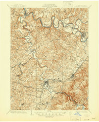
1900 Map of Latrobe
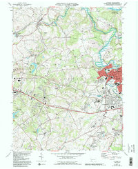
USGS Topo · Published 1958About this map
Latrobe and the surrounding industrial landscapes of Westmoreland County are recorded here at the turn of the century, a period of intensive development driven by the region's coal and coke production. The influence of the Pennsylvania Railroad is pervasive, its Main Line and various spurs connecting company towns like Hostetter, Humphreys, and Baggaley to the larger markets. Beyond the industrial corridors, the map traces older footprints of settlement, including the historic site of Hannastown and the religious and educational centers at St Vincent and St Xavier. The winding courses of the Conemaugh River and Loyalhanna Creek dictate the local topography, carving through the ridges where the Northern Turnpike and Philadelphia and Pittsburgh Pike once served as primary westward arteries. This survey documents the specific moment when traditional agriculture was rapidly being eclipsed by the heavy infrastructure of the steel and coal era.
Find a feature on this map
64 named features on this map. Tap any name to fly to it.
Don’t see what you’re looking for? This feature index may not catch every label — zoom into the map to look around manually.
Map Details
Editions of this 1900 Latrobe Map
This is the sole edition of this map. No revisions or reprints were ever made.
Historical Maps of White Through Time
5 maps found