1970s Maps of Lackawanna County, Pennsylvania
Explore 5 historic maps of Lackawanna County from the 1970s. These maps offer a rare glimpse into what life looked like during the 1970s — showing old roads, neighborhoods, homes, and landmarks that have changed or disappeared over time.
Whether you're researching your family's past, planning a metal detecting trip, or studying how Lackawanna County's landscape evolved across the 1970s, these high-resolution maps are a powerful tool for exploring the history of this region.
- Focus on a specific era: All maps on this page are from the 1970s, giving you a focused view of this time period.
- See what’s changed: Compare century-old streets, trails, and buildings to today's modern landscape using overlays and satellite layers.
- Research with precision: Use these maps for genealogy, historical research, land use analysis, or educational projects.
- View, download, or print: Maps are fully viewable online in high resolution, and can be downloaded or printed for your own records.
Start exploring Lackawanna County's history through authentic maps from the 1970s. This is your window into the past.
Lackawanna County, PA maps
(5)- 1976 Map of Tobyhanna, 1978 Print
 1976 Tobyhanna1978 Print · USGSThe Monroe County landscape near the border of Lackawanna County is shown through detailed 1970s aerial photography. Researchers can examine the physical layout of Tobyhanna and Gouldsboro or trace the water levels of Tobyhanna Lake.
 - 1976 Map of Pleasant View Summit, 1979 Print
 1976 Pleasant View Summit1979 Print · USGSLuzerne County's forested heights and river valleys are captured in this mid-seventies aerial survey. Local historians can trace the early footprints of Stoddartsville and Shades Glen along the course of the Lehigh River.
 - 1976 Map of Avoca, 1979 Print
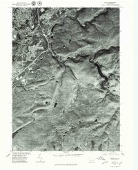 1976 Avoca1979 Print · USGSThe Lackawanna River valley in the mid-1970s shows a landscape of dense river towns and upland clearings. Researchers can trace the residential grids of Old Forge and Avoca or the winding course of Spring Brook.
 - 1976 Map of Thornhurst, 1979 Print
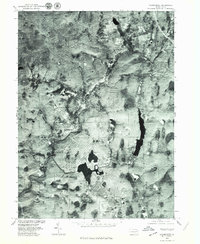 1976 Thornhurst1979 Print · USGSThe Lehigh Valley highlands are captured in the mid-seventies, showing the intersection of river geography and mountain development. Local historians can trace the settlement footprints of Thornhurst and Clifton or the shorelines of Bradys Lake and Arrowhead Lake.2 unique versions available
 - 1976 Map of Pittston, 1979 Print
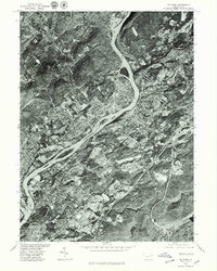 1976 Pittston1979 Print · USGSThe Wyoming Valley comes into sharp focus in the mid-1970s, showcasing the urban density along the Susquehanna River. Trace the industrial footprint of Pittston and Wilkes-Barre or locate family properties in Swoyersville.
End of results
Showing maps 1-5 of 5
Top cities of Lackawanna County
- Scranton historical maps
- Dunmore historical maps
- Carbondale historical maps
- Old Forge historical maps
- Blakely historical maps
- Archbald historical maps
See more
Frequently asked questions
- What are the different types of historical maps available for Lackawanna County?
- What is the oldest map of Lackawanna County?
- Where can I purchase historical maps of Lackawanna County for my home or office?
- Where can I download high-res historical maps of Lackawanna County?
- Are there historical topographic maps available for Lackawanna County?
- Is there historical aerial imagery available for Lackawanna County?
- Where are historical maps of Lackawanna County sourced from?