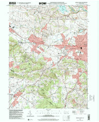
Old Maps of East Cocalico Township, Pennsylvania
Explore 40 old maps of East Cocalico Township, spanning from 1902 to today. These high-resolution historic maps reveal how streets, neighborhoods, landmarks, and natural features evolved over time — perfect for genealogy, metal detecting, research, and local history exploration.
What you can do with these maps:
- See how East Cocalico Township changed over time: Compare historical maps to modern-day views to trace roads, homesites, rail lines & more.
- View detailed metadata: Each map includes creators, publishers, year, scale, and archive source.
- Overlay maps with satellite & LiDAR: Visualize the past alongside modern tools to explore terrain & human change.
- Trusted historical sources: Maps sourced from the USGS, Library of Congress, and other archives.
- Access maps your way: View online, download high-res files, or order prints for personal or research use.
Start exploring old maps of East Cocalico Township to uncover forgotten places, hidden landmarks, and the deep history beneath your feet.
East Cocalico Township, PA maps
(40)- 1902 Map of Wernersville
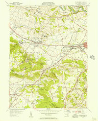
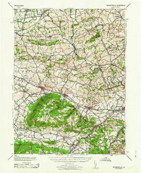
 1902 Wernersville1902 Print · USGSBerks and Lebanon counties at the start of the twentieth century show a landscape defined by industrial rail lines and agricultural valleys. Trace family roots at the Orphans Home or locate landmarks like Krick's Mill and Eagle Peak.8 unique versions available
 - 1906 Map of New Holland, 1962 Print
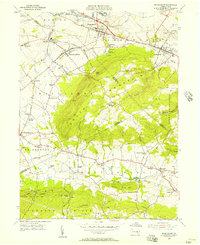
 1906 New Holland1962 Print · USGSLancaster County at the start of the twentieth century shows a landscape transitioning from turnpikes to electric railways. Genealogists can trace family roots through an extensive network of rural landmarks, including Heller Church, Red Well School, and the early Waterworks at Ephrata.
 - 1908 Map of New Holland
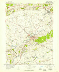
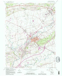
 1908 New Holland1908 Print · USGSLancaster County at the turn of the century shows a thriving landscape of rural schoolhouses and turnpike villages. Genealogists can locate family landmarks like Middle Creek Church, Heller Church, and dozens of local schools from Stony Hill School to Clay School.6 unique versions available
 - 1941 Map of New Holland
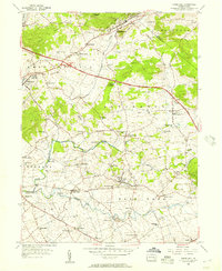
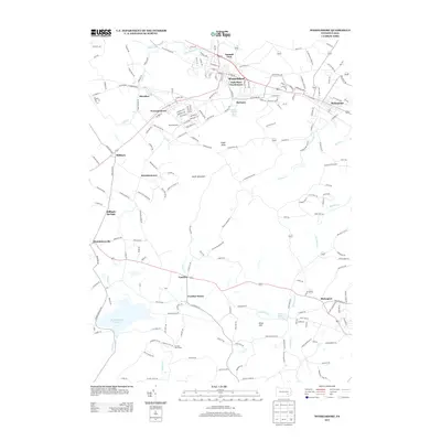
 1941 New Holland1941 Print · USGSLancaster County’s agricultural heartland is documented here just as the modern highway era arrived. Genealogists and local historians can trace family locations through dozens of named rural landmarks like Heller Church, Fetter School, and the Pennsylvania RR corridor.
 - 1943 Map of Wernersville
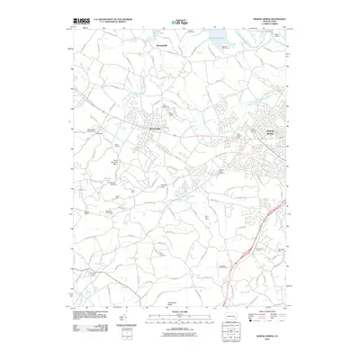
 1943 Wernersville1943 Print · USGSSoutheastern Pennsylvania farmland and rail towns are captured here during the wartime era, showing the intersection of Berks, Lebanon, and Lancaster counties. Genealogists and local researchers can trace historic institutions like Bethany Orphans Home or the Blue Meeting House.2 unique versions available
 - 1950 Map of Harrisburg, 1952 Print
 1950 Harrisburg1952 Print · USGSMid-century Central Pennsylvania comes alive through its dense rail networks and river valley settlements during the post-war industrial era. Genealogists and historians can trace family roots through hubs like Harrisburg, locate Carlisle Barracks, or follow the Pennsylvania RR through the Lebanon Valley.
 - 1953 Map of Wernersville
 1953 Wernersville1953 Print · USGSBerks and Lebanon counties are shown in detail during the early 1950s, highlighting a landscape of institutional growth and deep-rooted rural settlements. Genealogists can locate family landmarks like the Bethany Orphans Home, Kricks Mill, and the Blue Meeting House.
 - 1955 Map of Sinking Spring, 1956 Print
 1955 Sinking Spring1956 Print · USGSBerks and Lancaster counties are shown during a period of steady mid-century growth along the Reading railroad line. Researchers can trace the layout of the Wernersville State Hospital or locate historic local churches like Hains Ch and Olive Leaf Chapel.6 unique versions available
 - 1955 Map of Womelsdorf, 1957 Print
 1955 Womelsdorf1957 Print · USGSMid-century Berks and Lebanon Counties are shown here at a time when mountain missions and traditional farmstead life still defined the landscape. You can trace the READING railroad line through Robesonia or locate historic sites like St Daniels Ch, the Bethany Orphan Home, and the Texter Mission.6 unique versions available
 - 1956 Map of Terre Hill, 1957 Print
 1956 Terre Hill1957 Print · USGSMid-century Lancaster County is captured here at the meeting of tradition and transit, just as the turnpike began reshaping the countryside. Genealogists can trace family roots through numerous local landmarks like Wide Hollow Sch, Red Run Ch, and the many small crossroads settlements like Fivepointville.6 unique versions available
 - 1956 Map of Ephrata, 1957 Print
 1956 Ephrata1957 Print · USGSMid-century Lancaster County comes to life through this survey of the boroughs and rural townships north of Lancaster. Genealogists and historians can trace family-named landmarks like Durlach Cem or locate community hubs such as Vogansville Sch and Zion Ch.5 unique versions available
 - 1957 Map of Harrisburg
 1957 Harrisburg1957 Print · USGSMid-century Central Pennsylvania comes into focus as a bustling network of rail, river, and mountain ridges. Genealogists and historians can trace the development of the State Capitol and surrounding hubs like Middletown, Columbia, and Pottsville.7 unique versions available
 - 1961 Map of Harrisburg
 1961 Harrisburg1961 Print · USGSCentral Pennsylvania is shown at a mid-century peak of industrial and military activity, from the Susquehanna water gaps to the fertile Dutch Country. Genealogists and historians can trace the rail corridors of the Pennsylvania RR and find landmarks like Carlisle Barracks or the Anthracite Coal Fields.2 unique versions available
 - 1963 Map of Wernersville
 1963 Wernersville1963 Print · USGSBerks County and Lebanon County are captured here in the early 1960s, showing a landscape defined by ridgelines and Pennsylvania Dutch heritage. Researchers can trace historic local institutions like the Bethany Orphans Home, the Jesuit College, and the winding Reading RR.
 - 1964 Map of Harrisburg
 1964 Harrisburg1964 Print · USGSCentral Pennsylvania in the mid-fifties reveals a landscape shaped by ridge-and-valley geology and critical Cold War infrastructure. Researchers can trace the massive Indiantown Gap Military Reservation or the rail corridors of the Pennsylvania RR and Reading RR.
 - 1984 Map of Harrisburg, 1985 Print
 1984 Harrisburg1985 Print · USGSCentral Pennsylvania in the mid-eighties shows a landscape defined by the winding Susquehanna River and the industrial growth of its river towns. Researchers can trace the rail corridors of Amtrak and Conrail or explore the bounds of Fort Indiantown Gap Military Reservation.2 unique versions available
 - 1992 Map of Ephrata, 1995 Print
 1992 Ephrata1995 Print · USGSLancaster County's northern townships appear here during a period of sustained growth, balancing industrial rail access with traditional rural crossroads. Researchers can locate dozens of historic landmarks, from the Reading RR lines in Denver to local congregational sites like Steinmetz Ch and St Pauls Ch.
 - 1999 Map of Terre Hill, 2001 Print
 1999 Terre Hill2001 Print · USGSNortheastern Lancaster County at the end of the century retains its traditional rural layout despite the path of the Pennsylvania Turnpike. Genealogists and historians can trace numerous local landmarks including Salem Cem, Reddenbach Ch, and the many schools of East Earl.
 - 1999 Map of Ephrata, 2001 Print
 1999 Ephrata2001 Print · USGSNorthern Lancaster County at the turn of the millennium shows a blend of growing boroughs and deep-rooted rural townships. Researchers can trace historic family landmarks through sites like Mellingers Ch, Hans Graf Sch, and Fairview Cem.
 - 1999 Map of Sinking Spring, 2001 Print
 1999 Sinking Spring2001 Print · USGSSinking Spring and the South Mountain slopes are shown at the turn of the millennium, as suburban expansion meets historic institutions. Researchers can trace the grounds of the Wernersville State Hospital, old burial sites like Pleasant View Cem, and the path of the CONRAIL line.
 - 2010 Map of Ephrata, 2010 Print
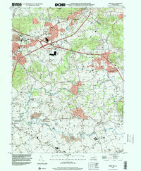
 2010 Ephrata2010 Print · USGSCovers East Cocalico Township, including Ephrata, Clay Township, and other nearby areas
 - 2010 Map of Womelsdorf, 2010 Print
 2010 Womelsdorf2010 Print · USGSCovers East Cocalico Township, including Clay Township, Womelsdorf, and other nearby areas
 - 2010 Map of Terre Hill, 2010 Print
 2010 Terre Hill2010 Print · USGSCovers East Cocalico Township, including East Earl Township, Adamstown, and other nearby areas
 - 2010 Map of Sinking Spring, 2010 Print
 2010 Sinking Spring2010 Print · USGSCovers East Cocalico Township, including Sinking Spring, Wernersville, and other nearby areas
 - 2013 Map of Womelsdorf, 2013 Print
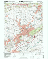
 2013 Womelsdorf2013 Print · USGSCovers East Cocalico Township, including Clay Township, Womelsdorf, and other nearby areas
Showing maps 1-25 of 40
Top cities near East Cocalico Township
- Reading historical maps
- Lancaster historical maps
- Muhlenberg Park historical maps
- West Lampeter Township historical maps
- Ephrata historical maps
- Wyomissing historical maps
See more
Top neighborhoods of East Cocalico Township
- Reamstown historical maps
- Napiersville historical maps
- Swartzville historical maps
- Vera Cruz historical maps
- Stonecrest Village historical maps
- Stoney Pointe historical maps
Frequently asked questions
- What are the different types of historical maps available for East Cocalico Township?
- What is the oldest map of East Cocalico Township?
- Where can I purchase historical maps of East Cocalico Township for my home or office?
- Where can I download high-res historical maps of East Cocalico Township?
- Are there historical topographic maps available for East Cocalico Township?
- Is there historical aerial imagery available for East Cocalico Township?
- Where are historical maps of East Cocalico Township sourced from?