Old Maps of Lehigh County, Pennsylvania
Explore 126 old maps of Lehigh County, spanning from 1888 to today. These high-resolution historic maps reveal how streets, neighborhoods, landmarks, and natural features evolved over time — perfect for genealogy, metal detecting, research, and local history exploration.
What you can do with these maps:
- See how Lehigh County changed over time: Compare historical maps to modern-day views to trace roads, homesites, rail lines & more.
- View detailed metadata: Each map includes creators, publishers, year, scale, and archive source.
- Overlay maps with satellite & LiDAR: Visualize the past alongside modern tools to explore terrain & human change.
- Trusted historical sources: Maps sourced from the USGS, Library of Congress, and other archives.
- Access maps your way: View online, download high-res files, or order prints for personal or research use.
Start exploring old maps of Lehigh County to uncover forgotten places, hidden landmarks, and the deep history beneath your feet.
Lehigh County, PA maps
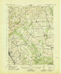
(126)- 1888 Map of Quakertown, 1963 Print
 1888 Quakertown1963 Print · USGSBucks and Montgomery counties are shown in high detail during the railroad era, when rural life centered on mill streams and village junctions. Genealogists can trace family roots through settlements like Richlandtown, Dillingersville, and the transit hub at Rocky Ridge Sta.
 - 1890 Map of Quakertown
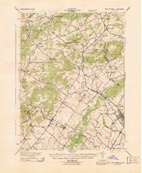
 1890 Quakertown1890 Print · USGSUpper Bucks and Montgomery counties are shown in the 1880s as a thriving corridor of rail towns and rural villages. Researchers can trace the original routes of the Perkasie and Sellersville settlements or locate family homesteads near Trumbauersville and Tylers Port.
 - 1894 Map of Allentown
 1894 Allentown1894 Print · USGSThe Lehigh Valley's industrial heartland is caught in a moment of rapid Victorian-era growth along the river and canal corridor. Genealogists and local historians can trace the early footprints of Allentown and Nazareth, or locate vanished rail stops along the Lehigh Valley R.R. and Central R.R. of N.J.10 unique versions available
 - 1894 Map of Quakertown
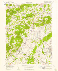
 1894 Quakertown1894 Print · USGSSoutheast Pennsylvania at the close of the nineteenth century reveals a flourishing landscape of rail-linked villages and fertile creek valleys. Genealogists can trace family roots through dozens of named settlements like Trumbauersville, Zion Hill, and Applebachsville.9 unique versions available
 - 1902 Map of Boyertown
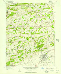
 1902 Boyertown1902 Print · USGSSoutheast Pennsylvania at the dawn of the century reveals an intricate landscape of iron-era settlements and early rail networks. Genealogists and historians can trace the foundations of Boyertown, locate rural landmarks like Landis Store, or follow the path of the Schuylkill Canal.9 unique versions available
 - 1902 Map of Slatington
 1902 Slatington1902 Print · USGSLehigh County's industrial and quarrying heart comes into focus at the dawn of the 1900s. Researchers can trace the path of the Lehigh Canal and locate family landmarks like Peters Store, Jordan Church, and the Consolidated Quarries.5 unique versions available
 - 1909 Map of Hamburg, 1957 Print
 1909 Hamburg1957 Print · USGSSchuylkill and Berks counties are captured here during the height of the steam era, showing the intricate relationship between the mountain gaps and the rail lines. Genealogists and researchers can trace old postal routes through Wessnersville Stony Run P O, locate the historic Five Locks, and identify family farms near Crystal Cave.
 - 1911 Map of Hamburg
 1911 Hamburg1911 Print · USGSBerks and Schuylkill counties are captured here at a peak of rail-driven rural life just before the Great War. Researchers can trace family roots through specific locales like New Ringgold, Dorset Sta, and the historic Five Locks along the Schuylkill River.5 unique versions available
 - 1922 Map of Mauch Chunk, 1952 Print
 1922 Mauch Chunk1952 Print · USGSThe industrial Lehigh Valley thrives in the early 1920s, dominated by the winding river and two major competing railroad lines. Genealogists can locate old rural landmarks like the Larrytown Poor Farm, Indian Hills School, and the busy rail hub of Mauch Chunk.2 unique versions available
 - 1924 Map of Mauch Chunk
 1924 Mauch Chunk1924 Print · USGSCarbon County in the early twenties is a landscape of industrial power and rural mountain life, dominated by the winding Lehigh River. Genealogists and historians can trace family roots through numerous small schools like Lentz School and old settlements from Mauch Chunk to Palmerton.4 unique versions available
 - 1937 Map of Allentown West
 1937 Allentown West1937 Print · USGSLehigh County at the end of the Depression era reveals a dense network of rural schoolhouses and crossroads hamlets before post-war expansion. Genealogists can trace family names at James Peters Sch or Heidelberg Sch, and locate landmarks like Schantz Spr and Rising Sun.
 - 1939 Map of Allentown
 1939 Allentown1939 Print · USGSThe Lehigh Valley thrives as an industrial and aviation hub in the mid-1930s, where rail lines and early airfields meet historic Pennsylvania townships. Researchers can trace family roots through dozens of rural landmarks like Washington Sch, Christian Springs, and the Vera Cruz Sta.4 unique versions available
 - 1942 Map of Norristown
 1942 Norristown1942 Print · USGSSoutheastern Pennsylvania at the onset of World War II shows a landscape of busy industrial river towns and expanding rail suburbs. Genealogists and historians can trace the early transit networks connecting Norristown, Doylestown, and the riverfront at New Hope.
 - 1942 Map of Allentown West
 1942 Allentown West1942 Print · USGSLehigh County during the early war years displays a landscape of industrial river towns and agrarian crossroads. Researchers can locate dozens of country schools like Snyder Sch, historic landmarks like Cedar Crest College, and the sprawling Trexler Game Preserve.3 unique versions available
 - 1943 Map of Mauch Chunk
 1943 Mauch Chunk1943 Print · USGSThe Lehigh River corridor is captured here during the mid-forties, showing the vital rail and industry centers of Carbon County. Genealogists and researchers can trace dozens of rural schoolhouses and family-named landmarks like the Larrytown Poor Farm, St Pauls Ch, and Three O'clock Spring.
 - 1943 Map of Milford Square
 1943 Milford Square1943 Print · USGSSoutheastern Pennsylvania's tri-county borderlands come to life in this mid-century survey. Genealogists can trace family roots through historic hamlets like Mumbauersville, Geryville, and the transit corridor of the Fogelsville Branch rail line.2 unique versions available
 - 1943 Map of East Greenville
 1943 East Greenville1943 Print · USGSSoutheast Pennsylvania at the height of the war years reveals a landscape of dense small settlements and rural industry. Genealogists and historians can trace family roots through the grids of East Greenville and Pennsburg or locate landmarks like Huffs Church and Seisholtzville.
 - 1943 Map of Bethlehem
 1943 Bethlehem1943 Print · USGSNorthampton and Lehigh counties hummed with industry and river commerce during the early war years. Researchers can trace the path of the Lehigh Valley RR, locate family-named landmarks like Chief Tatamy, and find rural schools such as Mexico School and Poplar Valley Sch.
 - 1944 Map of Newark, 1971 Print
 1944 Newark1971 Print · USGSThe industrial corridor from Philadelphia to New York was in a period of massive transition during the mid-forties. Genealogists and researchers can trace the rail lines of the Lehigh Valley RR, locate military installations like Picatinny Arsenal, and explore the early sprawl near Levittown.5 unique versions available
 - 1949 Map of Newark
 1949 Newark1949 Print · USGSThe industrial corridor between Philadelphia and New York comes alive in this post-war survey. Genealogists and historians can trace the massive rail networks of the Reading Railroad and locate major installations like Fort Dix or Picatinny Arsenal.2 unique versions available
 - 1956 Map of East Greenville
 1956 East Greenville1956 Print · USGSThe Upper Perkiomen Valley thrives in the mid-fifties, centered on the boroughs of East Greenville and Pennsburg along the Reading railroad. Genealogists and local historians can locate country landmarks like New Goshenhoppen Ch, Kings Highway Sch, and the Hosensack Sta.6 unique versions available
 - 1956 Map of Newark
 1956 Newark1956 Print · USGSThe industrial heart of the Mid-Atlantic is captured here at the dawn of the highway era, tracing the dense corridors between Newark and Philadelphia. Genealogists and local historians can map the rail networks of the Reading RR or locate mid-century military life at Fort Dix Military Reservation.2 unique versions available
 - 1956 Map of Kutztown, 1957 Print
 1956 Kutztown1957 Print · USGSMid-century Berks County comes into focus as a landscape of rural tradition and collegiate growth. Researchers can trace local heritage at Kutztown State Teachers College, explore family roots near New Jerusalem Ch, or locate the historic Dietrichs Mill Bridge along the creek.7 unique versions available
 - 1956 Map of New Ringgold, 1957 Print
 1956 New Ringgold1957 Print · USGSSchuylkill and Berks counties are captured here in the mid-fifties, showing a landscape of ridge-top trails and valley railroads. Genealogists and historians can trace family roots through the West Penn Ch Cem, numerous rural schoolhouses like Dorset Sch, and the quiet borough of New Ringgold.6 unique versions available
 - 1956 Map of New Tripoli, 1957 Print
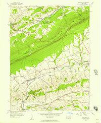 1956 New Tripoli1957 Print · USGSLehigh County's agricultural valleys and the ridge lines of BLUE MOUNTAIN are captured here in the mid-1950s. Researchers can trace the Reading railroad through Lynnport and Wanamakers or locate family sites near New Jerusalem Ch and Ontelaunee Park.7 unique versions available
Showing maps 1-25 of 126
Top cities of Lehigh County
- Allentown historical maps
- Emmaus historical maps
- Catasauqua historical maps
- Weisenberg Township historical maps
- Fountain Hill historical maps
- Slatington historical maps
See more
Frequently asked questions
- What are the different types of historical maps available for Lehigh County?
- What is the oldest map of Lehigh County?
- Where can I purchase historical maps of Lehigh County for my home or office?
- Where can I download high-res historical maps of Lehigh County?
- Are there historical topographic maps available for Lehigh County?
- Is there historical aerial imagery available for Lehigh County?
- Where are historical maps of Lehigh County sourced from?