Old Maps of Bear Creek Village, Luzerne County for Academic Research
Study the evolution of Bear Creek Village with 21 high-resolution historic maps. Whether you're teaching, researching, or modeling changes in land use, these maps provide essential visual documentation of urban, environmental, and geographic change.
- Analyze long-term change: Track patterns in development, transportation, and natural features.
- Ideal for environmental or urban studies: Support academic projects with primary historical map data.
- Use in the classroom or lab: Educators and researchers rely on these maps to bring historical context to life.
These maps are a powerful tool for teaching, research, and visualizing how Bear Creek Village has changed over the decades.
Bear Creek Village, Luzerne County maps
(21)- 1891 Map of Wilkesbarre
 1891 Wilkesbarre1891 Print · USGSCovers Bear Creek Village, including Wilkes-Barre, Nanticoke, and other nearby areas2 unique versions available
 - 1894 Map of Wilkesbarre
 1894 Wilkesbarre1894 Print · USGSCovers Bear Creek Village, including Wilkes-Barre, Nanticoke, and other nearby areas8 unique versions available
 - 1922 Map of Stoddartsville, 1958 Print
 1922 Stoddartsville1958 Print · USGSCovers Bear Creek Village, including Clifton Township, Thornhurst Township, and other nearby areas2 unique versions available
 - 1924 Map of Stoddartsville
 1924 Stoddartsville1924 Print · USGSCovers Bear Creek Village, including Clifton Township, Thornhurst Township, and other nearby areas5 unique versions available
 - 1943 Map of Scranton
 1943 Scranton1943 Print · USGSCovers Bear Creek Village, including Scranton, Wilkes-Barre, and other nearby areas
 - 1943 Map of Stoddartsville
 1943 Stoddartsville1943 Print · USGSCovers Bear Creek Village, including Clifton Township, Thornhurst Township, and other nearby areas
 - 1947 Map of Wilkes-Barre East, 1959 Print
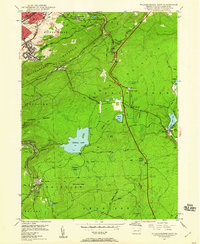 1947 Wilkes-Barre East1959 Print · USGSCovers Bear Creek Village, including Wilkes-Barre, Plains Township, and other nearby areas7 unique versions available
 - 1950 Map of Wilkes-Barre East
 1950 Wilkes-Barre East1950 Print · USGSCovers Bear Creek Village, including Wilkes-Barre, Plains Township, and other nearby areas2 unique versions available
 - 1950 Map of Scranton, 1952 Print
 1950 Scranton1952 Print · USGSCovers Bear Creek Village, including Ramapo, Clarkstown, and other nearby areas
 - 1953 Map of Scranton
 1953 Scranton1953 Print · USGSCovers Bear Creek Village, including Ramapo, Clarkstown, and other nearby areas
 - 1959 Map of Scranton
 1959 Scranton1959 Print · USGSCovers Bear Creek Village, including Ramapo, Clarkstown, and other nearby areas2 unique versions available
 - 1962 Map of Scranton, 1977 Print
 1962 Scranton1977 Print · USGSCovers Bear Creek Village, including Ramapo, Clarkstown, and other nearby areas2 unique versions available
 - 1965 Map of Scranton
 1965 Scranton1965 Print · USGSCovers Bear Creek Village, including Ramapo, Clarkstown, and other nearby areas2 unique versions available
 - 1965 Map of Pleasant View Summit, 1967 Print
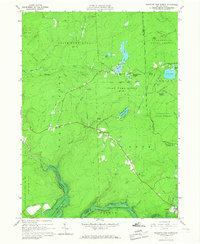 1965 Pleasant View Summit1967 Print · USGSCovers Bear Creek Village, including Thornhurst Township, Kidder Township, and other nearby areas4 unique versions available
 - 1976 Map of Pleasant View Summit, 1979 Print
 1976 Pleasant View Summit1979 Print · USGSCovers Bear Creek Village, including Thornhurst Township, Kidder Township, and other nearby areas
 - 1976 Map of Wilkes-Barre East, 1979 Print
 1976 Wilkes-Barre East1979 Print · USGSCovers Bear Creek Village, including Wilkes-Barre, Plains Township, and other nearby areas
 - 1986 Map of Scranton
 1986 Scranton1986 Print · USGSCovers Bear Creek Village, including Scranton, Wilkes-Barre, and other nearby areas2 unique versions available
 - 1992 Map of Pleasant View Summit, 1995 Print
 1992 Pleasant View Summit1995 Print · USGSCovers Bear Creek Village, including Thornhurst Township, Kidder Township, and other nearby areas
 - 1994 Map of Wilkes-Barre East, 1995 Print
 1994 Wilkes-Barre East1995 Print · USGSCovers Bear Creek Village, including Wilkes-Barre, Plains Township, and other nearby areas
 - 1997 Map of Pleasant View Summit, 1999 Print
 1997 Pleasant View Summit1999 Print · USGSCovers Bear Creek Village, including Thornhurst Township, Kidder Township, and other nearby areas
 - 1999 Map of Wilkes-Barre East, 2002 Print
 1999 Wilkes-Barre East2002 Print · USGSCovers Bear Creek Village, including Wilkes-Barre, Plains Township, and other nearby areas
End of results
Showing maps 1-21 of 21
Frequently asked questions
- What are the different types of historical maps available for Bear Creek Village?
- What is the oldest map of Bear Creek Village?
- Where can I purchase historical maps of Bear Creek Village for my home or office?
- Where can I download high-res historical maps of Bear Creek Village?
- Are there historical topographic maps available for Bear Creek Village?
- Is there historical aerial imagery available for Bear Creek Village?
- Where are historical maps of Bear Creek Village sourced from?