Old Maps of Black Creek Township, Pennsylvania for Hiking & Exploration
Hike through history with 39 historic maps of Black Creek Township. Explore old trails, ghost towns, and forgotten backroads — perfect for outdoor adventurers and local explorers.
- Rediscover forgotten places: Map out old mining camps, roads, and footpaths that no longer exist on modern maps.
- Layer with modern tools: Combine with LiDAR or satellite views to plan hikes through historical terrain.
- Made for exploration: Popular among hikers, overlanders, and local history lovers.
Use these maps to find adventure and explore the hidden past of Black Creek Township.
Black Creek Township, PA maps
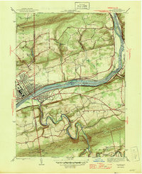
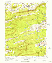
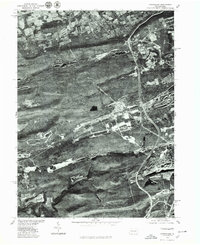
(39)- 1892 Map of Mahanoy
 1892 Mahanoy1892 Print · USGSSchuylkill and Luzerne counties are captured here at a peak of industrial development during the 1890s coal era. Researchers can trace the massive rail networks serving Shenandoah, Mahanoy City, and lost junctions like Silver Brook Junction.
 - 1893 Map of Mahanoy, 1898 Print
 1893 Mahanoy1898 Print · USGSSchuylkill and Luzerne counties are shown at the height of the coal era, revealing a landscape etched by mining and rail commerce. Genealogists and industrial historians can trace the specific neighborhoods of Shenandoah, Mahanoy City, and the railway junctions at Tamanend and Delano.7 unique versions available
 - 1894 Map of Shickshinny
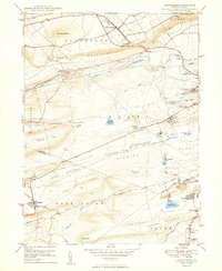
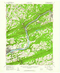
 1894 Shickshinny1894 Print · USGSLuzerne County at the height of the coal and canal era reveals a landscape shaped by river transport and mountain ridges. Trace the remnants of the Pennsylvania Canal and locate long-standing river crossings like Hicks Ferry and Beach Haven Ferry.6 unique versions available
 - 1946 Map of Berwick
 1946 Berwick1946 Print · USGSBerwick and the Susquehanna River valley are shown here in the mid-forties, highlighting a landscape of river-oriented industry and mountain-bound rural life. Genealogists can trace numerous local landmarks including Mt Zion Ch, Harter Sch, and the riverside community of Beach Haven.2 unique versions available
 - 1949 Map of Conyngham
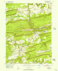
 1949 Conyngham1949 Print · USGSThe northern reaches of the coal country show a landscape shaped by ridge-traversing railroads and mining towns in the late 1940s. Genealogists can locate family sites in West Hazleton, Sheppton, or the colliery-linked Harwood (Harwood Mines PO).2 unique versions available
 - 1950 Map of Nuremberg
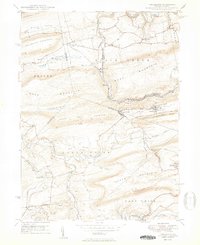 1950 Nuremberg1950 Print · USGSThe tri-county borderlands of Eastern Pennsylvania are captured here at the start of the 1950s. Genealogists can trace family names at Millers Corner and Raricks, or locate ancestors at the Nuremberg Cem and Mt Zion Ch.2 unique versions available
 - 1950 Map of Harrisburg, 1952 Print
 1950 Harrisburg1952 Print · USGSMid-century Central Pennsylvania comes alive through its dense rail networks and river valley settlements during the post-war industrial era. Genealogists and historians can trace family roots through hubs like Harrisburg, locate Carlisle Barracks, or follow the Pennsylvania RR through the Lebanon Valley.
 - 1954 Map of Williamsport
 1954 Williamsport1954 Print · USGSNorth-central Pennsylvania in the mid-fifties is defined by the winding West Branch Susquehanna River and its industrial valley. Local historians can trace the massive Susquehanna Ordnance Depot and the extensive rail networks of the Pennsylvania Railroad.
 - 1955 Map of Berwick, 1956 Print
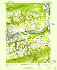 1955 Berwick1956 Print · USGSThe Susquehanna River valley thrives in the mid-fifties, showing the industrial heart of Berwick and its rail-connected neighbors. Genealogists can trace family roots through numerous local landmarks like Stone Ch, Hunter Sch, and Township School.6 unique versions available
 - 1955 Map of Conyngham, 1956 Print
 1955 Conyngham1956 Print · USGSThe anthracite coal fields of Luzerne and Schuylkill counties are shown here in the mid-fifties, just as strip mining began to reshape the ridges. Genealogists and historians can locate family homes in Oneida, Sheppton, or Kelayres, and trace the rail lines of the Reading and Lehigh Valley railroads.6 unique versions available
 - 1955 Map of Nuremberg, 1956 Print
 1955 Nuremberg1956 Print · USGSThe anthracite region near the Luzerne and Schuylkill border is shown here in the mid-1950s, highlighting the industrial rail network and hilltop mining towns. Researchers can trace family roots through sites like Nuremberg Cem, Zion Grove, and the mining village of Oneida.6 unique versions available
 - 1955 Map of Shickshinny, 1960 Print
 1955 Shickshinny1960 Print · USGSThe Susquehanna River valley and the anthracite coal region appear in fine detail during the mid-fifties. Researchers can trace old rail corridors, family cemeteries like St Alberts Cem, and smaller settlements such as Mocanaqua or Patterson Grove.
 - 1955 Map of Mahanoy, 1960 Print
 1955 Mahanoy1960 Print · USGSThe anthracite coalfields of Schuylkill County are shown in full industrial operation during the mid-1950s. Researchers can locate specific colliery sites and landmarks like Harwood, the Mahanoy Tunnel, and the lone Peddlars Grave.
 - 1957 Map of Harrisburg
 1957 Harrisburg1957 Print · USGSMid-century Central Pennsylvania comes into focus as a bustling network of rail, river, and mountain ridges. Genealogists and historians can trace the development of the State Capitol and surrounding hubs like Middletown, Columbia, and Pottsville.7 unique versions available
 - 1960 Map of Williamsport
 1960 Williamsport1960 Print · USGSNorth-central Pennsylvania in the mid-twentieth century was a vital corridor of rail and river industry stretching from the New York line to the coal regions. Genealogists can trace the rail networks of the Pennsylvania RR and Lehigh Valley RR connecting towns like Williamsport, Towanda, and Lock Haven.
 - 1961 Map of Harrisburg
 1961 Harrisburg1961 Print · USGSCentral Pennsylvania is shown at a mid-century peak of industrial and military activity, from the Susquehanna water gaps to the fertile Dutch Country. Genealogists and historians can trace the rail corridors of the Pennsylvania RR and find landmarks like Carlisle Barracks or the Anthracite Coal Fields.2 unique versions available
 - 1962 Map of Williamsport, 1966 Print
 1962 Williamsport1966 Print · USGSNorth-central Pennsylvania was a landscape of industrial river hubs and vast state woodlands in the early sixties. Researchers can trace the path of the Pennsylvania Railroad through Williamsport and explore the remote reaches of Bucktail State Park.5 unique versions available
 - 1964 Map of Harrisburg
 1964 Harrisburg1964 Print · USGSCentral Pennsylvania in the mid-fifties reveals a landscape shaped by ridge-and-valley geology and critical Cold War infrastructure. Researchers can trace the massive Indiantown Gap Military Reservation or the rail corridors of the Pennsylvania RR and Reading RR.
 - 1965 Map of Williamsport
 1965 Williamsport1965 Print · USGSNorth-central Pennsylvania in the mid-1960s is defined by the industrial river towns and vast timberlands of the Allegheny Plateau. Researchers can trace historic rail lines like the Erie Lackawanna and Reading as they thread through Williamsport, Lock Haven, and Jersey Shore.
 - 1966 Map of Williamsport
 1966 Williamsport1966 Print · USGSThe Susquehanna Valley was a hub of transit and industry in the mid-seventies, where the river's West Branch connected major college towns and timberlands. Researchers can trace historical rail lines like the Reading or locate regional landmarks from Jersey Shore to Ricketts Glen State Park.
 - 1976 Map of Nuremberg, 1979 Print
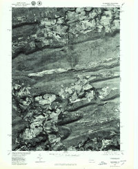 1976 Nuremberg1979 Print · USGSEastern Pennsylvania in the late seventies is shown in this aerial orthophotoquad of the anthracite coal region. Genealogists and local historians can trace the layouts of Nuremberg, Weston, and Rock Glen at the base of Buck Mountain.
 - 1976 Map of Conyngham, 1979 Print
 1976 Conyngham1979 Print · USGSLuzerne and Schuylkill counties are shown through detailed aerial imagery in the mid-1970s, revealing the intersection of industry and mountain settlement. Trace the exact layout of coal-region towns like Conyngham, Sheppton, and West Hazleton.
 - 1984 Map of Williamsport East, 1985 Print
 1984 Williamsport East1985 Print · USGSThe Susquehanna River valley and Allegheny highlands come together in this mid-eighties survey of central Pennsylvania. Trace family roots at Muncy Cem or locate institutional landmarks like Lycoming College and the State Correctional Institution at Retreat.2 unique versions available
 - 1984 Map of Sunbury, 1985 Print
 1984 Sunbury1985 Print · USGSPennsylvania coal country and the Susquehanna valley appear here in the early eighties, showcasing a landscape defined by industrial ridges and river towns. Genealogists and historians can trace rail corridors like Conrail and explore mountain settlements from Mahanoy City to Elizabethville.2 unique versions available
 - 2010 Map of Nuremberg, 2010 Print
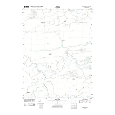 2010 Nuremberg2010 Print · USGSCovers Black Creek Township, including Monticello, Gowen, and other nearby areas
Showing maps 1-25 of 39
Top cities near Black Creek Township
- Hazleton historical maps
- Nanticoke historical maps
- Berwick historical maps
- Tamaqua historical maps
- Shenandoah historical maps
- Mahanoy City historical maps
See more
Top neighborhoods of Black Creek Township
- Rock Glen historical maps
- Weston historical maps
- Derringer historical maps
- Fern Glen historical maps
- Gowen historical maps
- Gum Run historical maps
See more
Frequently asked questions
- What are the different types of historical maps available for Black Creek Township?
- What is the oldest map of Black Creek Township?
- Where can I purchase historical maps of Black Creek Township for my home or office?
- Where can I download high-res historical maps of Black Creek Township?
- Are there historical topographic maps available for Black Creek Township?
- Is there historical aerial imagery available for Black Creek Township?
- Where are historical maps of Black Creek Township sourced from?