1970s Maps of Dorrance Township, Pennsylvania
Explore 4 historic maps of Dorrance Township from the 1970s. These maps offer a rare glimpse into what life looked like during the 1970s — showing old roads, neighborhoods, homes, and landmarks that have changed or disappeared over time.
Whether you're researching your family's past, planning a metal detecting trip, or studying how Dorrance Township's landscape evolved across the 1970s, these high-resolution maps are a powerful tool for exploring the history of this region.
- Focus on a specific era: All maps on this page are from the 1970s, giving you a focused view of this time period.
- See what’s changed: Compare century-old streets, trails, and buildings to today's modern landscape using overlays and satellite layers.
- Research with precision: Use these maps for genealogy, historical research, land use analysis, or educational projects.
- View, download, or print: Maps are fully viewable online in high resolution, and can be downloaded or printed for your own records.
Start exploring Dorrance Township's history through authentic maps from the 1970s. This is your window into the past.
Dorrance Township, PA maps
(4)- 1976 Map of Freeland, 1979 Print
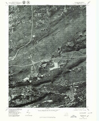 1976 Freeland1979 Print · USGSLuzerne County's ridges and valleys are shown in detail during the mid-seventies, highlighting the industrial-era settlement patterns of the anthracite region. Genealogists can trace the residential layouts of Freeland, Pardeesville, and Edgewood against the backdrop of Nescopeck Mountain.
 - 1976 Map of Sybertsville, 1979 Print
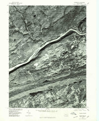
 1976 Sybertsville1979 Print · USGSLuzerne County land patterns appear in sharp detail through this mid-seventies aerial survey of the ridges and valleys south of Wilkes-Barre. Researchers can trace the layout of Sybertsville, Conyngham, and Hobbie against the massive wooded backdrop of Nescopeck Mountain.
 - 1976 Map of Wilkes-Barre West, 1979 Print
 1976 Wilkes-Barre West1979 Print · USGSThe Wyoming Valley's industrial corridor comes into focus in the late 1970s, showing the dense riverside development of the coal region. Trace the layout of boroughs like Plymouth and Sugar Notch or the high ridges of Penobscot Mountain.
 - 1976 Map of Nanticoke, 1979 Print
 1976 Nanticoke1979 Print · USGSLuzerne County's industrial heart is seen from above in the mid-1970s as coal operations and river towns define the landscape. Researchers can trace the massive mining footprints near Nanticoke and Glen Lyon or locate rural homesteads near Slocum Corners.
End of results
Showing maps 1-4 of 4
Top cities near Dorrance Township
- Wilkes-Barre historical maps
- Hazleton historical maps
- Kingston historical maps
- Nanticoke historical maps
- Plains Township historical maps
- Dallas Township historical maps
See more
Top neighborhoods of Dorrance Township
- Stairville historical maps
- Feys Grove historical maps
- Bliem Corners historical maps
- Springtown historical maps
Frequently asked questions
- What are the different types of historical maps available for Dorrance Township?
- What is the oldest map of Dorrance Township?
- Where can I purchase historical maps of Dorrance Township for my home or office?
- Where can I download high-res historical maps of Dorrance Township?
- Are there historical topographic maps available for Dorrance Township?
- Is there historical aerial imagery available for Dorrance Township?
- Where are historical maps of Dorrance Township sourced from?