Old Maps of Nescopeck Township, Pennsylvania
Explore 23 old maps of Nescopeck Township, spanning from 1894 to today. These high-resolution historic maps reveal how streets, neighborhoods, landmarks, and natural features evolved over time — perfect for genealogy, metal detecting, research, and local history exploration.
What you can do with these maps:
- See how Nescopeck Township changed over time: Compare historical maps to modern-day views to trace roads, homesites, rail lines & more.
- View detailed metadata: Each map includes creators, publishers, year, scale, and archive source.
- Overlay maps with satellite & LiDAR: Visualize the past alongside modern tools to explore terrain & human change.
- Trusted historical sources: Maps sourced from the USGS, Library of Congress, and other archives.
- Access maps your way: View online, download high-res files, or order prints for personal or research use.
Start exploring old maps of Nescopeck Township to uncover forgotten places, hidden landmarks, and the deep history beneath your feet.
Nescopeck Township, PA maps
(23)- 1894 Map of Shickshinny
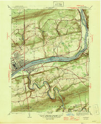
 1894 Shickshinny1894 Print · USGSLuzerne County at the height of the coal and canal era reveals a landscape shaped by river transport and mountain ridges. Trace the remnants of the Pennsylvania Canal and locate long-standing river crossings like Hicks Ferry and Beach Haven Ferry.6 unique versions available
 - 1946 Map of Sybertsville
 1946 Sybertsville1946 Print · USGSLuzerne County's rural townships are captured here just after the war, showing a landscape defined by small farms and local schoolhouses. Genealogists can trace family connections to landmarks like St Johns, Moyers Grove, and the Whitebread Sch.2 unique versions available
 - 1946 Map of Berwick
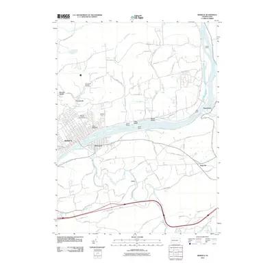
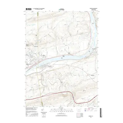
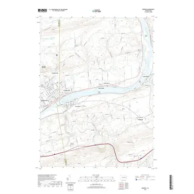
 1946 Berwick1946 Print · USGSBerwick and the Susquehanna River valley are shown here in the mid-forties, highlighting a landscape of river-oriented industry and mountain-bound rural life. Genealogists can trace numerous local landmarks including Mt Zion Ch, Harter Sch, and the riverside community of Beach Haven.2 unique versions available
 - 1954 Map of Williamsport
 1954 Williamsport1954 Print · USGSNorth-central Pennsylvania in the mid-fifties is defined by the winding West Branch Susquehanna River and its industrial valley. Local historians can trace the massive Susquehanna Ordnance Depot and the extensive rail networks of the Pennsylvania Railroad.
 - 1955 Map of Berwick, 1956 Print
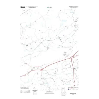
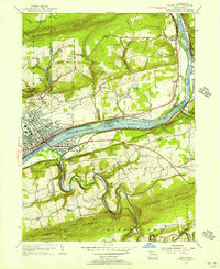 1955 Berwick1956 Print · USGSThe Susquehanna River valley thrives in the mid-fifties, showing the industrial heart of Berwick and its rail-connected neighbors. Genealogists can trace family roots through numerous local landmarks like Stone Ch, Hunter Sch, and Township School.6 unique versions available
 - 1955 Map of Sybertsville, 1957 Print
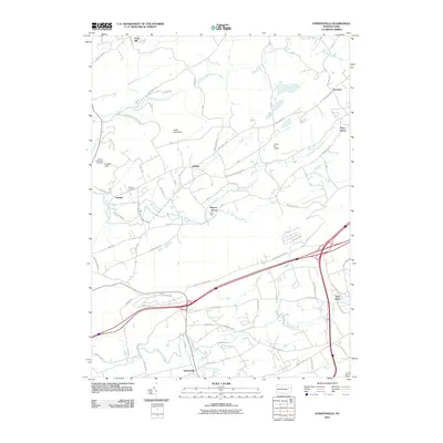
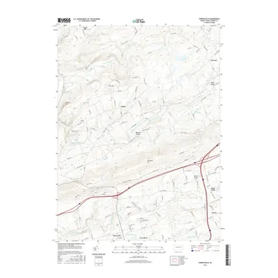
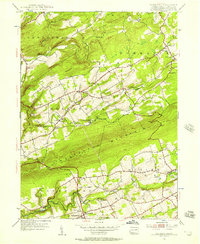 1955 Sybertsville1957 Print · USGSLuzerne County's rural townships are shown here in the mid-1950s, defined by the prominent ridge of Nescopeck Mountain. Genealogists and local historians can locate family-named sites such as Groover Cem and country landmarks like Brainerd Ch and the Township Sch.4 unique versions available
 - 1955 Map of Shickshinny, 1960 Print
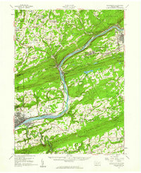 1955 Shickshinny1960 Print · USGSThe Susquehanna River valley and the anthracite coal region appear in fine detail during the mid-fifties. Researchers can trace old rail corridors, family cemeteries like St Alberts Cem, and smaller settlements such as Mocanaqua or Patterson Grove.
 - 1960 Map of Williamsport
 1960 Williamsport1960 Print · USGSNorth-central Pennsylvania in the mid-twentieth century was a vital corridor of rail and river industry stretching from the New York line to the coal regions. Genealogists can trace the rail networks of the Pennsylvania RR and Lehigh Valley RR connecting towns like Williamsport, Towanda, and Lock Haven.
 - 1962 Map of Williamsport, 1966 Print
 1962 Williamsport1966 Print · USGSNorth-central Pennsylvania was a landscape of industrial river hubs and vast state woodlands in the early sixties. Researchers can trace the path of the Pennsylvania Railroad through Williamsport and explore the remote reaches of Bucktail State Park.5 unique versions available
 - 1965 Map of Williamsport
 1965 Williamsport1965 Print · USGSNorth-central Pennsylvania in the mid-1960s is defined by the industrial river towns and vast timberlands of the Allegheny Plateau. Researchers can trace historic rail lines like the Erie Lackawanna and Reading as they thread through Williamsport, Lock Haven, and Jersey Shore.
 - 1966 Map of Williamsport
 1966 Williamsport1966 Print · USGSThe Susquehanna Valley was a hub of transit and industry in the mid-seventies, where the river's West Branch connected major college towns and timberlands. Researchers can trace historical rail lines like the Reading or locate regional landmarks from Jersey Shore to Ricketts Glen State Park.
 - 1976 Map of Sybertsville, 1979 Print
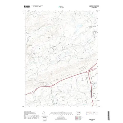
 1976 Sybertsville1979 Print · USGSLuzerne County land patterns appear in sharp detail through this mid-seventies aerial survey of the ridges and valleys south of Wilkes-Barre. Researchers can trace the layout of Sybertsville, Conyngham, and Hobbie against the massive wooded backdrop of Nescopeck Mountain.
 - 1984 Map of Williamsport East, 1985 Print
 1984 Williamsport East1985 Print · USGSThe Susquehanna River valley and Allegheny highlands come together in this mid-eighties survey of central Pennsylvania. Trace family roots at Muncy Cem or locate institutional landmarks like Lycoming College and the State Correctional Institution at Retreat.2 unique versions available
 - 2010 Map of Sybertsville, 2010 Print
 2010 Sybertsville2010 Print · USGSCovers Nescopeck Township, including Dorrance Township, Conyngham Township, and other nearby areas
 - 2010 Map of Berwick, 2010 Print
 2010 Berwick2010 Print · USGSCovers Nescopeck Township, including Berwick, Nescopeck, and other nearby areas
 - 2013 Map of Sybertsville, 2013 Print
 2013 Sybertsville2013 Print · USGSCovers Nescopeck Township, including Dorrance Township, Conyngham Township, and other nearby areas
 - 2013 Map of Berwick, 2013 Print
 2013 Berwick2013 Print · USGSCovers Nescopeck Township, including Berwick, Nescopeck, and other nearby areas
 - 2016 Map of Sybertsville, 2016 Print
 2016 Sybertsville2016 Print · USGSCovers Nescopeck Township, including Dorrance Township, Conyngham Township, and other nearby areas
 - 2016 Map of Berwick, 2016 Print
 2016 Berwick2016 Print · USGSCovers Nescopeck Township, including Berwick, Nescopeck, and other nearby areas
 - 2019 Map of Sybertsville, 2019 Print
 2019 Sybertsville2019 Print · USGSCovers Nescopeck Township, including Dorrance Township, Conyngham Township, and other nearby areas
 - 2019 Map of Berwick, 2019 Print
 2019 Berwick2019 Print · USGSCovers Nescopeck Township, including Berwick, Nescopeck, and other nearby areas
 - 2023 Map of Sybertsville, 2023 Print
 2023 Sybertsville2023 Print · USGSLuzerne County's ridge-and-valley landscape is documented here in the early twenty-first century, showing traditional crossroads settlements between the mountains. Genealogists and local historians can trace family sites at the Everard Family Cem, Old Mount Zion Cem, and the old church grounds at Hobbie.
 - 2023 Map of Berwick, 2023 Print
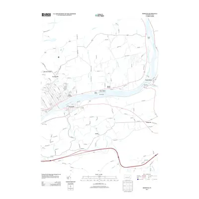
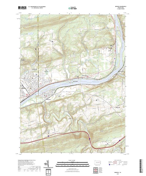 2023 Berwick2023 Print · USGSThe industrial corridor of the Susquehanna River comes into sharp focus in this recent survey of Berwick and Nescopeck. Genealogists can trace family plots at Garrison Memorial Cem and Mount Zion Cem, or explore rural reaches like Foundryville and Wapwallopen.
End of results
Showing maps 1-23 of 23
Top cities near Nescopeck Township
- Hazleton historical maps
- Nanticoke historical maps
- Berwick historical maps
- Tamaqua historical maps
- Shenandoah historical maps
- West Hazleton historical maps
See more
Top neighborhoods of Nescopeck Township
Frequently asked questions
- What are the different types of historical maps available for Nescopeck Township?
- What is the oldest map of Nescopeck Township?
- Where can I purchase historical maps of Nescopeck Township for my home or office?
- Where can I download high-res historical maps of Nescopeck Township?
- Are there historical topographic maps available for Nescopeck Township?
- Is there historical aerial imagery available for Nescopeck Township?
- Where are historical maps of Nescopeck Township sourced from?