1970s Maps of Sugarloaf Township, Pennsylvania
Explore 3 historic maps of Sugarloaf Township from the 1970s. These maps offer a rare glimpse into what life looked like during the 1970s — showing old roads, neighborhoods, homes, and landmarks that have changed or disappeared over time.
Whether you're researching your family's past, planning a metal detecting trip, or studying how Sugarloaf Township's landscape evolved across the 1970s, these high-resolution maps are a powerful tool for exploring the history of this region.
- Focus on a specific era: All maps on this page are from the 1970s, giving you a focused view of this time period.
- See what’s changed: Compare century-old streets, trails, and buildings to today's modern landscape using overlays and satellite layers.
- Research with precision: Use these maps for genealogy, historical research, land use analysis, or educational projects.
- View, download, or print: Maps are fully viewable online in high resolution, and can be downloaded or printed for your own records.
Start exploring Sugarloaf Township's history through authentic maps from the 1970s. This is your window into the past.
Sugarloaf Township, PA maps
(3)- 1976 Map of Nuremberg, 1979 Print
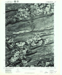 1976 Nuremberg1979 Print · USGSEastern Pennsylvania in the late seventies is shown in this aerial orthophotoquad of the anthracite coal region. Genealogists and local historians can trace the layouts of Nuremberg, Weston, and Rock Glen at the base of Buck Mountain.
 - 1976 Map of Sybertsville, 1979 Print
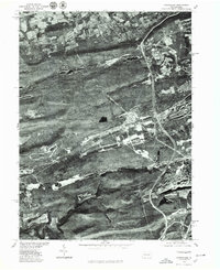
 1976 Sybertsville1979 Print · USGSLuzerne County land patterns appear in sharp detail through this mid-seventies aerial survey of the ridges and valleys south of Wilkes-Barre. Researchers can trace the layout of Sybertsville, Conyngham, and Hobbie against the massive wooded backdrop of Nescopeck Mountain.
 - 1976 Map of Conyngham, 1979 Print
 1976 Conyngham1979 Print · USGSLuzerne and Schuylkill counties are shown through detailed aerial imagery in the mid-1970s, revealing the intersection of industry and mountain settlement. Trace the exact layout of coal-region towns like Conyngham, Sheppton, and West Hazleton.
End of results
Showing maps 1-3 of 3
Top cities near Sugarloaf Township
- Wilkes-Barre historical maps
- Hazleton historical maps
- Nanticoke historical maps
- Berwick historical maps
- Tamaqua historical maps
- Shenandoah historical maps
See more
Top neighborhoods of Sugarloaf Township
- Dippel Manor historical maps
- Sybertsville historical maps
- Tomhicken historical maps
- College Crest Colony historical maps
Frequently asked questions
- What are the different types of historical maps available for Sugarloaf Township?
- What is the oldest map of Sugarloaf Township?
- Where can I purchase historical maps of Sugarloaf Township for my home or office?
- Where can I download high-res historical maps of Sugarloaf Township?
- Are there historical topographic maps available for Sugarloaf Township?
- Is there historical aerial imagery available for Sugarloaf Township?
- Where are historical maps of Sugarloaf Township sourced from?