1960s Maps of Gamble Township, Pennsylvania
Explore 10 historic maps of Gamble Township from the 1960s. These maps offer a rare glimpse into what life looked like during the 1960s — showing old roads, neighborhoods, homes, and landmarks that have changed or disappeared over time.
Whether you're researching your family's past, planning a metal detecting trip, or studying how Gamble Township's landscape evolved across the 1960s, these high-resolution maps are a powerful tool for exploring the history of this region.
- Focus on a specific era: All maps on this page are from the 1960s, giving you a focused view of this time period.
- See what’s changed: Compare century-old streets, trails, and buildings to today's modern landscape using overlays and satellite layers.
- Research with precision: Use these maps for genealogy, historical research, land use analysis, or educational projects.
- View, download, or print: Maps are fully viewable online in high resolution, and can be downloaded or printed for your own records.
Start exploring Gamble Township's history through authentic maps from the 1960s. This is your window into the past.
Gamble Township, PA maps
(10)- 1960 Map of Williamsport
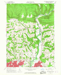
 1960 Williamsport1960 Print · USGSNorth-central Pennsylvania in the mid-twentieth century was a vital corridor of rail and river industry stretching from the New York line to the coal regions. Genealogists can trace the rail networks of the Pennsylvania RR and Lehigh Valley RR connecting towns like Williamsport, Towanda, and Lock Haven.
 - 1962 Map of Williamsport, 1966 Print
 1962 Williamsport1966 Print · USGSNorth-central Pennsylvania was a landscape of industrial river hubs and vast state woodlands in the early sixties. Researchers can trace the path of the Pennsylvania Railroad through Williamsport and explore the remote reaches of Bucktail State Park.5 unique versions available
 - 1965 Map of Williamsport
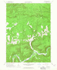
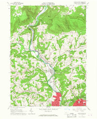
 1965 Williamsport1965 Print · USGSNorth-central Pennsylvania in the mid-1960s is defined by the industrial river towns and vast timberlands of the Allegheny Plateau. Researchers can trace historic rail lines like the Erie Lackawanna and Reading as they thread through Williamsport, Lock Haven, and Jersey Shore.
 - 1965 Map of Trout Run, 1967 Print
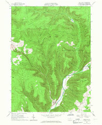 1965 Trout Run1967 Print · USGSLycoming County mountain life in the mid-sixties is centered on the rail-and-river corridor at Trout Run and Fields Station. Genealogists and historians can locate rural landmarks like Rose Valley Sch, Steam Valley Ch, and the winding Pennsylvania Railroad.3 unique versions available
 - 1965 Map of Bodines, 1967 Print
 1965 Bodines1967 Print · USGSLycoming County’s wooded ridges and creek valleys are captured in the mid-sixties, showing a landscape shaped by state forests and small rural outposts. Genealogists and hikers can trace local landmarks like the Beech Valley Cemetery, Hoffman Church, and the winding Pennsylvania Grade Road.3 unique versions available
 - 1965 Map of Barbours, 1967 Print
 1965 Barbours1967 Print · USGSLycoming County’s high ridges and creek valleys are documented here during the mid-sixties, as reforestation shaped the landscape. Genealogists and hikers can trace the roads around Barbours, find the Jefferson Sch, or locate the Lookout Tower on McIntyre Ridge.2 unique versions available
 - 1965 Map of Huntersville, 1967 Print
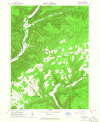
 1965 Huntersville1967 Print · USGSLycoming County in the mid-1960s reveals a landscape transitioning from the steep timberlands of Tiadaghton State Forest to the farm valleys of Muncy. Genealogists and historians can trace community roots through the Grange Hall, Huntersville Trinity Cem, and old crossroads like Dewey Corner.4 unique versions available
 - 1965 Map of Montoursville North, 1967 Print
 1965 Montoursville North1967 Print · USGSThe northern Lycoming County hills meet the Susquehanna valley in the mid-sixties, where the Tiadaghton State Forest transitions into growing residential areas. Local researchers can trace family roots at Quaker Hill Cem or locate community centers like the Township High Sch and Loyalsockville.4 unique versions available
 - 1965 Map of Cogan Station, 1967 Print
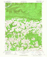
 1965 Cogan Station1967 Print · USGSLycoming County enters a period of mid-century suburban expansion in the 1960s as the valley north of WILLIAMSPORT develops. Researchers can trace family sites at the Blooming Grove Meetinghouse, St Michaels Ch, and the sprawling Wildwood Cemetery.2 unique versions available
 - 1966 Map of Williamsport
 1966 Williamsport1966 Print · USGSThe Susquehanna Valley was a hub of transit and industry in the mid-seventies, where the river's West Branch connected major college towns and timberlands. Researchers can trace historical rail lines like the Reading or locate regional landmarks from Jersey Shore to Ricketts Glen State Park.
End of results
Showing maps 1-10 of 10
Top cities near Gamble Township
- Williamsport historical maps
- South Williamsport historical maps
- Montoursville historical maps
- Kenmar historical maps
- Garden View historical maps
- Montgomery historical maps
See more
Top neighborhoods of Gamble Township
Frequently asked questions
- What are the different types of historical maps available for Gamble Township?
- What is the oldest map of Gamble Township?
- Where can I purchase historical maps of Gamble Township for my home or office?
- Where can I download high-res historical maps of Gamble Township?
- Are there historical topographic maps available for Gamble Township?
- Is there historical aerial imagery available for Gamble Township?
- Where are historical maps of Gamble Township sourced from?