Old Maps of Caldwell, Lewis Township for Genealogy
Trace your family roots with 11 historic maps of Caldwell. These high-res maps reveal old neighborhoods, homesites, landmarks, and streets — helping you uncover where your ancestors lived and how the area evolved over time.
- Explore historic neighborhoods: Identify where your relatives may have lived in the 1800s or 1900s.
- Compare maps over time: Trace the changes in streets, buildings, and landmarks for multi-generational research.
- Perfect for genealogy & ancestry research: Used by family historians and researchers to map out lineage and migration.
These maps are an incredible resource for exploring your personal connection to Caldwell's past.
Caldwell, Lewis Township maps
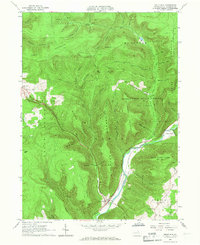
(11)- 1921 Map of Trout Run, 1957 Print
 1921 Trout Run1957 Print · USGSCovers Caldwell, including Williamsport, Garden View, and other nearby areas3 unique versions available
 - 1923 Map of Trout Run
 1923 Trout Run1923 Print · USGSCovers Caldwell, including Williamsport, Garden View, and other nearby areas4 unique versions available
 - 1944 Map of Trout Run
 1944 Trout Run1944 Print · USGSCovers Caldwell, including Williamsport, Garden View, and other nearby areas
 - 1954 Map of Williamsport
 1954 Williamsport1954 Print · USGSCovers Caldwell, including Vestal, Williamsport, and other nearby areas
 - 1960 Map of Williamsport
 1960 Williamsport1960 Print · USGSCovers Caldwell, including Vestal, Williamsport, and other nearby areas
 - 1962 Map of Williamsport, 1966 Print
 1962 Williamsport1966 Print · USGSCovers Caldwell, including Vestal, Williamsport, and other nearby areas5 unique versions available
 - 1965 Map of Williamsport
 1965 Williamsport1965 Print · USGSCovers Caldwell, including Vestal, Williamsport, and other nearby areas
 - 1965 Map of Trout Run, 1967 Print
 1965 Trout Run1967 Print · USGSCovers Caldwell, including Cogan House Township, Trout Run, and other nearby areas3 unique versions available
 - 1966 Map of Williamsport
 1966 Williamsport1966 Print · USGSCovers Caldwell, including Vestal, Williamsport, and other nearby areas
 - 1984 Map of Williamsport West, 1985 Print
 1984 Williamsport West1985 Print · USGSCovers Caldwell, including Williamsport, Lock Haven, and other nearby areas2 unique versions available
 - 2023 Map of Trout Run, 2023 Print
 2023 Trout Run2023 Print · USGSCovers Caldwell, including Jackson Township, Lewis Township, and other nearby areas
End of results
Showing maps 1-11 of 11
Top cities near Caldwell
- Williamsport historical maps
- South Williamsport historical maps
- Montoursville historical maps
- Jersey Shore historical maps
- Kenmar historical maps
- Garden View historical maps
See more
Frequently asked questions
- What are the different types of historical maps available for Caldwell?
- What is the oldest map of Caldwell?
- Where can I purchase historical maps of Caldwell for my home or office?
- Where can I download high-res historical maps of Caldwell?
- Are there historical topographic maps available for Caldwell?
- Is there historical aerial imagery available for Caldwell?
- Where are historical maps of Caldwell sourced from?