Old Maps of Mount Pocono, Monroe County for Academic Research
Study the evolution of Mount Pocono with 45 high-resolution historic maps. Whether you're teaching, researching, or modeling changes in land use, these maps provide essential visual documentation of urban, environmental, and geographic change.
- Analyze long-term change: Track patterns in development, transportation, and natural features.
- Ideal for environmental or urban studies: Support academic projects with primary historical map data.
- Use in the classroom or lab: Educators and researchers rely on these maps to bring historical context to life.
These maps are a powerful tool for teaching, research, and visualizing how Mount Pocono has changed over the decades.
Mount Pocono, Monroe County maps
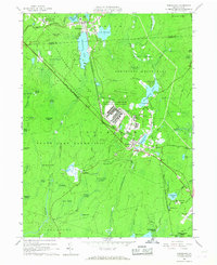
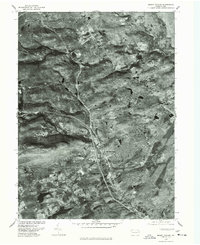
(45)- 1919 Map of Pocono
 1919 Pocono1919 Print · USGSMonroe County was a critical military and rail corridor at the close of the Great War. Researchers can trace the massive Tobyhanna Military Reservation and the early rail-centered footprints of Mount Pocono, Tannerville, and Cresco.
 - 1921 Map of Pocono, 1962 Print
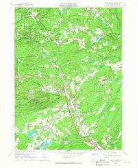
 1921 Pocono1962 Print · USGSThe Pocono Mountains at the start of the 1920s reveal a landscape of military training grounds, remote mountain schools, and early summer resorts. Trace the rail lines of the Wilkes-Barre and Eastern RR or locate rural landmarks like Cherry Lane Church and Beaver Brook School.
 - 1923 Map of Pocono
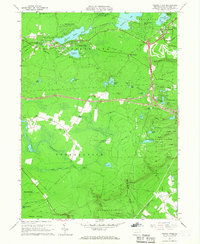
 1923 Pocono1923 Print · USGSMonroe County was evolving into a mountain retreat in the early twenties, connected by the Delaware Lackawanna and Western RR. Researchers can trace early resort life at Lake Naomi, find rural schools like Butz School, and locate the expansive Artillery Reservation.5 unique versions available
 - 1943 Map of Pocono
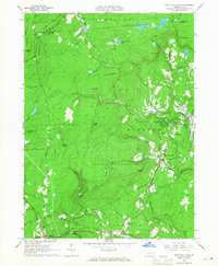
 1943 Pocono1943 Print · USGSMonroe County was a well-established retreat and transportation hub in the early 1940s, centered around the Delaware Lackawanna and Western railroad. Researchers can trace old mountain roads and family-named landmarks like Camelback Mountain, Naomi Pines Sch, and the Mount Pocono Airport.
 - 1950 Map of Scranton, 1952 Print
 1950 Scranton1952 Print · USGSMid-century Northeast Pennsylvania and the Hudson Valley come alive in this survey of the tri-state region. Genealogists and historians can trace the dense rail networks of the Erie RR and DL&W RR between industrial hubs like Scranton and Wilkes-Barre.
 - 1953 Map of Scranton
 1953 Scranton1953 Print · USGSNortheastern Pennsylvania and the Catskills are shown in great detail during the early fifties, a time when rail lines and river valleys dictated the region's growth. Genealogists and historians can trace the industrial hearts of Scranton and Wilkes-Barre or locate remote landmarks like High Point and Lake Wallenpaupack.
 - 1959 Map of Scranton
 1959 Scranton1959 Print · USGSThe northern coalfields and the Hudson Valley meet in this mid-century survey of the Pennsylvania and New York borderlands. Genealogists and historians can trace the intricate rail networks of the Erie Railroad and the vast waters of Lake Wallenpaupack.2 unique versions available
 - 1959 Map of Pocono
 1959 Pocono1959 Print · USGSThe Pocono Mountains region is captured here in the late fifties, showcasing its evolution from a railway-dependent timber and ice landscape to a premier resort destination. Researchers can locate dozens of country schoolhouses like Maplewood Sch and trace the paths of the Erie RR through Hawley and Kimbles.
 - 1962 Map of Scranton, 1977 Print
 1962 Scranton1977 Print · USGSThe industrial heart of eastern Pennsylvania and the New York Catskills are captured here in the early sixties. Genealogists and historians can trace the dense valley settlements from Scranton to Wilkes-Barre and the rail lines of the Erie Lackawanna Railroad.2 unique versions available
 - 1965 Map of Scranton
 1965 Scranton1965 Print · USGSThe tri-state highlands of Pennsylvania, New York, and New Jersey come alive in the mid-sixties as industry and recreation converge. Trace the intricate rail lines of the Erie Lackawanna RR or locate landmarks like the U S Military Academy.2 unique versions available
 - 1965 Map of Tobyhanna, 1967 Print
 1965 Tobyhanna1967 Print · USGSMonroe County was a hub of military logistics and emerging lakeside communities in the mid-sixties. Researchers can trace the sprawling Tobyhanna Army Depot, the Erie Lackawanna rail line, and early developments at Stillwater Lake Estates.3 unique versions available
 - 1966 Map of Mount Pocono, 1967 Print
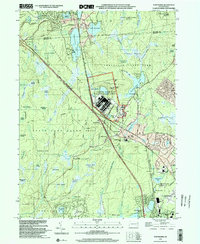
 1966 Mount Pocono1967 Print · USGSMid-century Monroe County comes to life as the modern resort era begins to shape these highlands. Trace family roots at Pocono Union Cem, the Erie-Lackawanna rail corridor, or the growing campus of Pocono Mountain Jr-Sr High Sch.5 unique versions available
 - 1966 Map of Pocono Pines, 1967 Print
 1966 Pocono Pines1967 Print · USGSThe Pocono plateau in the mid-sixties shows a landscape of rising lakeside vacation communities and vast protected woodlands. Researchers can trace the Erie-Lackawanna rail lines, the Old Railroad Grade, and local centers like Pocono Pines.6 unique versions available
 - 1966 Map of Buck Hill Falls, 1968 Print
 1966 Buck Hill Falls1968 Print · USGSThe Pocono plateau comes alive in the mid-1960s, showing a region balanced between recreation and rail infrastructure. Locate landmarks like Buck Hill Falls and Pocono Playhouse or trace the ERIE-LACKAWANNA rail line through Cresco.4 unique versions available
 - 1976 Map of Mount Pocono, 1978 Print
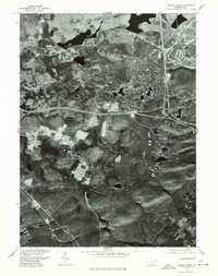
 1976 Mount Pocono1978 Print · USGSMonroe County was undergoing significant land-use changes in the mid-seventies, as seen in this detailed aerial orthophotomap. Genealogists and local historians can trace property developments and road networks near Tannersville, Bartonsville, and Mount Pocono.
 - 1976 Map of Tobyhanna, 1978 Print
 1976 Tobyhanna1978 Print · USGSThe Monroe County landscape near the border of Lackawanna County is shown through detailed 1970s aerial photography. Researchers can examine the physical layout of Tobyhanna and Gouldsboro or trace the water levels of Tobyhanna Lake.
 - 1976 Map of Buck Hill Falls, 1978 Print
 1976 Buck Hill Falls1978 Print · USGSThe Monroe County resort region is seen in detail during the mid-seventies through this precise orthophotographic survey. Trace the layout of mountain communities and forest clearings around Mount Pocono, Buck Hill Falls, and Mountainhome.
 - 1976 Map of Pocono Pines, 1978 Print
 1976 Pocono Pines1978 Print · USGSThe Pocono Mountains landscape in the mid-seventies reveals a mix of dense forest and growing recreational communities. Genealogists and local historians can trace the footprint of Pocono Pines and the early development surrounding Pocono Lake and Crescent Lake.
 - 1986 Map of Scranton
 1986 Scranton1986 Print · USGSNortheastern Pennsylvania in the mid-eighties shows an era of transition between its deep-rooted mining history and modern transit growth. Researchers can trace the industrial footprint of a Strip Mine, locate the Tobyhanna Army Depot, or find family sites near St Marys Cem and Wilkes College.2 unique versions available
 - 1994 Map of Buck Hill Falls, 1995 Print
 1994 Buck Hill Falls1995 Print · USGSMonroe County was undergoing significant residential growth in the mid-1990s while maintaining its deep-rooted resort identity. Genealogists and local historians can trace family locations near Buck Hill Falls, Mountainhome, and St Anne Ch or locate landmarks like the Pocono Playhouse.
 - 1994 Map of Tobyhanna, 1996 Print
 1994 Tobyhanna1996 Print · USGSMonroe County was a hub of military logistics and Pocono recreation during the mid-nineties. Researchers can trace the layout of the Tobyhanna Army Depot, locate the Coolbaugh Sch, and explore the grounds of Camp Tegawitha.
 - 1997 Map of Pocono Pines, 1998 Print
 1997 Pocono Pines1998 Print · USGSMonroe County’s plateau transition into a residential and resort destination is fully visible in the late nineties. Researchers can trace the development of Lake Naomi Estates and find traces of earlier industry along the Old Railroad Grade and near Pocono Pines.
 - 1997 Map of Buck Hill Falls, 2000 Print
 1997 Buck Hill Falls2000 Print · USGSMonroe County enters the millennium as a premier mountain destination, balancing vast conservation lands with growing resort villages. Researchers can trace local development around Mountainhome, the Pocono Playhouse, and the historical church at St Anna Ch.
 - 1999 Map of Mount Pocono, 2001 Print
 1999 Mount Pocono2001 Print · USGSMonroe County’s resort and mountain landscape is captured here just before the turn of the millennium, showing a unique mix of recreation and local industry. Researchers can trace family roots through sites like Keokee Cemetery or locate landmarks such as St Marys Villa and Camelback Mountain.
 - 1999 Map of Tobyhanna, 2002 Print
 1999 Tobyhanna2002 Print · USGSThe Pocono Plateau at the end of the twentieth century remains a mix of heavy military infrastructure and expansive state-protected wilds. Researchers can locate family landmarks near Warnertown or trace the development of Lynchwood Lake and Pocono Summit Estates.
Showing maps 1-25 of 45
Frequently asked questions
- What are the different types of historical maps available for Mount Pocono?
- What is the oldest map of Mount Pocono?
- Where can I purchase historical maps of Mount Pocono for my home or office?
- Where can I download high-res historical maps of Mount Pocono?
- Are there historical topographic maps available for Mount Pocono?
- Is there historical aerial imagery available for Mount Pocono?
- Where are historical maps of Mount Pocono sourced from?