Old Maps of Schwenksville, Montgomery County
Explore 23 old maps of Schwenksville, spanning from 1888 to today. These high-resolution historic maps reveal how streets, neighborhoods, landmarks, and natural features evolved over time — perfect for genealogy, metal detecting, research, and local history exploration.
What you can do with these maps:
- See how Schwenksville changed over time: Compare historical maps to modern-day views to trace roads, homesites, rail lines & more.
- View detailed metadata: Each map includes creators, publishers, year, scale, and archive source.
- Overlay maps with satellite & LiDAR: Visualize the past alongside modern tools to explore terrain & human change.
- Trusted historical sources: Maps sourced from the USGS, Library of Congress, and other archives.
- Access maps your way: View online, download high-res files, or order prints for personal or research use.
Start exploring old maps of Schwenksville to uncover forgotten places, hidden landmarks, and the deep history beneath your feet.
Schwenksville, Montgomery County maps
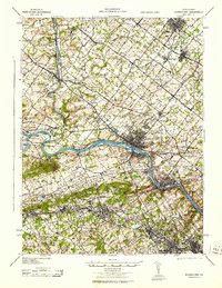
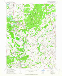
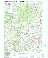
(23)- 1888 Map of Quakertown, 1963 Print
 1888 Quakertown1963 Print · USGSCovers Schwenksville, including Limerick Township, Skippack Township, and other nearby areas
 - 1890 Map of Quakertown
 1890 Quakertown1890 Print · USGSCovers Schwenksville, including Limerick Township, Skippack Township, and other nearby areas
 - 1894 Map of Quakertown
 1894 Quakertown1894 Print · USGSCovers Schwenksville, including Limerick Township, Skippack Township, and other nearby areas9 unique versions available
 - 1894 Map of Norristown, 1959 Print
 1894 Norristown1959 Print · USGSCovers Schwenksville, including Philadelphia, Norristown, and other nearby areas
 - 1895 Map of Norristown, 1898 Print
 1895 Norristown1898 Print · USGSCovers Schwenksville, including Philadelphia, Norristown, and other nearby areas11 unique versions available
 - 1896 Map of Norristown
 1896 Norristown1896 Print · USGSCovers Schwenksville, including Philadelphia, Norristown, and other nearby areas
 - 1942 Map of Norristown
 1942 Norristown1942 Print · USGSCovers Schwenksville, including Philadelphia, Abington Township, and other nearby areas
 - 1943 Map of Norristown
 1943 Norristown1943 Print · USGSCovers Schwenksville, including Philadelphia, Norristown, and other nearby areas
 - 1943 Map of Perkiomenville
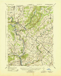 1943 Perkiomenville1943 Print · USGSCovers Schwenksville, including Limerick Township, Skippack Township, and other nearby areas
 - 1944 Map of Newark, 1971 Print
 1944 Newark1971 Print · USGSCovers Schwenksville, including New York, Philadelphia, and other nearby areas5 unique versions available
 - 1949 Map of Newark
 1949 Newark1949 Print · USGSCovers Schwenksville, including New York, Philadelphia, and other nearby areas3 unique versions available
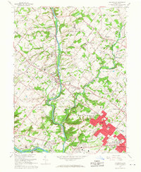
 - 1951 Map of Collegeville, 1953 Print
 1951 Collegeville1953 Print · USGSCovers Schwenksville, including Limerick Township, Phoenixville, and other nearby areas2 unique versions available
 - 1953 Map of Perkiomenville, 1954 Print
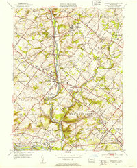
 1953 Perkiomenville1954 Print · USGSCovers Schwenksville, including Limerick Township, Skippack Township, and other nearby areas2 unique versions available
 - 1956 Map of Newark
 1956 Newark1956 Print · USGSCovers Schwenksville, including New York, Philadelphia, and other nearby areas2 unique versions available
 - 1957 Map of Newark
 1957 Newark1957 Print · USGSCovers Schwenksville, including New York, Philadelphia, and other nearby areas
 - 1960 Map of Newark
 1960 Newark1960 Print · USGSCovers Schwenksville, including New York, Philadelphia, and other nearby areas3 unique versions available
 - 1960 Map of Perkiomenville, 1963 Print
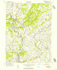
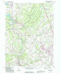
 1960 Perkiomenville1963 Print · USGSCovers Schwenksville, including Limerick Township, Skippack Township, and other nearby areas5 unique versions available
 - 1964 Map of Newark
 1964 Newark1964 Print · USGSCovers Schwenksville, including New York, Philadelphia, and other nearby areas2 unique versions available
 - 1966 Map of Collegeville, 1968 Print
 1966 Collegeville1968 Print · USGSCovers Schwenksville, including Limerick Township, Phoenixville, and other nearby areas5 unique versions available
 - 1984 Map of Reading, 1986 Print
 1984 Reading1986 Print · USGSCovers Schwenksville, including Philadelphia, Reading, and other nearby areas2 unique versions available
 - 1992 Map of Perkiomenville, 1995 Print
 1992 Perkiomenville1995 Print · USGSCovers Schwenksville, including Limerick Township, Skippack Township, and other nearby areas
 - 1992 Map of Collegeville, 1998 Print
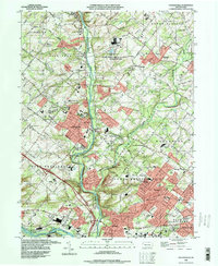 1992 Collegeville1998 Print · USGSCovers Schwenksville, including Limerick Township, Phoenixville, and other nearby areas
 - 1997 Map of Perkiomenville, 1999 Print
 1997 Perkiomenville1999 Print · USGSCovers Schwenksville, including Limerick Township, Skippack Township, and other nearby areas
End of results
Showing maps 1-23 of 23
Frequently asked questions
- What are the different types of historical maps available for Schwenksville?
- What is the oldest map of Schwenksville?
- Where can I purchase historical maps of Schwenksville for my home or office?
- Where can I download high-res historical maps of Schwenksville?
- Are there historical topographic maps available for Schwenksville?
- Is there historical aerial imagery available for Schwenksville?
- Where are historical maps of Schwenksville sourced from?