Old Maps of Schwenksville, Montgomery County for Hiking & Exploration
Hike through history with 23 historic maps of Schwenksville. Explore old trails, ghost towns, and forgotten backroads — perfect for outdoor adventurers and local explorers.
- Rediscover forgotten places: Map out old mining camps, roads, and footpaths that no longer exist on modern maps.
- Layer with modern tools: Combine with LiDAR or satellite views to plan hikes through historical terrain.
- Made for exploration: Popular among hikers, overlanders, and local history lovers.
Use these maps to find adventure and explore the hidden past of Schwenksville.
Schwenksville, Montgomery County maps
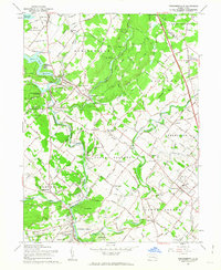
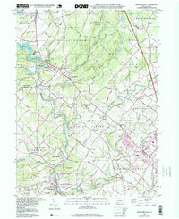
(23)- 1888 Map of Quakertown, 1963 Print
 1888 Quakertown1963 Print · USGSCovers Schwenksville, including Limerick Township, Skippack Township, and other nearby areas
 - 1890 Map of Quakertown
 1890 Quakertown1890 Print · USGSCovers Schwenksville, including Limerick Township, Skippack Township, and other nearby areas
 - 1894 Map of Quakertown
 1894 Quakertown1894 Print · USGSCovers Schwenksville, including Limerick Township, Skippack Township, and other nearby areas9 unique versions available
 - 1894 Map of Norristown, 1959 Print
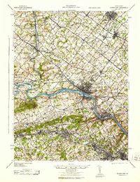
 1894 Norristown1959 Print · USGSCovers Schwenksville, including Philadelphia, Norristown, and other nearby areas
 - 1895 Map of Norristown, 1898 Print
 1895 Norristown1898 Print · USGSCovers Schwenksville, including Philadelphia, Norristown, and other nearby areas11 unique versions available
 - 1896 Map of Norristown
 1896 Norristown1896 Print · USGSCovers Schwenksville, including Philadelphia, Norristown, and other nearby areas
 - 1942 Map of Norristown
 1942 Norristown1942 Print · USGSCovers Schwenksville, including Philadelphia, Abington Township, and other nearby areas
 - 1943 Map of Norristown
 1943 Norristown1943 Print · USGSCovers Schwenksville, including Philadelphia, Norristown, and other nearby areas
 - 1943 Map of Perkiomenville
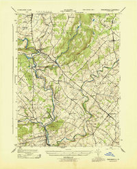 1943 Perkiomenville1943 Print · USGSCovers Schwenksville, including Limerick Township, Skippack Township, and other nearby areas
 - 1944 Map of Newark, 1971 Print
 1944 Newark1971 Print · USGSCovers Schwenksville, including New York, Philadelphia, and other nearby areas5 unique versions available
 - 1949 Map of Newark
 1949 Newark1949 Print · USGSCovers Schwenksville, including New York, Philadelphia, and other nearby areas3 unique versions available
 - 1951 Map of Collegeville, 1953 Print
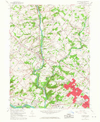
 1951 Collegeville1953 Print · USGSCovers Schwenksville, including Limerick Township, Phoenixville, and other nearby areas2 unique versions available
 - 1953 Map of Perkiomenville, 1954 Print
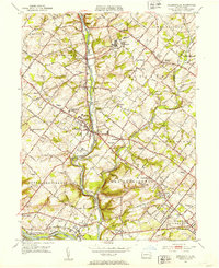
 1953 Perkiomenville1954 Print · USGSCovers Schwenksville, including Limerick Township, Skippack Township, and other nearby areas2 unique versions available
 - 1956 Map of Newark
 1956 Newark1956 Print · USGSCovers Schwenksville, including New York, Philadelphia, and other nearby areas2 unique versions available
 - 1957 Map of Newark
 1957 Newark1957 Print · USGSCovers Schwenksville, including New York, Philadelphia, and other nearby areas
 - 1960 Map of Newark
 1960 Newark1960 Print · USGSCovers Schwenksville, including New York, Philadelphia, and other nearby areas3 unique versions available
 - 1960 Map of Perkiomenville, 1963 Print
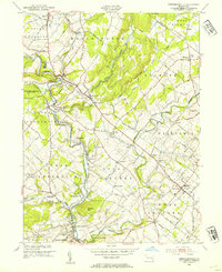
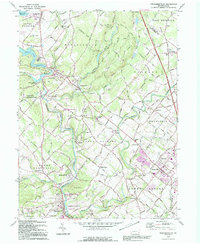
 1960 Perkiomenville1963 Print · USGSCovers Schwenksville, including Limerick Township, Skippack Township, and other nearby areas5 unique versions available
 - 1964 Map of Newark
 1964 Newark1964 Print · USGSCovers Schwenksville, including New York, Philadelphia, and other nearby areas2 unique versions available
 - 1966 Map of Collegeville, 1968 Print
 1966 Collegeville1968 Print · USGSCovers Schwenksville, including Limerick Township, Phoenixville, and other nearby areas5 unique versions available
 - 1984 Map of Reading, 1986 Print
 1984 Reading1986 Print · USGSCovers Schwenksville, including Philadelphia, Reading, and other nearby areas2 unique versions available
 - 1992 Map of Perkiomenville, 1995 Print
 1992 Perkiomenville1995 Print · USGSCovers Schwenksville, including Limerick Township, Skippack Township, and other nearby areas
 - 1992 Map of Collegeville, 1998 Print
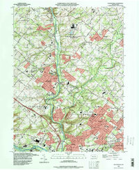 1992 Collegeville1998 Print · USGSCovers Schwenksville, including Limerick Township, Phoenixville, and other nearby areas
 - 1997 Map of Perkiomenville, 1999 Print
 1997 Perkiomenville1999 Print · USGSCovers Schwenksville, including Limerick Township, Skippack Township, and other nearby areas
End of results
Showing maps 1-23 of 23
Frequently asked questions
- What are the different types of historical maps available for Schwenksville?
- What is the oldest map of Schwenksville?
- Where can I purchase historical maps of Schwenksville for my home or office?
- Where can I download high-res historical maps of Schwenksville?
- Are there historical topographic maps available for Schwenksville?
- Is there historical aerial imagery available for Schwenksville?
- Where are historical maps of Schwenksville sourced from?