Old Maps of Towamencin Township, Pennsylvania for Academic Research
Study the evolution of Towamencin Township with 41 high-resolution historic maps. Whether you're teaching, researching, or modeling changes in land use, these maps provide essential visual documentation of urban, environmental, and geographic change.
- Analyze long-term change: Track patterns in development, transportation, and natural features.
- Ideal for environmental or urban studies: Support academic projects with primary historical map data.
- Use in the classroom or lab: Educators and researchers rely on these maps to bring historical context to life.
These maps are a powerful tool for teaching, research, and visualizing how Towamencin Township has changed over the decades.
Towamencin Township, PA maps
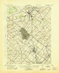
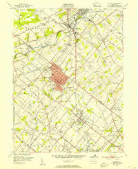
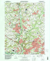
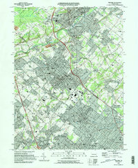
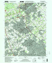
(41)- 1888 Map of Quakertown, 1963 Print
 1888 Quakertown1963 Print · USGSBucks and Montgomery counties are shown in high detail during the railroad era, when rural life centered on mill streams and village junctions. Genealogists can trace family roots through settlements like Richlandtown, Dillingersville, and the transit hub at Rocky Ridge Sta.
 - 1890 Map of Quakertown
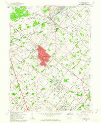
 1890 Quakertown1890 Print · USGSUpper Bucks and Montgomery counties are shown in the 1880s as a thriving corridor of rail towns and rural villages. Researchers can trace the original routes of the Perkasie and Sellersville settlements or locate family homesteads near Trumbauersville and Tylers Port.
 - 1894 Map of Quakertown
 1894 Quakertown1894 Print · USGSSoutheast Pennsylvania at the close of the nineteenth century reveals a flourishing landscape of rail-linked villages and fertile creek valleys. Genealogists can trace family roots through dozens of named settlements like Trumbauersville, Zion Hill, and Applebachsville.9 unique versions available
 - 1894 Map of Norristown, 1959 Print
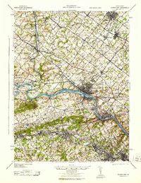
 1894 Norristown1959 Print · USGSSoutheast Pennsylvania at the end of the nineteenth century reveals a landscape defined by the Schuylkill River and a dense network of early railroads. Researchers can trace ancestral roots through old settlements like Skippack, Lansdale, and the rail junctions of the Perkiomen RR and Stony Creek RR.
 - 1895 Map of Norristown, 1898 Print
 1895 Norristown1898 Print · USGSMontgomery County at the end of the 19th century is a landscape of thriving river towns and bustling rail corridors. Researchers can trace the Victorian-era footprints of Norristown and Lansdale or locate historic landmarks like Valley Forge and Perkiomen Bridge.11 unique versions available
 - 1896 Map of Norristown
 1896 Norristown1896 Print · USGSMontgomery County in the mid-1890s reveals a landscape of growing railroad towns and historic creek-side settlements. Genealogists can trace family footprints near Waterloo Mills, the historic Perkiomen Bridge, and across the townships from Lansdale to Norristown.
 - 1942 Map of Norristown
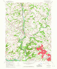
 1942 Norristown1942 Print · USGSSoutheastern Pennsylvania at the onset of World War II shows a landscape of busy industrial river towns and expanding rail suburbs. Genealogists and historians can trace the early transit networks connecting Norristown, Doylestown, and the riverfront at New Hope.
 - 1943 Map of Telford
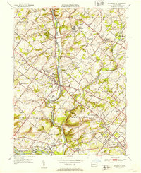
 1943 Telford1943 Print · USGSBucks and Montgomery Counties are captured here during the mid-century, defined by the busy rail corridor connecting Souderton and Perkasie. Researchers can trace old township boundaries and find long-standing community sites like St Peters Ch, Line Lexington, and Menlo Park.
 - 1943 Map of Norristown
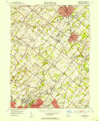
 1943 Norristown1943 Print · USGSMontgomery County in the early 1940s is a thriving network of rail-side industrial hubs and established borough centers. Genealogists and local historians can trace the development of Norristown and Lansdale or locate landmarks like the Eastern State Penitentiary.
 - 1944 Map of Newark, 1971 Print
 1944 Newark1971 Print · USGSThe industrial corridor from Philadelphia to New York was in a period of massive transition during the mid-forties. Genealogists and researchers can trace the rail lines of the Lehigh Valley RR, locate military installations like Picatinny Arsenal, and explore the early sprawl near Levittown.5 unique versions available
 - 1949 Map of Newark
 1949 Newark1949 Print · USGSThe industrial corridor between Philadelphia and New York comes alive in this post-war survey. Genealogists and historians can trace the massive rail networks of the Reading Railroad and locate major installations like Fort Dix or Picatinny Arsenal.2 unique versions available
 - 1951 Map of Collegeville, 1953 Print
 1951 Collegeville1953 Print · USGSMontgomery County was a landscape of historic institutional grounds and creek-side villages in the early fifties. Local historians can trace the footprint of Ursinus College, locate the Eastern State Penitentiary, and find old schools like Henry R Boyer Sch.2 unique versions available
 - 1951 Map of Lansdale, 1953 Print
 1951 Lansdale1953 Print · USGSPost-war Montgomery County sees the transition from rural townships to growing boroughs as the rail lines hum with activity. Trace the development of Lansdale and North Wales, or find historic sites like Central Schwenkfelder Ch and the Lansdale Airport.2 unique versions available
 - 1953 Map of Telford, 1954 Print
 1953 Telford1954 Print · USGSThe North Penn region comes alive in this mid-century survey, capturing the industrial heart of Souderton and Telford along the Reading railroad. Genealogists can trace family names at Jerusalem Union Ch, Franconia Sch, and the Perkasie Cem.
 - 1956 Map of Newark
 1956 Newark1956 Print · USGSThe industrial heart of the Mid-Atlantic is captured here at the dawn of the highway era, tracing the dense corridors between Newark and Philadelphia. Genealogists and local historians can map the rail networks of the Reading RR or locate mid-century military life at Fort Dix Military Reservation.2 unique versions available
 - 1957 Map of Newark
 1957 Newark1957 Print · USGSThe industrial and military heart of the Mid-Atlantic is mapped during its post-war suburban boom. Genealogists and historians can trace the intricate rail corridors of the Reading Railroad and locate key landmarks from Princeton University to Fort Hancock.
 - 1960 Map of Newark
 1960 Newark1960 Print · USGSThe industrial heart of the Mid-Atlantic is shown at mid-century, stretching from the dense urban centers of Newark and Philadelphia to the Blue Mountain ridges. Researchers can trace historic rail lines, coastal defenses at Fort Hancock, and the riverfront growth of Trenton and Easton.3 unique versions available
 - 1960 Map of Telford, 1963 Print
 1960 Telford1963 Print · USGSThe boroughs of Souderton and Telford anchor this 1960s study of the Bucks and Montgomery county line at the height of its rail-era layout. Genealogists can trace family roots through historic sites like Schwenkfelder Ch, St Michaels Cem, and the Reading rail corridor.5 unique versions available
 - 1964 Map of Newark
 1964 Newark1964 Print · USGSGreater New Jersey and eastern Pennsylvania appear at the peak of their industrial and rail-centered development in the mid-sixties. Genealogists and historians can trace the paths of the Pennsylvania RR, identify mid-century landmarks like CAMP KILMER, or follow the Schuylkill River through READING.2 unique versions available
 - 1966 Map of Collegeville, 1968 Print
 1966 Collegeville1968 Print · USGSMid-century Montgomery County comes to life as Collegeville and its neighbors expand along the Perkiomen Creek. Researchers can trace institutional history at the State Correctional Institution or find local landmarks like Ursinus College and Markleys Pond.5 unique versions available
 - 1966 Map of Lansdale, 1968 Print
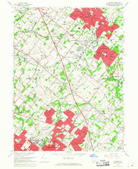 1966 Lansdale1968 Print · USGSMontgomery County experienced significant suburban growth in the mid-sixties, as residential developments began filling the spaces between historic crossroads. Genealogists and local historians can trace the foundations of Lansdale and North Wales, or locate family sites at the St Patricks Cem and Schwenkfelder Cem.5 unique versions available
 - 1984 Map of Reading, 1986 Print
 1984 Reading1986 Print · USGSSoutheastern Pennsylvania in the mid-eighties shows a landscape of established industrial hubs and rapid suburban expansion. Trace local history through landmarks like Valley Forge National Historical Park, the Willow Grove Naval Air Station, and Kutztown University.2 unique versions available
 - 1992 Map of Collegeville, 1998 Print
 1992 Collegeville1998 Print · USGSMontgomery County in the early nineties shows a landscape of growing suburbs and historic institutions. Trace local foundations at Ursinus College, the Schuylkill Canal, and family landmarks like Keelys Ch Cem.
 - 1995 Map of Telford, 1996 Print
 1995 Telford1996 Print · USGSThe boroughs of Telford and Souderton appear at a peak of late-century development along the Bucks and Montgomery county line. Genealogists and local historians can trace family-named sites and institutions like Lukins Cem, St Maria Goretti Sch, and the Schwenkfelder Ch.
 - 1997 Map of Telford, 2000 Print
 1997 Telford2000 Print · USGSSouderton and Telford are shown in the late nineties as established industrial and residential hubs along the Bucks and Montgomery county line. Researchers can trace institutional history through Grand View Hospital and old congregations like the Schwenkfelder Ch or Little Zion Ch.
Showing maps 1-25 of 41
Top cities near Towamencin Township
- Philadelphia historical maps
- Abington Township historical maps
- Cheltenham Township historical maps
- Norristown historical maps
- Warminster Township historical maps
- Radnor Township historical maps
See more
Top neighborhoods of Towamencin Township
Frequently asked questions
- What are the different types of historical maps available for Towamencin Township?
- What is the oldest map of Towamencin Township?
- Where can I purchase historical maps of Towamencin Township for my home or office?
- Where can I download high-res historical maps of Towamencin Township?
- Are there historical topographic maps available for Towamencin Township?
- Is there historical aerial imagery available for Towamencin Township?
- Where are historical maps of Towamencin Township sourced from?