Old Maps of Montour County, Pennsylvania for Genealogy
Trace your family roots with 67 historic maps of Montour County. These high-res maps reveal old neighborhoods, homesites, landmarks, and streets — helping you uncover where your ancestors lived and how the area evolved over time.
- Explore historic neighborhoods: Identify where your relatives may have lived in the 1800s or 1900s.
- Compare maps over time: Trace the changes in streets, buildings, and landmarks for multi-generational research.
- Perfect for genealogy & ancestry research: Used by family historians and researchers to map out lineage and migration.
These maps are an incredible resource for exploring your personal connection to Montour County's past.
Montour County, PA maps
(67)- 1892 Map of Shamokin
 1892 Shamokin1892 Print · USGSNorthumberland and Montour Counties are shown here during their industrial prime, when coal and rail shaped every valley. Researchers can trace the early footprints of Shamokin and Danville or locate smaller rail stops like Wolverton Station and Paxinos.
 - 1893 Map of Sunbury
 1893 Sunbury1893 Print · USGSThe Susquehanna River forks define this late nineteenth-century Pennsylvania landscape during a peak era of rail and canal competition. Researchers can trace historic riverfronts at Sunbury and Northumberland or find old family footprints in Selins Grove, Mazeppa, and Freeburg.6 unique versions available
 - 1893 Map of Shamokin
 1893 Shamokin1893 Print · USGSNorthumberland County's coal-and-rail landscape is captured here during the peak of its industrial development in the late nineteenth century. Researchers can trace the extensive rail networks serving settlements like Shamokin, Danville, and Trevorton, alongside early infrastructure like the Weigh Scale.6 unique versions available
 - 1924 Map of Milton
 1924 Milton1924 Print · USGSNorthumberland and Lycoming counties thrived along the river during the 1920s, dominated by a dense network of mountain ridges and rail corridors. Genealogists can locate dozens of rural landmarks, from the Old Furnace to the Stone Church and Pioneer School.4 unique versions available
 - 1935 Map of Hughesville
 1935 Hughesville1935 Print · USGSThe rural landscapes of Lycoming and Columbia counties are captured here in the mid-1930s, documenting a time when small schoolhouses and family farms still defined the region. Researchers can trace the Pennsylvania rail line and locate ancestral sites like Wintersteen Sch, Exchange, and Washingtonville.3 unique versions available
 - 1943 Map of Shamokin
 1943 Shamokin1943 Print · USGSNorthumberland and Montour Counties were hubs of industry and river trade in the 1940s. Genealogists and historians can trace rail-era landmarks like Wolverton Station and coal-country staples such as the Trevorton Colliery and Zion Church.
 - 1943 Map of Sunbury
 1943 Sunbury1943 Print · USGSDuring the mid-1940s, the Susquehanna River valley functioned as a vital corridor for both higher education and heavy industry. Genealogists can trace family roots through numerous country schools like Ulrich School and landmarks such as Hummels Wharf or the Isle of Que.
 - 1950 Map of Harrisburg, 1952 Print
 1950 Harrisburg1952 Print · USGSMid-century Central Pennsylvania comes alive through its dense rail networks and river valley settlements during the post-war industrial era. Genealogists and historians can trace family roots through hubs like Harrisburg, locate Carlisle Barracks, or follow the Pennsylvania RR through the Lebanon Valley.
 - 1952 Map of Shamokin, 1954 Print
 1952 Shamokin1954 Print · USGSNorthumberland County in the early 1950s shows a landscape defined by the Susquehanna River and the coal-rich ridges of Big Mountain. Genealogists can locate family names at Pine Hill Cem or trace landmarks like the Slovac Academy and Geisinger Hospital.3 unique versions available
 - 1953 Map of Hughesville, 1956 Print
 1953 Hughesville1956 Print · USGSThe rural heart of Lycoming and Columbia Counties is captured here in the early fifties, showing a landscape defined by small townships and creek-side settlements. Researchers can locate vanished rural landmarks like Frenchtown Sch, Hendrickson Ch, and the streets of Washingtonville or Jerseytown.3 unique versions available
 - 1953 Map of Sunbury, 1956 Print
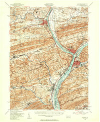 1953 Sunbury1956 Print · USGSThe Susquehanna River Valley in the early fifties shows a bustling corridor of rail, industry, and academia. Genealogists can trace family names at Stoltzfus Cem, explore the grounds of Bucknell University, or locate the historic Joseph Priestley Home.3 unique versions available
 - 1953 Map of Milton, 1956 Print
 1953 Milton1956 Print · USGSThe Susquehanna Valley thrives during the early fifties, defined by its river-town industries and coal-hauling rail lines. Genealogists can trace family names through country landmarks like Stone Church, Old Furnace, and the U S Military Reservation.2 unique versions available
 - 1954 Map of Williamsport
 1954 Williamsport1954 Print · USGSNorth-central Pennsylvania in the mid-fifties is defined by the winding West Branch Susquehanna River and its industrial valley. Local historians can trace the massive Susquehanna Ordnance Depot and the extensive rail networks of the Pennsylvania Railroad.
 - 1957 Map of Harrisburg
 1957 Harrisburg1957 Print · USGSMid-century Central Pennsylvania comes into focus as a bustling network of rail, river, and mountain ridges. Genealogists and historians can trace the development of the State Capitol and surrounding hubs like Middletown, Columbia, and Pottsville.7 unique versions available
 - 1960 Map of Williamsport
 1960 Williamsport1960 Print · USGSNorth-central Pennsylvania in the mid-twentieth century was a vital corridor of rail and river industry stretching from the New York line to the coal regions. Genealogists can trace the rail networks of the Pennsylvania RR and Lehigh Valley RR connecting towns like Williamsport, Towanda, and Lock Haven.
 - 1961 Map of Harrisburg
 1961 Harrisburg1961 Print · USGSCentral Pennsylvania is shown at a mid-century peak of industrial and military activity, from the Susquehanna water gaps to the fertile Dutch Country. Genealogists and historians can trace the rail corridors of the Pennsylvania RR and find landmarks like Carlisle Barracks or the Anthracite Coal Fields.2 unique versions available
 - 1962 Map of Williamsport, 1966 Print
 1962 Williamsport1966 Print · USGSNorth-central Pennsylvania was a landscape of industrial river hubs and vast state woodlands in the early sixties. Researchers can trace the path of the Pennsylvania Railroad through Williamsport and explore the remote reaches of Bucktail State Park.5 unique versions available
 - 1964 Map of Harrisburg
 1964 Harrisburg1964 Print · USGSCentral Pennsylvania in the mid-fifties reveals a landscape shaped by ridge-and-valley geology and critical Cold War infrastructure. Researchers can trace the massive Indiantown Gap Military Reservation or the rail corridors of the Pennsylvania RR and Reading RR.
 - 1965 Map of Williamsport
 1965 Williamsport1965 Print · USGSNorth-central Pennsylvania in the mid-1960s is defined by the industrial river towns and vast timberlands of the Allegheny Plateau. Researchers can trace historic rail lines like the Erie Lackawanna and Reading as they thread through Williamsport, Lock Haven, and Jersey Shore.
 - 1965 Map of Milton, 1966 Print
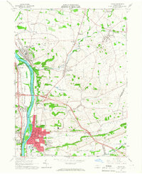 1965 Milton1966 Print · USGSThe Susquehanna River valley and its industrial hubs are seen here in the mid-sixties, capturing the rail-and-river network of Northumberland and Union counties. Researchers can locate many family landmarks, including Milton Cemetery, the Milton Airport, and the Warrior Run High School.4 unique versions available
 - 1965 Map of Northumberland, 1967 Print
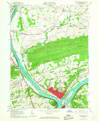 1965 Northumberland1967 Print · USGSThe Susquehanna River forks meet at Northumberland and Sunbury in the mid-1960s, capturing a landscape of vital riverfront industry and transit. Researchers can trace the rail lines of the Erie-Lackawanna and Reading or locate local landmarks like the Sodom Sch (Historic) and Packers Island.4 unique versions available
 - 1966 Map of Williamsport
 1966 Williamsport1966 Print · USGSThe Susquehanna Valley was a hub of transit and industry in the mid-seventies, where the river's West Branch connected major college towns and timberlands. Researchers can trace historical rail lines like the Reading or locate regional landmarks from Jersey Shore to Ricketts Glen State Park.
 - 1968 Map of Millville, 1972 Print
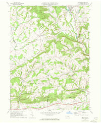 1968 Millville1972 Print · USGSMillville and the surrounding Columbia County townships appear here in the late sixties as a traditional landscape of creek-side hamlets and ridge-top farms. Genealogists can trace family footprints at Longs Ch Cem, St Johns Ch, and old settlements like Jerseytown or Eyers Grove.3 unique versions available
 - 1968 Map of Hughesville, 1972 Print
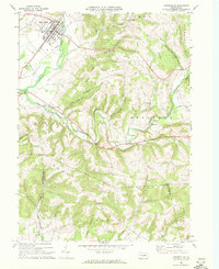 1968 Hughesville1972 Print · USGSHughesville and its rural surroundings in Lycoming County appear here during the late sixties as a network of ridge-top farms and valley hamlets. Researchers can trace local heritage through sites like Moreland Community Ch, Pleasant Hill Cem, and the old Fairgrounds.3 unique versions available
 - 1969 Map of Riverside, 1972 Print
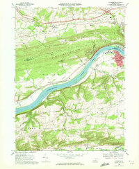 1969 Riverside1972 Print · USGSThe river and rail corridors of the Susquehanna valley define this Central Pennsylvania region in the late sixties. Researchers can trace historic industrial sites like Franklin Furnace and family burial grounds including Mt Vernon Cem and Klines Grove Cem.3 unique versions available
Showing maps 1-25 of 67
Top cities of Montour County
Frequently asked questions
- What are the different types of historical maps available for Montour County?
- What is the oldest map of Montour County?
- Where can I purchase historical maps of Montour County for my home or office?
- Where can I download high-res historical maps of Montour County?
- Are there historical topographic maps available for Montour County?
- Is there historical aerial imagery available for Montour County?
- Where are historical maps of Montour County sourced from?