2000s (21st Century) Maps of East Allen Township, Pennsylvania
Explore 5 historic maps of East Allen Township from the 2000s (21st Century). These maps offer a rare glimpse into what life looked like during the 2000s — showing old roads, neighborhoods, homes, and landmarks that have changed or disappeared over time.
Whether you're researching your family's past, planning a metal detecting trip, or studying how East Allen Township's landscape evolved across the 2000s, these high-resolution maps are a powerful tool for exploring the history of this region.
- Focus on a specific era: All maps on this page are from the 2000s, giving you a focused view of this time period.
- See what’s changed: Compare century-old streets, trails, and buildings to today's modern landscape using overlays and satellite layers.
- Research with precision: Use these maps for genealogy, historical research, land use analysis, or educational projects.
- View, download, or print: Maps are fully viewable online in high resolution, and can be downloaded or printed for your own records.
Start exploring East Allen Township's history through authentic maps from the 2000s. This is your window into the past.
East Allen Township, PA maps
(5)- 2010 Map of Catasauqua, 2010 Print
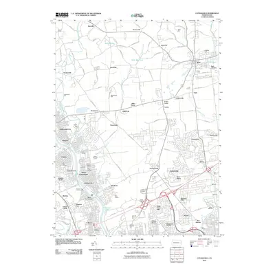 2010 Catasauqua2010 Print · USGSCovers East Allen Township, including Allentown, Bethlehem, and other nearby areas
 - 2013 Map of Catasauqua, 2013 Print
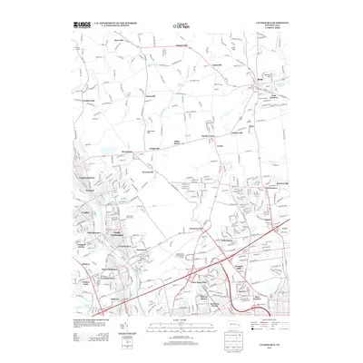 2013 Catasauqua2013 Print · USGSCovers East Allen Township, including Allentown, Bethlehem, and other nearby areas
 - 2016 Map of Catasauqua, 2016 Print
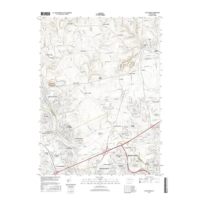 2016 Catasauqua2016 Print · USGSCovers East Allen Township, including Allentown, Bethlehem, and other nearby areas
 - 2019 Map of Catasauqua, 2019 Print
 2019 Catasauqua2019 Print · USGSCovers East Allen Township, including Allentown, Bethlehem, and other nearby areas
 - 2023 Map of Catasauqua, 2023 Print
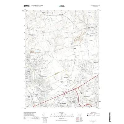
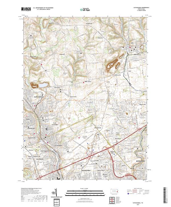 2023 Catasauqua2023 Print · USGSIn the Lehigh Valley during the early twenty-first century, industrial river towns and rural hamlets meet along a complex rail and water corridor. Genealogists can find numerous sites like Bath Kircheyard Cem and traces of the old Fousts Ferry.
End of results
Showing maps 1-5 of 5
Top cities near East Allen Township
- Allentown historical maps
- Bethlehem historical maps
- Easton historical maps
- Fullerton historical maps
- Phillipsburg historical maps
- Emmaus historical maps
See more
Top neighborhoods of East Allen Township
- Clyde historical maps
- Lerchs historical maps
- Nelighsville historical maps
- Miller Manor historical maps
- Bath Junction historical maps
- Seemsville historical maps
See more
Frequently asked questions
- What are the different types of historical maps available for East Allen Township?
- What is the oldest map of East Allen Township?
- Where can I purchase historical maps of East Allen Township for my home or office?
- Where can I download high-res historical maps of East Allen Township?
- Are there historical topographic maps available for East Allen Township?
- Is there historical aerial imagery available for East Allen Township?
- Where are historical maps of East Allen Township sourced from?