Old Maps of Liverpool, Perry County for Genealogy
Trace your family roots with 19 historic maps of Liverpool. These high-res maps reveal old neighborhoods, homesites, landmarks, and streets — helping you uncover where your ancestors lived and how the area evolved over time.
- Explore historic neighborhoods: Identify where your relatives may have lived in the 1800s or 1900s.
- Compare maps over time: Trace the changes in streets, buildings, and landmarks for multi-generational research.
- Perfect for genealogy & ancestry research: Used by family historians and researchers to map out lineage and migration.
These maps are an incredible resource for exploring your personal connection to Liverpool's past.
Liverpool, Perry County maps
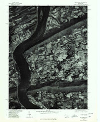
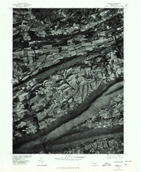
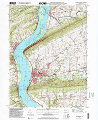
(19)- 1893 Map of Millersburg
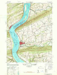
 1893 Millersburg1893 Print · USGSCovers Liverpool, including Chapman, Elizabethville, and other nearby areas7 unique versions available
 - 1907 Map of Millerstown
 1907 Millerstown1907 Print · USGSCovers Liverpool, including Beaver Springs, Millerstown, and other nearby areas4 unique versions available
 - 1943 Map of Millerstown
 1943 Millerstown1943 Print · USGSCovers Liverpool, including Beaver Springs, Millerstown, and other nearby areas
 - 1943 Map of Millersburg
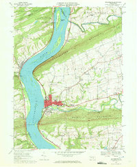
 1943 Millersburg1943 Print · USGSCovers Liverpool, including Chapman, Elizabethville, and other nearby areas
 - 1947 Map of Millersburg
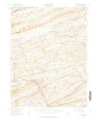
 1947 Millersburg1947 Print · USGSCovers Liverpool, including Jackson Township, Mifflin Township, and other nearby areas2 unique versions available
 - 1950 Map of Harrisburg, 1952 Print
 1950 Harrisburg1952 Print · USGSCovers Liverpool, including Lancaster, Harrisburg, and other nearby areas
 - 1953 Map of Millersburg, 1956 Print
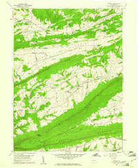
 1953 Millersburg1956 Print · USGSCovers Liverpool, including Chapman, Elizabethville, and other nearby areas3 unique versions available
 - 1955 Map of Millerstown, 1957 Print
 1955 Millerstown1957 Print · USGSCovers Liverpool, including Beaver Springs, Millerstown, and other nearby areas3 unique versions available
 - 1957 Map of Harrisburg
 1957 Harrisburg1957 Print · USGSCovers Liverpool, including Lancaster, Harrisburg, and other nearby areas7 unique versions available
 - 1959 Map of Reward, 1961 Print
 1959 Reward1961 Print · USGSCovers Liverpool, including Greenwood Township, Greenwood Township, and other nearby areas4 unique versions available
 - 1961 Map of Harrisburg
 1961 Harrisburg1961 Print · USGSCovers Liverpool, including Lancaster, Harrisburg, and other nearby areas2 unique versions available
 - 1964 Map of Harrisburg
 1964 Harrisburg1964 Print · USGSCovers Liverpool, including Lancaster, Harrisburg, and other nearby areas
 - 1969 Map of Millersburg, 1972 Print
 1969 Millersburg1972 Print · USGSCovers Liverpool, including Jackson Township, Mifflin Township, and other nearby areas4 unique versions available
 - 1977 Map of Millersburg, 1979 Print
 1977 Millersburg1979 Print · USGSCovers Liverpool, including Jackson Township, Mifflin Township, and other nearby areas
 - 1977 Map of Reward, 1979 Print
 1977 Reward1979 Print · USGSCovers Liverpool, including Greenwood Township, Greenwood Township, and other nearby areas
 - 1984 Map of State College, 1985 Print
 1984 State College1985 Print · USGSCovers Liverpool, including State College, Lewistown, and other nearby areas
 - 1984 Map of Sunbury, 1985 Print
 1984 Sunbury1985 Print · USGSCovers Liverpool, including Bloomsburg, Pottsville, and other nearby areas2 unique versions available
 - 1988 Map of State College, 1989 Print
 1988 State College1989 Print · USGSCovers Liverpool, including State College, Lewistown, and other nearby areas
 - 1999 Map of Millersburg, 2001 Print
 1999 Millersburg2001 Print · USGSCovers Liverpool, including Jackson Township, Mifflin Township, and other nearby areas
End of results
Showing maps 1-19 of 19
Frequently asked questions
- What are the different types of historical maps available for Liverpool?
- What is the oldest map of Liverpool?
- Where can I purchase historical maps of Liverpool for my home or office?
- Where can I download high-res historical maps of Liverpool?
- Are there historical topographic maps available for Liverpool?
- Is there historical aerial imagery available for Liverpool?
- Where are historical maps of Liverpool sourced from?