Old Maps of Scrubgrass Township, Pennsylvania
Explore 30 old maps of Scrubgrass Township, spanning from 1907 to today. These high-resolution historic maps reveal how streets, neighborhoods, landmarks, and natural features evolved over time — perfect for genealogy, metal detecting, research, and local history exploration.
What you can do with these maps:
- See how Scrubgrass Township changed over time: Compare historical maps to modern-day views to trace roads, homesites, rail lines & more.
- View detailed metadata: Each map includes creators, publishers, year, scale, and archive source.
- Overlay maps with satellite & LiDAR: Visualize the past alongside modern tools to explore terrain & human change.
- Trusted historical sources: Maps sourced from the USGS, Library of Congress, and other archives.
- Access maps your way: View online, download high-res files, or order prints for personal or research use.
Start exploring old maps of Scrubgrass Township to uncover forgotten places, hidden landmarks, and the deep history beneath your feet.
Scrubgrass Township, PA maps
(30)- 1907 Map of Foxburg, 1953 Print
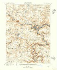
 1907 Foxburg1953 Print · USGSThe river-and-rail economies of Clarion and Armstrong counties are on full display in this early 1900s survey. Genealogists and industrial historians can trace vanished post offices like Perryville Pollock PO, early iron works at Canoe Furnace, and the riverside tracks of the Pennsylvania railroad.2 unique versions available
 - 1908 Map of Foxburg
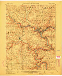
 1908 Foxburg1908 Print · USGSThe Pennsylvania river valleys thrive during the early twentieth-century industrial boom, as river traffic and railroads intersect in the heart of the coal and iron region. Researchers can locate early post offices at New Salem Lamartine PO, industrial sites like Sarah Furnace, and the Blue Goose Mine.5 unique versions available
 - 1909 Map of Franklin, 1956 Print
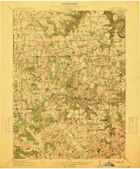
 1909 Franklin1956 Print · USGSVenango County at the dawn of the twentieth century is a landscape defined by the deep meanders of the Allegheny River and a dense network of competing railroads. Genealogists can trace rural life through numerous landmarks like Five Points School, Hickory Grove Church, and the State Institute for Feeble Minded at Polk.2 unique versions available
 - 1910 Map of Hilliards, 1956 Print
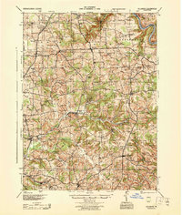
 1910 Hilliards1956 Print · USGSButler and Venango Counties come into focus during this early twentieth-century survey of western Pennsylvania's hill country. Researchers can trace the era's rural infrastructure through dozens of sites like Mechanicsville Wesley PO, Rankin Church, and the Boyer's Annandale Sta.
 - 1911 Map of Franklin
 1911 Franklin1911 Print · USGSVenango County at the peak of the rail era shows the busy confluence of the Allegheny River and French Creek. Trace the legacy of early industrial settlements like Coal City, family landmarks at McKenzie Cors, and the grounds of the State Institute for Feeble Minded.4 unique versions available
 - 1912 Map of Hilliards
 1912 Hilliards1912 Print · USGSButler and Venango Counties at the height of the rail era are shown here in intricate detail. Genealogists can trace family names across dozens of rural institutions, from Wesley PO and Sutton Mill to the remote Whiskerville.4 unique versions available
 - 1944 Map of Hilliards
 1944 Hilliards1944 Print · USGSThe rural borderlands of Butler and Venango counties are captured here in the mid-1940s, showing a landscape of small farming hamlets and rail-side industry. Genealogists can locate family landmarks such as the Anderson Stone House, Gillmans Mill, and dozens of local schoolhouses like Pike Sch.
 - 1957 Map of Warren, 1964 Print
 1957 Warren1964 Print · USGSThe northern Pennsylvania oil and timber country comes into focus in the mid-fifties, showing the region before modern highway expansions. Trace the industrial rail networks of the Pennsylvania RR and the early Allegheny River Reservoir near Warren and Oil City.4 unique versions available
 - 1958 Map of Warren
 1958 Warren1958 Print · USGSNorthern Pennsylvania’s timber and oil country is captured here during the late fifties, showing the interplay of industrial valleys and vast state forests. Genealogists can trace family connections across the Cornplanter Indian Reservation or through rail hubs like Oil City and Saint Marys.
 - 1959 Map of Warren
 1959 Warren1959 Print · USGSNorthern Pennsylvania's oil and timber country comes alive in this late-fifties study of the forest-clad plateaus. Trace the historic Cornplanter (Indian Reservation), the sprawling Oil Field, and the rail lines of the Pennsylvania RR.2 unique versions available
 - 1963 Map of Kennerdell, 1965 Print
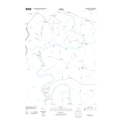
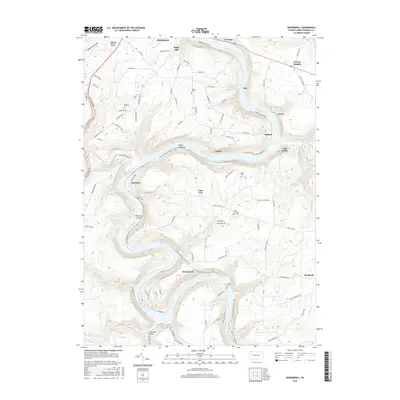
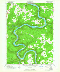 1963 Kennerdell1965 Print · USGSVenango County's river valleys and oil fields are captured here in the early 1960s as the Allegheny River loops past industrial rail lines. Genealogists and historians can trace the Kennerdell Tunnel, numerous family plots like Graham Cem, and rural hubs such as Coal City and Smiths Corners.4 unique versions available
 - 1963 Map of Emlenton, 1965 Print
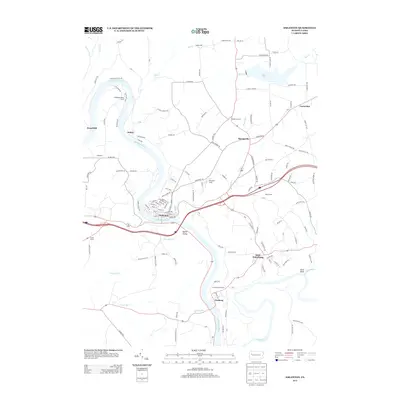
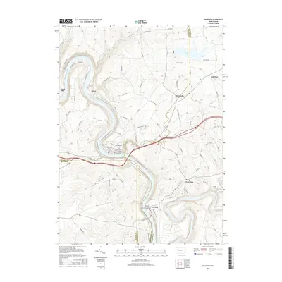
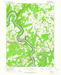 1963 Emlenton1965 Print · USGSThe Allegheny and Clarion rivers converge in the early 1960s, creating a hub of rail activity and resource extraction. Genealogists and historians can trace the numerous oil wells and strip mines surrounding communities like St Petersburg, Emlenton, and Foxburg.4 unique versions available
 - 1963 Map of Eau Claire, 1965 Print
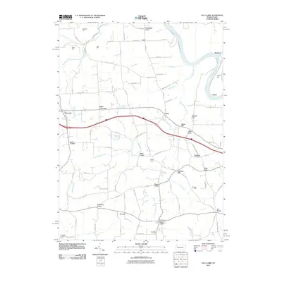
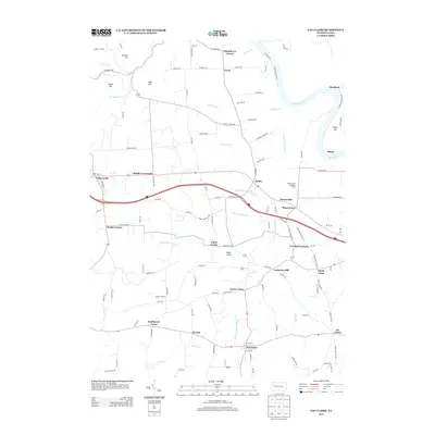
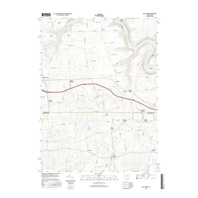
 1963 Eau Claire1965 Print · USGSThe northern reaches of Butler and Venango Counties are captured here in the early sixties, showing a landscape defined by fossil fuel extraction. Genealogists can locate family-named settlements like Riddle Crossroads, landmarks such as the Anderson Stone House, and the Eau Claire Cemetery.5 unique versions available
 - 1971 Map of Warren
 1971 Warren1971 Print · USGSNorth Central Pennsylvania is captured here in the early seventies, showing a landscape defined by industrial centers and massive state forests. Genealogists and historians can trace the rail lines of the Penn Central and Erie Lackawanna connecting towns like Warren, Kane, and Du Bois.
 - 1983 Map of Oil City, 1984 Print
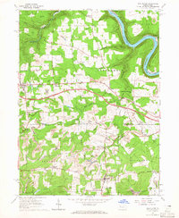
 1983 Oil City1984 Print · USGSThe Allegheny and Clarion river valleys are shown in the early eighties as a hub of rail lines and conservation lands. Genealogists can trace family connections in Oil City and Franklin or locate rural sites like the Pennsylvania State Hospital and School and Coal City.
 - 2010 Map of Emlenton, 2010 Print
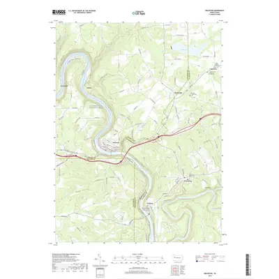
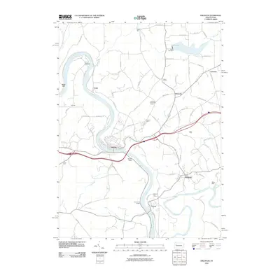 2010 Emlenton2010 Print · USGSCovers Scrubgrass Township, including Rockland Township, Emlenton, and other nearby areas
 - 2010 Map of Kennerdell, 2010 Print
 2010 Kennerdell2010 Print · USGSCovers Scrubgrass Township, including Cranberry Township, Franklin, and other nearby areas
 - 2010 Map of Eau Claire, 2010 Print
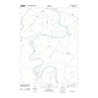
 2010 Eau Claire2010 Print · USGSCovers Scrubgrass Township, including Rockland Township, Clintonville, and other nearby areas
 - 2013 Map of Emlenton, 2013 Print
 2013 Emlenton2013 Print · USGSCovers Scrubgrass Township, including Rockland Township, Emlenton, and other nearby areas
 - 2013 Map of Kennerdell, 2013 Print
 2013 Kennerdell2013 Print · USGSCovers Scrubgrass Township, including Cranberry Township, Franklin, and other nearby areas
 - 2013 Map of Eau Claire, 2013 Print
 2013 Eau Claire2013 Print · USGSCovers Scrubgrass Township, including Rockland Township, Clintonville, and other nearby areas
 - 2016 Map of Eau Claire, 2016 Print
 2016 Eau Claire2016 Print · USGSCovers Scrubgrass Township, including Rockland Township, Clintonville, and other nearby areas
 - 2016 Map of Kennerdell, 2016 Print
 2016 Kennerdell2016 Print · USGSCovers Scrubgrass Township, including Cranberry Township, Franklin, and other nearby areas
 - 2016 Map of Emlenton, 2016 Print
 2016 Emlenton2016 Print · USGSCovers Scrubgrass Township, including Rockland Township, Emlenton, and other nearby areas
 - 2019 Map of Emlenton, 2019 Print
 2019 Emlenton2019 Print · USGSCovers Scrubgrass Township, including Rockland Township, Emlenton, and other nearby areas
Showing maps 1-25 of 30
Top cities near Scrubgrass Township
- Oil City historical maps
- Cranberry Township historical maps
- Franklin historical maps
- Sugarcreek historical maps
- Monroe historical maps
- Rockland Township historical maps
See more
Top neighborhoods of Scrubgrass Township
- Crawford Corners historical maps
- Lisbon historical maps
- Sutton Mill historical maps
- Pine Grove historical maps
- Eakin Corner historical maps
- Humphreys Corner historical maps
See more
Frequently asked questions
- What are the different types of historical maps available for Scrubgrass Township?
- What is the oldest map of Scrubgrass Township?
- Where can I purchase historical maps of Scrubgrass Township for my home or office?
- Where can I download high-res historical maps of Scrubgrass Township?
- Are there historical topographic maps available for Scrubgrass Township?
- Is there historical aerial imagery available for Scrubgrass Township?
- Where are historical maps of Scrubgrass Township sourced from?