Old Maps of Jefferson Township, Pennsylvania
Explore 30 old maps of Jefferson Township, spanning from 1904 to today. These high-resolution historic maps reveal how streets, neighborhoods, landmarks, and natural features evolved over time — perfect for genealogy, metal detecting, research, and local history exploration.
What you can do with these maps:
- See how Jefferson Township changed over time: Compare historical maps to modern-day views to trace roads, homesites, rail lines & more.
- View detailed metadata: Each map includes creators, publishers, year, scale, and archive source.
- Overlay maps with satellite & LiDAR: Visualize the past alongside modern tools to explore terrain & human change.
- Trusted historical sources: Maps sourced from the USGS, Library of Congress, and other archives.
- Access maps your way: View online, download high-res files, or order prints for personal or research use.
Start exploring old maps of Jefferson Township to uncover forgotten places, hidden landmarks, and the deep history beneath your feet.
Jefferson Township, PA maps
(30)- 1904 Map of Steubenville
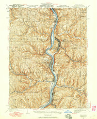
 1904 Steubenville1904 Print · USGSThe industrial heart of the Ohio River Valley comes to life in this early 1900s survey of the tri-state border region. Genealogists and historians can trace the early footprints of Steubenville, the rail junctions at Mingo Junction, and river crossings like Middle Ferry.5 unique versions available
 - 1904 Map of Burgettstown, 1958 Print
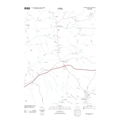
 1904 Burgettstown1958 Print · USGSWashington County and its neighbors are documented at the turn of the century as the coal and rail industries began reshaping the landscape. Researchers can trace early family sites and infrastructure from Pattersons Mill to the Francis Mine and the North Star Tyre P O.
 - 1906 Map of Burgettstown
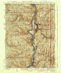
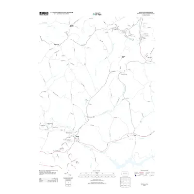
 1906 Burgettstown1906 Print · USGSWestern Pennsylvania’s coal and rail landscape comes into focus at the dawn of the twentieth century. Researchers can trace historic family landmarks and industrial sites like Francis Mine, Pattersons Mill, and the North Star Tyre P O.5 unique versions available
 - 1935 Map of Steubenville, 1958 Print
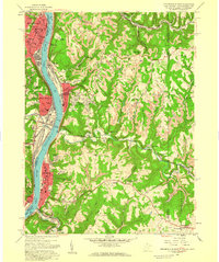
 1935 Steubenville1958 Print · USGSThe industrial heart of the Ohio River valley comes to life in this mid-century survey of the Ohio, West Virginia, and Pennsylvania borders. Genealogists and historians can trace the early footprints of Weirton, Steubenville, and smaller stops like Zalia and Reeds Mills.
 - 1942 Map of Steubenville
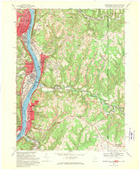
 1942 Steubenville1942 Print · USGSThe industrial corridor of the upper Ohio River comes to life here during the early 1940s. Genealogists can trace family roots through the streets of Steubenville and Weirton, or locate rural landmarks like Jefferson Sch and New Alexandria Sta.2 unique versions available
 - 1951 Map of Canton
 1951 Canton1951 Print · USGSThe industrial heartland of Ohio and Pennsylvania reached its mid-century peak during this era of heavy rail and river transit. Genealogists and historians can trace the development of steel towns like Aliquippa and Weirton alongside the Ohio River and major lines of the Pennsylvania RR.
 - 1953 Map of Canton
 1953 Canton1953 Print · USGSThe industrial heartland of Ohio and Pennsylvania is captured at its mid-century peak in this detailed regional survey. Genealogists and historians can trace the vast rail networks of the Pennsylvania RR and find local landmarks like Nimisila Reservoir and Tappan Reservoir.
 - 1954 Map of Burgettstown, 1955 Print
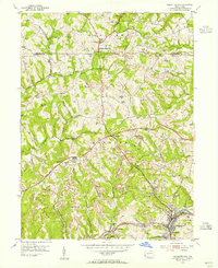 1954 Burgettstown1955 Print · USGSMid-century Washington County shows a landscape defined by the coal industry and rural life before modern expansion. Genealogists can trace family names at Grandview Cem or locate the Hancock Twp Sch and numerous Strip Mines across the county line.6 unique versions available
 - 1954 Map of Avella, 1955 Print
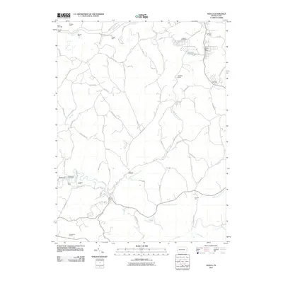
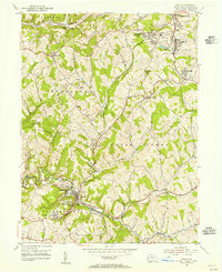 1954 Avella1955 Print · USGSWestern Washington County during the mid-fifties shows a landscape shaped by coal mining and established rail lines. Genealogists can locate family landmarks like Pattersons Mill, St Johns Ch, and schools like Cedar Grove Sch.3 unique versions available
 - 1957 Map of Canton, 1971 Print
 1957 Canton1971 Print · USGSThe industrial heartland of eastern Ohio and western Pennsylvania comes alive in this mid-century survey of the Ohio River Valley. Trace the heritage of rail and river commerce through Pittsburgh, the massive steel towns along the Ohio River, and major junctions on the Pennsylvania RR.3 unique versions available
 - 1958 Map of Steubenville East, 1959 Print
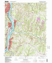
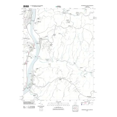
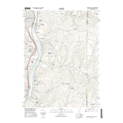
 1958 Steubenville East1959 Print · USGSSteubenville and the Ohio River valley are shown in detail during the late fifties as industrial growth climbed the surrounding bluffs. Researchers can trace local landmarks like the College of Steubenville, Mingo Cem, and the rail lines through Colliers.2 unique versions available
 - 1962 Map of Canton
 1962 Canton1962 Print · USGSThe industrial heartland of Eastern Ohio and Western Pennsylvania thrives in the early sixties as steel mills and rail lines dominate the river valleys. Genealogists and historians can trace local landmarks like McKinley National Memorial, Malone College, and industrial sites such as Republic Steel Corp.2 unique versions available
 - 1968 Map of Steubenville East, 1970 Print
 1968 Steubenville East1970 Print · USGSThe Ohio River valley was a bustling hub of industry and transit in the late sixties, where West Virginia and Ohio river towns met. Genealogists can trace family footprints through sites like St Johns Cem, the Lower Buffalo Ch, and Mingo Junction.3 unique versions available
 - 1986 Map of Pittsburgh West
 1986 Pittsburgh West1986 Print · USGSThe Tri-State region's coal and rail corridors are captured in the mid-eighties as industry and aviation expanded. Trace the legacy of extraction at Nelms Mine No 1, locate Short Creek PO, or follow the Chessie System tracks along the Ohio River.3 unique versions available
 - 1997 Map of Steubenville East, 1999 Print
 1997 Steubenville East1999 Print · USGSThe industrial Ohio River valley is captured here in the late twentieth century, showing the dense riverside settlements of Steubenville and Follansbee. Researchers can trace local genealogy and land use through numerous hillside burial grounds like Oak Grove Cem and Cross Creek Cem.
 - 2010 Map of Burgettstown, 2010 Print
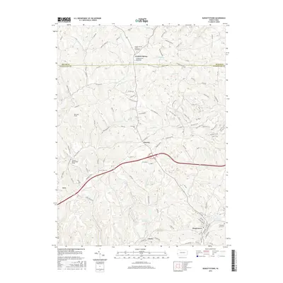
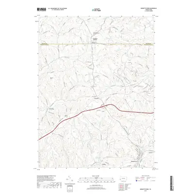
 2010 Burgettstown2010 Print · USGSCovers Jefferson Township, including Burgettstown, Frankfort Springs, and other nearby areas
 - 2010 Map of Avella, 2010 Print
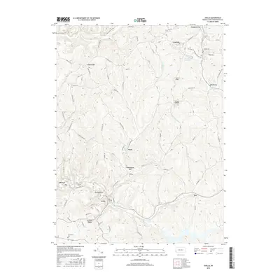
 2010 Avella2010 Print · USGSCovers Jefferson Township, including Cross Creek Township, Independence Township, and other nearby areas
 - 2010 Map of Steubenville East, 2010 Print
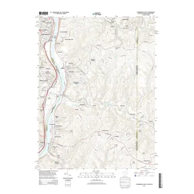
 2010 Steubenville East2010 Print · USGSCovers Jefferson Township, including Weirton, Steubenville, and other nearby areas
 - 2013 Map of Burgettstown, 2013 Print
 2013 Burgettstown2013 Print · USGSCovers Jefferson Township, including Burgettstown, Frankfort Springs, and other nearby areas
 - 2013 Map of Avella, 2013 Print
 2013 Avella2013 Print · USGSCovers Jefferson Township, including Cross Creek Township, Independence Township, and other nearby areas
 - 2013 Map of Steubenville East, 2013 Print
 2013 Steubenville East2013 Print · USGSCovers Jefferson Township, including Weirton, Steubenville, and other nearby areas
 - 2016 Map of Avella, 2016 Print
 2016 Avella2016 Print · USGSCovers Jefferson Township, including Cross Creek Township, Independence Township, and other nearby areas
 - 2016 Map of Burgettstown, 2016 Print
 2016 Burgettstown2016 Print · USGSCovers Jefferson Township, including Burgettstown, Frankfort Springs, and other nearby areas
 - 2016 Map of Steubenville East, 2016 Print
 2016 Steubenville East2016 Print · USGSCovers Jefferson Township, including Weirton, Steubenville, and other nearby areas
 - 2019 Map of Burgettstown, 2019 Print
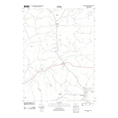
 2019 Burgettstown2019 Print · USGSCovers Jefferson Township, including Burgettstown, Frankfort Springs, and other nearby areas
Showing maps 1-25 of 30
Top cities near Jefferson Township
- Wheeling historical maps
- Moon Township historical maps
- Weirton historical maps
- Steubenville historical maps
- Washington historical maps
- Cecil Township historical maps
See more
Top neighborhoods of Jefferson Township
Frequently asked questions
- What are the different types of historical maps available for Jefferson Township?
- What is the oldest map of Jefferson Township?
- Where can I purchase historical maps of Jefferson Township for my home or office?
- Where can I download high-res historical maps of Jefferson Township?
- Are there historical topographic maps available for Jefferson Township?
- Is there historical aerial imagery available for Jefferson Township?
- Where are historical maps of Jefferson Township sourced from?