Old Maps of Marianna, Washington County for Metal Detecting
Plan your next treasure hunt with 34 historic maps of Marianna. Find old homesites, ghost towns, trails, and gathering spots that may be lost to time — perfect for identifying promising metal detecting locations.
- Locate forgotten sites: Uncover places like long-lost settlements, abandoned rail lines, or gathering spots.
- Plan better hunts: Use map overlays combined with LiDAR or satellite views to narrow in on historically rich areas.
- Made for detectorists: Thousands of hobbyists use these maps to discover relics, coins, and hidden history.
Use these historic maps to boost your research and find new opportunities beneath the surface of Marianna.
Marianna, Washington County maps
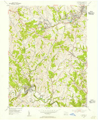
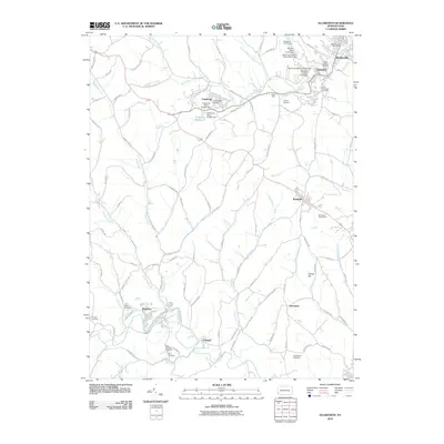
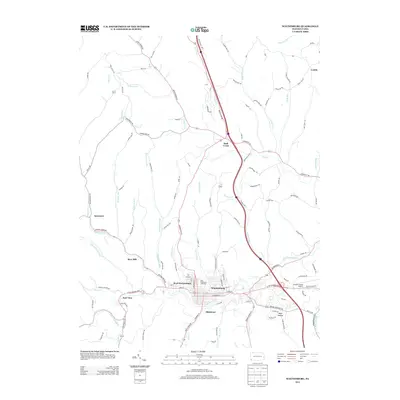
(34)- 1901 Map of Amity, 1956 Print
 1901 Amity1956 Print · USGSWashington County at the turn of the century shows a landscape transitioning between historic pikes and the burgeoning rail era. Researchers can trace ancestral property near Tenmile Creek or follow the route of the National Pike through Laboratory and Zediker.
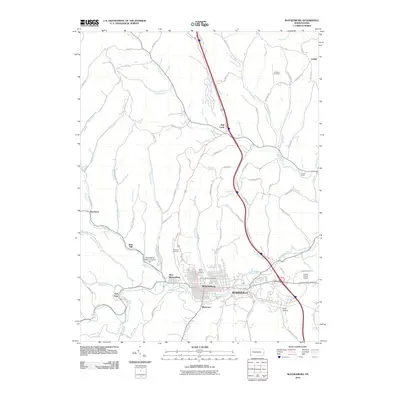
 - 1901 Map of Waynesburg, 1958 Print
 1901 Waynesburg1958 Print · USGSGreene County at the start of the twentieth century shows a landscape of deep valleys and rising townships connected by the South Fork of Tenmile Creek. Genealogists can trace family names through landmarks like Rees Mill, Gump, and the dual settlement of Kirby Newtown.
 - 1904 Map of Amity
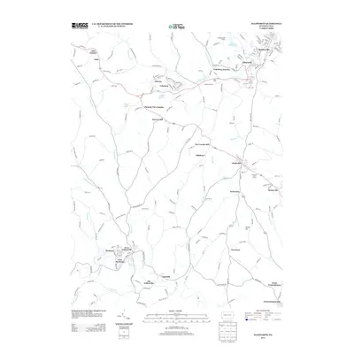
 1904 Amity1904 Print · USGSWashington County at the start of the twentieth century was a bustling nexus of rail and road, centered on the growing city of WASHINGTON. Researchers can trace early property lines and rail stops like Meadowlands, Laboratory, and the Pittsburg and Washington Turnpike.6 unique versions available
 - 1904 Map of Waynesburg
 1904 Waynesburg1904 Print · USGSGreene County was a landscape of deeply carved creek valleys and rural crossroads at the start of the twentieth century. Genealogists and local historians can trace early property settings near Waynesburg, Rees Mill, and the riverside borough of Rices Landing.5 unique versions available
 - 1949 Map of Clarksburg
 1949 Clarksburg1949 Print · USGSThe upper Ohio River valley and the industrial heart of West Virginia come into focus during this post-war period. Genealogists and researchers can trace the rail corridors of the Baltimore and Ohio and locate centers like Fairmont, Grafton, and Waynesburg.
 - 1951 Map of Canton
 1951 Canton1951 Print · USGSThe industrial heartland of Ohio and Pennsylvania reached its mid-century peak during this era of heavy rail and river transit. Genealogists and historians can trace the development of steel towns like Aliquippa and Weirton alongside the Ohio River and major lines of the Pennsylvania RR.
 - 1953 Map of Canton
 1953 Canton1953 Print · USGSThe industrial heartland of Ohio and Pennsylvania is captured at its mid-century peak in this detailed regional survey. Genealogists and historians can trace the vast rail networks of the Pennsylvania RR and find local landmarks like Nimisila Reservoir and Tappan Reservoir.
 - 1954 Map of Ellsworth, 1955 Print
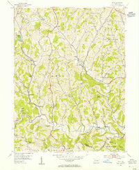
 1954 Ellsworth1955 Print · USGSWashington County at the height of its industrial era reveals a landscape of coal patches, rail spurs, and historic crossroads. Genealogists and historians can trace family roots through the numerous rural schools and cemeteries, from Old Zollarsville to the St Clements Cem.5 unique versions available
 - 1954 Map of Amity, 1955 Print
 1954 Amity1955 Print · USGSWashington and Greene Counties appear in the mid-fifties as a landscape of rural schoolhouses and coal mines. Genealogists and local historians can locate family-named landmarks like Baker Station and Condit Crossing or trace early industry at Harts Mill and the Lone Pine Mine.5 unique versions available
 - 1956 Map of Clarksburg, 1966 Print
 1956 Clarksburg1966 Print · USGSThe Ohio River valley and the industrial heart of West Virginia are seen here in the mid-1950s as rail and river commerce thrived. Researchers can trace historic transport lines like the Baltimore and Ohio RR and locate ancestral homes in Clarksburg, Moundsville, or Parkersburg.2 unique versions available
 - 1957 Map of Canton, 1971 Print
 1957 Canton1971 Print · USGSThe industrial heartland of eastern Ohio and western Pennsylvania comes alive in this mid-century survey of the Ohio River Valley. Trace the heritage of rail and river commerce through Pittsburgh, the massive steel towns along the Ohio River, and major junctions on the Pennsylvania RR.3 unique versions available
 - 1961 Map of Clarksburg
 1961 Clarksburg1961 Print · USGSThe mid-century industrial and river landscapes of West Virginia and Ohio are detailed here, centered on the Ohio River. Researchers can trace the Baltimore and Ohio rail lines connecting towns like Parkersburg, Clarksburg, and Monongah.
 - 1961 Map of Waynesburg, 1963 Print
 1961 Waynesburg1963 Print · USGSMid-century Greene County comes to life in this detailed survey centered on the collegiate town of Waynesburg. Researchers can locate family sites at Green Mount Cem, trace the local coal landscape at Grimes Portal, or find the old Drive-in Theater.4 unique versions available
 - 1961 Map of Mather, 1963 Print
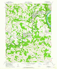 1961 Mather1963 Print · USGSThe industrial coal and river economy of Greene County is on full display in the early 1960s. Researchers can trace the layout of mining-era housing like Braden Plan, locate the Emerald Mine, or find ancestors at Pollock Cem and Mt Zion Cem & Ch.3 unique versions available
 - 1962 Map of Canton
 1962 Canton1962 Print · USGSThe industrial heartland of Eastern Ohio and Western Pennsylvania thrives in the early sixties as steel mills and rail lines dominate the river valleys. Genealogists and historians can trace local landmarks like McKinley National Memorial, Malone College, and industrial sites such as Republic Steel Corp.2 unique versions available
 - 1984 Map of Moundsville
 1984 Moundsville1984 Print · USGSThe Ohio River valley and the Appalachian interior meet in the mid-eighties as a hub of rail and river commerce. Genealogists and historians can trace the development of river towns like New Martinsville, inland hubs like Waynesburg, and the path of the B & O RR.
 - 1986 Map of Pittsburgh West
 1986 Pittsburgh West1986 Print · USGSThe Tri-State region's coal and rail corridors are captured in the mid-eighties as industry and aviation expanded. Trace the legacy of extraction at Nelms Mine No 1, locate Short Creek PO, or follow the Chessie System tracks along the Ohio River.3 unique versions available
 - 1988 Map of Clarksburg, 1989 Print
 1988 Clarksburg1989 Print · USGSThe central Appalachians are documented in detail during the late eighties, showing the industrial and river-based economies of West Virginia, Ohio, and Pennsylvania. Researchers can trace historic rail routes like the B & O RR and locate river towns from St Marys to Parkersburg.
 - 2010 Map of Ellsworth, 2010 Print
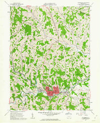
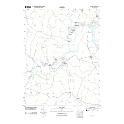
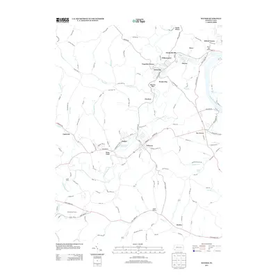
 2010 Ellsworth2010 Print · USGSCovers Marianna, including Bentleyville, Ellsworth, and other nearby areas
 - 2010 Map of Waynesburg, 2010 Print
 2010 Waynesburg2010 Print · USGSCovers Marianna, including Waynesburg, Morgan Township, and other nearby areas
 - 2010 Map of Mather, 2010 Print
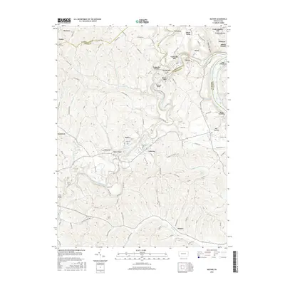
 2010 Mather2010 Print · USGSCovers Marianna, including Luzerne Township, Jefferson, and other nearby areas
 - 2013 Map of Ellsworth, 2013 Print
 2013 Ellsworth2013 Print · USGSCovers Marianna, including Bentleyville, Ellsworth, and other nearby areas
 - 2013 Map of Waynesburg, 2013 Print
 2013 Waynesburg2013 Print · USGSCovers Marianna, including Waynesburg, Morgan Township, and other nearby areas
 - 2013 Map of Mather, 2013 Print
 2013 Mather2013 Print · USGSCovers Marianna, including Luzerne Township, Jefferson, and other nearby areas
 - 2016 Map of Mather, 2016 Print
 2016 Mather2016 Print · USGSCovers Marianna, including Luzerne Township, Jefferson, and other nearby areas
Showing maps 1-25 of 34
Frequently asked questions
- What are the different types of historical maps available for Marianna?
- What is the oldest map of Marianna?
- Where can I purchase historical maps of Marianna for my home or office?
- Where can I download high-res historical maps of Marianna?
- Are there historical topographic maps available for Marianna?
- Is there historical aerial imagery available for Marianna?
- Where are historical maps of Marianna sourced from?