Old Maps of Mount Pleasant Township, Pennsylvania for Academic Research
Study the evolution of Mount Pleasant Township with 25 high-resolution historic maps. Whether you're teaching, researching, or modeling changes in land use, these maps provide essential visual documentation of urban, environmental, and geographic change.
- Analyze long-term change: Track patterns in development, transportation, and natural features.
- Ideal for environmental or urban studies: Support academic projects with primary historical map data.
- Use in the classroom or lab: Educators and researchers rely on these maps to bring historical context to life.
These maps are a powerful tool for teaching, research, and visualizing how Mount Pleasant Township has changed over the decades.
Mount Pleasant Township, PA maps
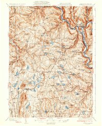
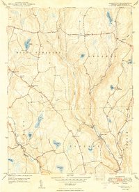
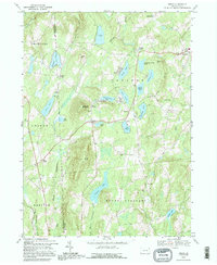
(25)- 1892 Map of Honesdale
 1892 Honesdale1892 Print · USGSWayne County was at its industrial peak in the 1890s, when gravity railroads and standard steam lines converged to move anthracite coal. You can trace the unique route of the Delaware and Hudson Canal Co Gravity Railroad and find early village layouts in Honesdale, Bethany, and Waymart.7 unique versions available
 - 1926 Map of Starrucca
 1926 Starrucca1926 Print · USGSThe river-and-rail corridor at the New York and Pennsylvania border comes alive in the mid-1920s, showing the vital confluence at Hancock. Genealogists and rail historians can trace the paths of the Erie R R, identifying old transit points like Stockport Sta and Sands Switch.
 - 1930 Map of Starrucca
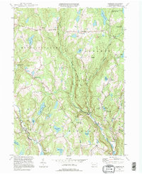
 1930 Starrucca1930 Print · USGSUpper Wayne County was a major transportation and recreation hub in the 1930s, defined by the Delaware River rail corridors and numerous upland lakes. Genealogists can trace family roots through localized sites like the South Preston Grange Hall and schools like Fairmont Sch.3 unique versions available
 - 1933 Map of Starrucca
 1933 Starrucca1933 Print · USGSUpper Wayne County was a landscape of rail-connected dairy farms and summer camps in the years between the wars. Genealogists can locate family-named rural schools and depots from Stephens Switch and Stockport Sta to Hines Corners.3 unique versions available
 - 1943 Map of Honesdale
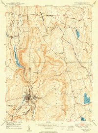
 1943 Honesdale1943 Print · USGSThe northern Poconos and the Upper Delaware River valley appear here during the early war years, showing a network of mountain hamlets and riverfront rail towns. Genealogists can trace family roots through numerous remote institutions like Kingsbury Hill Church, Peakville P O, and the Hiawatha School.
 - 1946 Map of Forest City, 1966 Print
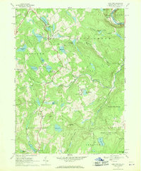
 1946 Forest City1966 Print · USGSPost-war Susquehanna County is captured here as the coal and rail era transitions into a new chapter. Genealogists can trace family lines through Forest City and find rural landmarks like the Curtis Valley Sch or Maple Grove Cem.3 unique versions available
 - 1946 Map of Aldenville, 1968 Print
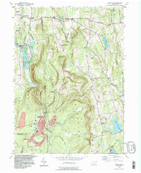
 1946 Aldenville1968 Print · USGSWayne County highlands in the mid-1940s reveal a network of historic turnpikes and rural hamlets. Researchers can trace ancestral locations like Aldenville and St Cecelia Ch, or locate the State Fish Hatchery and East Dyberry Cem.3 unique versions available
 - 1949 Map of Forest City
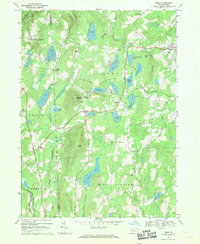
 1949 Forest City1949 Print · USGSIn the decade following the war, this Pennsylvania landscape shows the enduring rail-and-river network of the Moosic Mountains. Genealogists and historians can trace family-named landmarks and rural hubs such as Pleasant Mount, Uniondale, and the St Peter and Paul Ch.2 unique versions available
 - 1949 Map of Aldenville
 1949 Aldenville1949 Print · USGSWayne County's rural uplands are shown in the late 1940s, featuring a landscape of mountain townships and high ponds. Genealogists can trace family roots through the East Dyberry Cem, St Cecelia Ch, and early school sites like School No 3.2 unique versions available
 - 1950 Map of Scranton, 1952 Print
 1950 Scranton1952 Print · USGSMid-century Northeast Pennsylvania and the Hudson Valley come alive in this survey of the tri-state region. Genealogists and historians can trace the dense rail networks of the Erie RR and DL&W RR between industrial hubs like Scranton and Wilkes-Barre.
 - 1953 Map of Scranton
 1953 Scranton1953 Print · USGSNortheastern Pennsylvania and the Catskills are shown in great detail during the early fifties, a time when rail lines and river valleys dictated the region's growth. Genealogists and historians can trace the industrial hearts of Scranton and Wilkes-Barre or locate remote landmarks like High Point and Lake Wallenpaupack.
 - 1959 Map of Scranton
 1959 Scranton1959 Print · USGSThe northern coalfields and the Hudson Valley meet in this mid-century survey of the Pennsylvania and New York borderlands. Genealogists and historians can trace the intricate rail networks of the Erie Railroad and the vast waters of Lake Wallenpaupack.2 unique versions available
 - 1962 Map of Scranton, 1977 Print
 1962 Scranton1977 Print · USGSThe industrial heart of eastern Pennsylvania and the New York Catskills are captured here in the early sixties. Genealogists and historians can trace the dense valley settlements from Scranton to Wilkes-Barre and the rail lines of the Erie Lackawanna Railroad.2 unique versions available
 - 1965 Map of Scranton
 1965 Scranton1965 Print · USGSThe tri-state highlands of Pennsylvania, New York, and New Jersey come alive in the mid-sixties as industry and recreation converge. Trace the intricate rail lines of the Erie Lackawanna RR or locate landmarks like the U S Military Academy.2 unique versions available
 - 1968 Map of Lake Como, 1970 Print
 1968 Lake Como1970 Print · USGSWayne County and the New York borderlands appear here in the late sixties, showing a landscape of upland lakes and small dairy-era crossroads. Researchers can trace the Erie Lackawanna line, find St Julianas Ch, and locate family names near Dillontown or Rudes Corner.2 unique versions available
 - 1968 Map of Orson, 1971 Print
 1968 Orson1971 Print · USGSUpper Wayne County and Susquehanna County are shown here in the late sixties, a landscape of glacial lakes and mountain summits. Genealogists can trace early homesteads and landmarks near Orson Cemetery, the Township School at Lakewood, and the winding Old Railroad Grade.2 unique versions available
 - 1986 Map of Honesdale
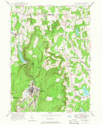
 1986 Honesdale1986 Print · USGSNortheastern Pennsylvania and the New York borderlands appear here in the mid-1980s, during a period of transition for the region's industrial river valleys. Genealogists can trace family connections across the Moosic Mountains between the coal towns of Carbondale and the canal-era heritage of Honesdale.2 unique versions available
 - 1992 Map of Lake Como, 1995 Print
 1992 Lake Como1995 Print · USGSWayne County's lake country is captured here in the early 1990s, showing a landscape of seasonal camps and rural crossroads. Researchers can locate St Julianas Cem at Church Hill or trace the Old Railroad Grade near Dillontown.
 - 1992 Map of Orson, 1995 Print
 1992 Orson1995 Print · USGSHigh in the lake country of Wayne County in the early nineties, this survey captures the headwaters of the Lackawanna. Genealogists can find family landmarks like Orson Cem, Hines Corners, and Orson Ch along the winding mountain roads.
 - 1994 Map of Aldenville, 1995 Print
 1994 Aldenville1995 Print · USGSWayne County’s river valleys and glacial lakes are shown here in the mid-1990s, when historic turnpikes still connected small crossroad settlements. Researchers can trace family sites like Hulls Cem and St Cecelia Ch, or locate local landmarks like Tanners Falls and Aldenville.
 - 1994 Map of Forest City, 1996 Print
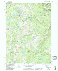
 1994 Forest City1996 Print · USGSNortheastern Pennsylvania’s high country near the turn of the millennium shows a landscape defined by the Lackawanna River and its upland reservoirs. Trace the historic Old Newburgh Turnpike and locate old family cemeteries like Maple Grove Cem and Sherwood Cem.
 - 2023 Map of Aldenville, 2023 Print
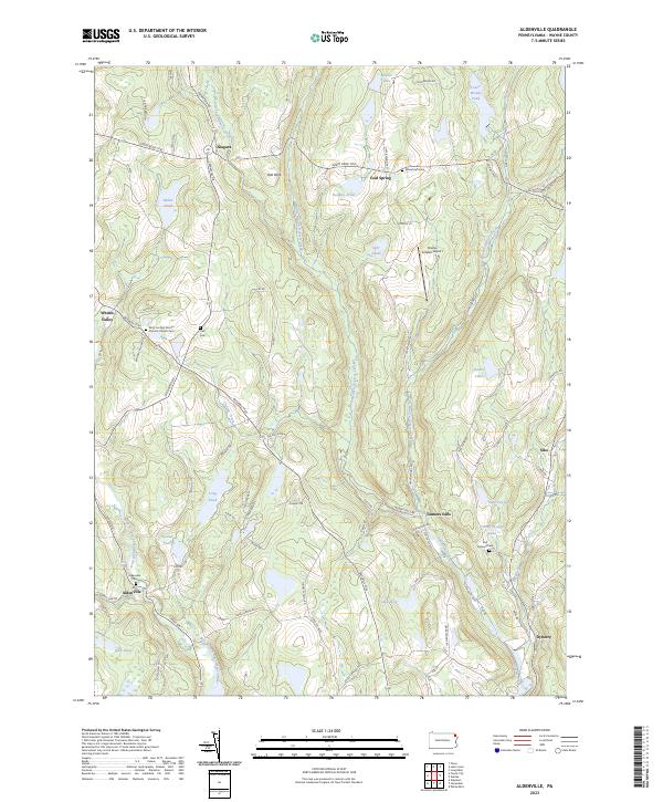 2023 Aldenville2023 Print · USGSWayne County's upland terrain is captured here in the early twenty-first century, showcasing a landscape defined by historic turnpikes and the many forks of the Dyberry. Researchers can locate family landmarks such as Aldenville Cem or trace the early paths of the Great Bend Tpke and Bethany Tpke.
 - 2023 Map of Lake Como, 2023 Print
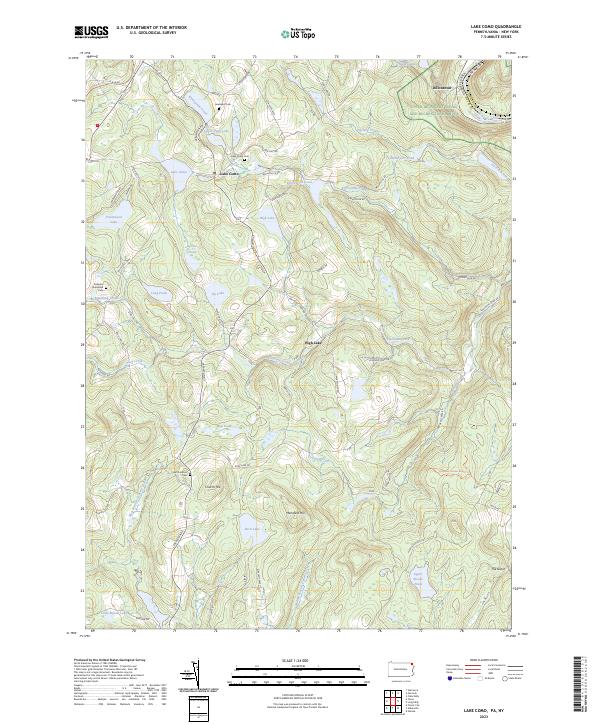 2023 Lake Como2023 Print · USGSWayne County’s high plateau is shown here at the turn of the millennium, where the O & W Rail Trl traces the path of a historic rail corridor through Lake Como. Researchers can locate several burial grounds like Jerusalem Cem and Saint Juliana's Cem near High Lake and Sly Lake.
 - 2023 Map of Orson, 2023 Print
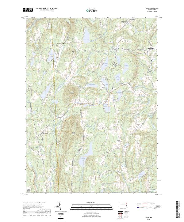 2023 Orson2023 Print · USGSWayne and Susquehanna counties are shown in the 2020s, a landscape defined by glacial lakes and the paths of old rail lines. Researchers can trace family history at the West Preston Cem or follow the historic rail grades of the O&W Rail-Trl and D&H Rail-Trl.
 - 2023 Map of Forest City, 2023 Print
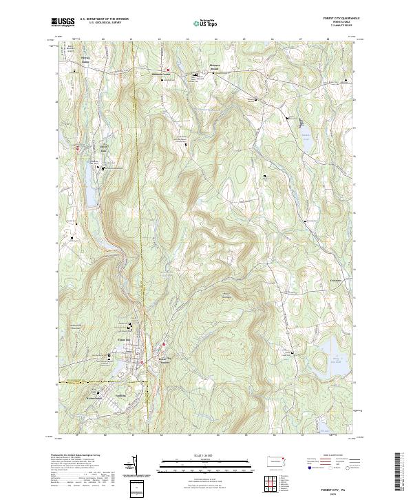 2023 Forest City2023 Print · USGSThe northern Moosic Mountains come into focus on the Susquehanna and Wayne County borders in this modern survey. Genealogists can trace family lines through the Meredith Family Cem, Wheeler Hill Cem, and the distinctive Old Colonial Mausoleum.
End of results
Showing maps 1-25 of 25
Top cities near Mount Pleasant Township
- Carbondale historical maps
- Lackawaxen Township historical maps
- Scott Township historical maps
- Honesdale historical maps
- Damascus Township historical maps
- Hancock historical maps
See more
Top neighborhoods of Mount Pleasant Township
- Belmont Corner historical maps
- Cascade historical maps
- Whites Valley historical maps
- Niagara historical maps
- Rudes Corner historical maps
- Pleasant Mount historical maps
Frequently asked questions
- What are the different types of historical maps available for Mount Pleasant Township?
- What is the oldest map of Mount Pleasant Township?
- Where can I purchase historical maps of Mount Pleasant Township for my home or office?
- Where can I download high-res historical maps of Mount Pleasant Township?
- Are there historical topographic maps available for Mount Pleasant Township?
- Is there historical aerial imagery available for Mount Pleasant Township?
- Where are historical maps of Mount Pleasant Township sourced from?