Old Maps of Fawn Township, Pennsylvania
Explore 44 old maps of Fawn Township, spanning from 1900 to today. These high-resolution historic maps reveal how streets, neighborhoods, landmarks, and natural features evolved over time — perfect for genealogy, metal detecting, research, and local history exploration.
What you can do with these maps:
- See how Fawn Township changed over time: Compare historical maps to modern-day views to trace roads, homesites, rail lines & more.
- View detailed metadata: Each map includes creators, publishers, year, scale, and archive source.
- Overlay maps with satellite & LiDAR: Visualize the past alongside modern tools to explore terrain & human change.
- Trusted historical sources: Maps sourced from the USGS, Library of Congress, and other archives.
- Access maps your way: View online, download high-res files, or order prints for personal or research use.
Start exploring old maps of Fawn Township to uncover forgotten places, hidden landmarks, and the deep history beneath your feet.
Fawn Township, PA maps
(44)- 1900 Map of Parkton
 1900 Parkton1900 Print · USGSThe Pennsylvania-Maryland borderlands in the early 1900s were defined by the busy Northern Central RR and the many mills along Gunpowder Falls. Researchers can trace old family locales and crossroads like Philopolis, Mount Carmel Ch, and Gorsuchs Mills.
 - 1901 Map of Belair
 1901 Belair1901 Print · USGSThe Harford County borderlands at the start of the twentieth century show a landscape defined by rail corridors and early mining. Genealogists can trace family names and small settlements along the Maryland and Pennsylvania RR, such as Fawn Grove, McIntyre Minefield, and Delta.7 unique versions available
 - 1902 Map of Parkton
 1902 Parkton1902 Print · USGSMaryland and Pennsylvania borders were still defined by active rail and milling economies when this survey was completed. Genealogists can trace family homesteads near Gorsuchs Mills, the Northern Central R.R. corridor, and the historic Maryland Line.7 unique versions available
 - 1908 Map of York, 1963 Print
 1908 York1963 Print · USGSYork County's diverse industrial and agricultural landscape is captured here in the early twentieth century. Researchers can trace ancestral property near dozens of local landmarks like Margaretta Furnace, Smalls School, and the Camp Meeting Grounds.
 - 1910 Map of York
 1910 York1910 Print · USGSYork County at the turn of the century reveals a landscape shaped by rail expansion and deep-rooted rural industry. Genealogists and historians can trace family-named sites like Sechrist Mill, Klein School, and Hopewell Church along the winding Maryland & Pennsylvania RR.6 unique versions available
 - 1912 Map of Mc Calls Ferry
 1912 Mc Calls Ferry1912 Print · USGSThe Susquehanna River valley near Safe Harbor is caught at a peak of rail-and-mill development during this pre-war survey. Genealogists and historians can trace the foundations of Martic Forge, find remote country schools like Red Hill School, and locate old stops on the Pennsylvania RR.5 unique versions available
 - 1942 Map of Bel Air
 1942 Bel Air1942 Print · USGSHarford and York counties at the start of the 1940s show a landscape shaped by the Maryland and Pennsylvania R.R. and deep-cut creek valleys. Trace the local rail-and-mill economy through Clermont Mills, Whiteford, and the village of Delta near the state line.
 - 1943 Map of Mc Calls Ferry
 1943 Mc Calls Ferry1943 Print · USGSMid-century Pennsylvania life unfolds along the Susquehanna during the 1940s, where river-based industry and rail lines meet established farming townships. Researchers can trace ancestral locations from Washington Boro to rural landmarks like Erbs Mill, Bethel Church, and the Red Hill School.2 unique versions available
 - 1944 Map of Norrisville
 1944 Norrisville1944 Print · USGSMaryland and Pennsylvania borderlands meet along the Mason and Dixon Line during the mid-1940s. Genealogists and researchers can trace rural life through landmarks like Ivory Mill, Ebaughs School, and the McKendree Church.
 - 1945 Map of Bel Air
 1945 Bel Air1945 Print · USGSThe Maryland-Pennsylvania borderlands are captured here at the end of the war, centered on the winding Maryland and Pennsylvania R. R. corridor. Genealogists and historians can trace the early layout of Whiteford, Delta, and Clermont Mills as they appeared in the mid-1940s.
 - 1948 Map of Baltimore
 1948 Baltimore1948 Print · USGSMaryland and Pennsylvania crossroads are captured in the late 1940s, showing a landscape defined by historic rail lines and major military installations. Genealogists can trace family connections in Gettysburg, Westminster, and near the U.S. Naval Academy in Annapolis.2 unique versions available
 - 1948 Map of Belair
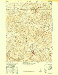 1948 Belair1948 Print · USGSHarford County and southern York County appear at a mid-century crossroads as the post-war era begins. Researchers can trace the winding Maryland and Pennsylvania railroad, find several dozen country churches, and locate industrial relics like the Talc (Abandoned) mine.2 unique versions available
 - 1953 Map of Norrisville
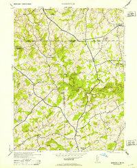 1953 Norrisville1953 Print · USGSThe Maryland-Pennsylvania border comes alive in this mid-century portrait of the Mason and Dixon Line and its surrounding farming communities. Genealogists and historians can trace the foundations of Norrisville and locate Ebaughs School or Amos Mill.2 unique versions available
 - 1953 Map of Stewartstown, 1956 Print
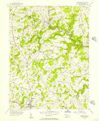 1953 Stewartstown1956 Print · USGSYork County's agricultural heartland is documented here in the early fifties, as the Maryland and Pennsylvania rail line served rural hubs like Stewartstown. Genealogists and historians can trace legacy landmarks from Sechrist Mill to local burials at Old Roundhill Cem.4 unique versions available
 - 1954 Map of Baltimore
 1954 Baltimore1954 Print · USGSThe Mid-Atlantic region in the early fifties shows a landscape of growing suburban centers and heavy rail corridors. Trace mid-century transit networks and military landmarks from the Aberdeen Proving Ground to the Gettysburg National Military Park.
 - 1955 Map of Airville, 1956 Print
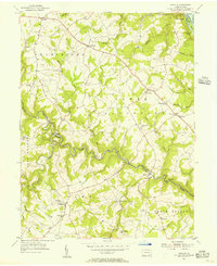 1955 Airville1956 Print · USGSYork County in the mid-fifties shows a landscape of river-valley hamlets and upland farms centered around the winding Muddy Creek. Genealogists can trace family footprints at Guinston Ch, the Indian Steps Museum, and old schoolhouses like Township Sch.5 unique versions available
 - 1956 Map of Baltimore
 1956 Baltimore1956 Print · USGSMid-century Maryland and Pennsylvania are captured here during a period of massive suburban and military growth across the Chesapeake region. Genealogists and historians can trace the rail corridors of the Baltimore & Ohio RR and locate landmarks like Fort McHenry or the Aberdeen Proving Ground.
 - 1956 Map of Fawn Grove, 1957 Print
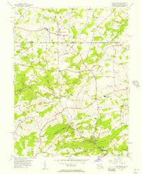 1956 Fawn Grove1957 Print · USGSThe Pennsylvania and Maryland borderlands are captured here in the mid-fifties, showing a landscape of small farming settlements and winding creek valleys. Genealogists and local historians can trace family locations near Fawn Grove, St Pauls Ch, and the rural community of Constitution.3 unique versions available
 - 1957 Map of Norrisville, 1958 Print
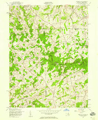 1957 Norrisville1958 Print · USGSThe Mason-Dixon line divides this rural landscape in the 1950s, where Harford and York counties meet. Genealogists and historians can trace the Baltimore and Pennsylvania RR and locate old landmarks like Gorsuch Mills, Ivory Mill, and Ayers Chapel.4 unique versions available
 - 1957 Map of Baltimore, 1964 Print
 1957 Baltimore1964 Print · USGSMaryland and Southern Pennsylvania are shown during the mid-century expansion of the Baltimore-Washington corridor. Researchers can trace the extensive rail lines of the Baltimore & Ohio RR and locate sites like Fort Detrick and Gettysburg National Military Park.5 unique versions available
 - 1961 Map of Baltimore
 1961 Baltimore1961 Print · USGSMaryland and Pennsylvania are captured at a mid-century peak of industrial and military expansion. Genealogists and historians can trace rail corridors like the Western Maryland Ry or locate regional landmarks such as Camp Detrick and Kent Island.
 - 1963 Map of Belair
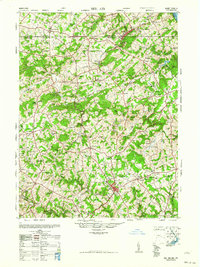 1963 Belair1963 Print · USGSHarford County and the Pennsylvania border are shown just after the war, when the Maryland and Pennsylvania RR still served these communities. Genealogists can locate family-named landmarks like the Broad Creek Meeting House, the Wheeler School, and St Ignatius Church.
 - 1983 Map of York, 1984 Print
 1983 York1984 Print · USGSSouth Central Pennsylvania and Northern Maryland meet along the Susquehanna during the early eighties. Genealogists and local historians can trace the transit networks of Conrail and Amtrak through towns like Red Lion and Seven Valleys.2 unique versions available
 - 1989 Map of Baltimore
 1989 Baltimore1989 Print · USGSThe Mid-Atlantic corridor in the late eighties is captured here, from the Baltimore harbor to the Blue Ridge foothills. Researchers can trace the sprawling footprints of Aberdeen Proving Ground, the historic grounds of Gettysburg National Military Park, and the winding Susquehanna River.
 - 1992 Map of Airville, 1995 Print
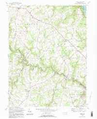 1992 Airville1995 Print · USGSSoutheastern York County is captured in the early nineties, showing a landscape defined by the deep valleys of Muddy Creek and the Susquehanna. Trace family history at Guinston Ch, Indian Steps Museum, and the many hamlets from Airville to Muddy Creek Forks.
Showing maps 1-25 of 44
Top cities near Fawn Township
- Forest Hill historical maps
- West Lampeter Township historical maps
- Bel Air historical maps
- Willow Street historical maps
- Millersville historical maps
- Shrewsbury historical maps
See more
Top neighborhoods of Fawn Township
- New Park historical maps
- Bald Eagle historical maps
- Gatchellville historical maps
- McDermott historical maps
Frequently asked questions
- What are the different types of historical maps available for Fawn Township?
- What is the oldest map of Fawn Township?
- Where can I purchase historical maps of Fawn Township for my home or office?
- Where can I download high-res historical maps of Fawn Township?
- Are there historical topographic maps available for Fawn Township?
- Is there historical aerial imagery available for Fawn Township?
- Where are historical maps of Fawn Township sourced from?