1990s Maps of Newberry Township, Pennsylvania
Explore 4 historic maps of Newberry Township from the 1990s. These maps offer a rare glimpse into what life looked like during the 1990s — showing old roads, neighborhoods, homes, and landmarks that have changed or disappeared over time.
Whether you're researching your family's past, planning a metal detecting trip, or studying how Newberry Township's landscape evolved across the 1990s, these high-resolution maps are a powerful tool for exploring the history of this region.
- Focus on a specific era: All maps on this page are from the 1990s, giving you a focused view of this time period.
- See what’s changed: Compare century-old streets, trails, and buildings to today's modern landscape using overlays and satellite layers.
- Research with precision: Use these maps for genealogy, historical research, land use analysis, or educational projects.
- View, download, or print: Maps are fully viewable online in high resolution, and can be downloaded or printed for your own records.
Start exploring Newberry Township's history through authentic maps from the 1990s. This is your window into the past.
Newberry Township, PA maps
(4)- 1998 Map of Steelton, 2000 Print
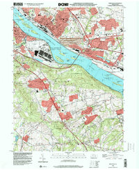 1998 Steelton2000 Print · USGSThe Susquehanna River corridor south of Harrisburg shows a landscape defined by heavy industry and aviation at the close of the century. Local historians can trace the development of Steelton and Goldsboro (Etters PO) or locate family sites like Paddletown Cem and St Pauls Ch.
 - 1999 Map of Middletown, 2001 Print
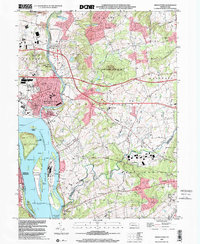 1999 Middletown2001 Print · USGSThe Lower Susquehanna valley at the turn of the millennium shows a complex mix of industrial infrastructure and rural traditions. Researchers can trace the development of Middletown and Royalton or locate family sites like Stoverdale Ch and Goldsboro (Etters PO).
 - 1999 Map of Dover, 2001 Print
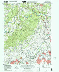 1999 Dover2001 Print · USGSNorthern York County at the end of the century shows a blend of suburban growth and traditional rural landscapes. Trace local history through landmark sites like Susquehanna Speedway, Zions View, and historic country churches like St James Ch.
 - 1999 Map of York Haven, 2001 Print
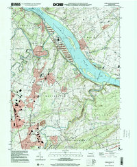 1999 York Haven2001 Print · USGSThe Susquehanna River corridor at the end of the twentieth century shows a blend of industrial legacy and growing residential communities. Genealogists and historians can locate family landmarks like Haldeman Cem, the historic Codorus Furnace, and Mundis Mill.
End of results
Showing maps 1-4 of 4
Top cities near Newberry Township
- Harrisburg historical maps
- York historical maps
- Colonial Park historical maps
- Hershey historical maps
- Elizabethtown historical maps
- Progress historical maps
See more
Top neighborhoods of Newberry Township
- Cly historical maps
- Conewago Heights historical maps
- Pleasant Grove historical maps
- Erney historical maps
- Ramblewood historical maps
- Harvest Hills historical maps
See more
Frequently asked questions
- What are the different types of historical maps available for Newberry Township?
- What is the oldest map of Newberry Township?
- Where can I purchase historical maps of Newberry Township for my home or office?
- Where can I download high-res historical maps of Newberry Township?
- Are there historical topographic maps available for Newberry Township?
- Is there historical aerial imagery available for Newberry Township?
- Where are historical maps of Newberry Township sourced from?