Old Maps of Hopkinton, Rhode Island
Explore 53 old maps of Hopkinton, spanning from 1889 to today. These high-resolution historic maps reveal how streets, neighborhoods, landmarks, and natural features evolved over time — perfect for genealogy, metal detecting, research, and local history exploration.
What you can do with these maps:
- See how Hopkinton changed over time: Compare historical maps to modern-day views to trace roads, homesites, rail lines & more.
- View detailed metadata: Each map includes creators, publishers, year, scale, and archive source.
- Overlay maps with satellite & LiDAR: Visualize the past alongside modern tools to explore terrain & human change.
- Trusted historical sources: Maps sourced from the USGS, Library of Congress, and other archives.
- Access maps your way: View online, download high-res files, or order prints for personal or research use.
Start exploring old maps of Hopkinton to uncover forgotten places, hidden landmarks, and the deep history beneath your feet.
Hopkinton, RI maps
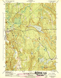
(53)- 1889 Map of Stonington
 1889 Stonington1889 Print · USGSThe Connecticut and Rhode Island borderlands are documented here at the height of the maritime and rail era. Genealogists and historians can trace family-named hills like Stewart Hill or locate industrial sites such as the Silax Mine and the rail hub at Mystic Bridge.
 - 1889 Map of Charlestown
 1889 Charlestown1889 Print · USGSCoastal Washington County in the late Victorian era is defined by salt ponds and a burgeoning rail network. Genealogists and historians can trace the early layouts of Quonochontaug, Carolina, and Richmond Switch near landmarks like Indian Burying Hill.9 unique versions available
 - 1889 Map of Moosup
 1889 Moosup1889 Print · USGSThe Connecticut-Rhode Island borderlands were a hive of rail activity and river power in the late nineteenth century. You can trace early transit routes through Plainfield Junction or locate rural landmarks like Moosup Valley P.O. and Sterling Station.
 - 1890 Map of Kent
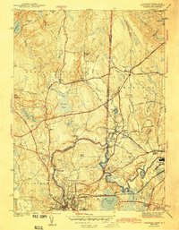
 1890 Kent1890 Print · USGSRhode Island's industrial heartland is in full swing during the late nineteenth century, dominated by mill towns and busy rail lines. Trace the development of Phenix, Coventry Center, and Arctic along the Pawtuxet River and the expanding New York and New England Railroad.
 - 1893 Map of Moosup
 1893 Moosup1893 Print · USGSEastern Connecticut and western Rhode Island meet here in the late nineteenth century at a peak of rail-driven industry. Genealogists can trace family footprints through historic hubs like Jewett City, Hopkins Hollow, and the mills surrounding Pachaug Pond.7 unique versions available
 - 1893 Map of Stonington
 1893 Stonington1893 Print · USGSThe coastal borderlands of Connecticut and Rhode Island are captured here in the late nineteenth century, showing a landscape defined by maritime trade and river power. Genealogists can trace family landmarks like Ayer Hill and Pequot Hill or locate industrial sites such as the Silex Mine.10 unique versions available
 - 1894 Map of Kent
 1894 Kent1894 Print · USGSCentral Rhode Island’s mill towns and rural uplands are shown here at the height of the Victorian era. Researchers can trace the path of the Valley Railroad through industrial hubs like Phenix or locate small settlements like Noose Neck and Usquepaug.7 unique versions available
 - 1919 Map of Charlestown
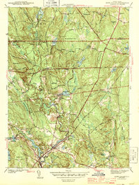
 1919 Charlestown1919 Print · USGSCoastal Rhode Island just after the Great War shows a landscape of rail-connected mill villages and sprawling salt ponds. Researchers can trace the legacy of the R.I. Agricultural College or locate landmarks like the King Philip Monument and Indian Burying Hill.
 - 1920 Map of Moosup
 1920 Moosup1920 Print · USGSEastern Connecticut and the Rhode Island border were thriving hubs of textile milling and rail transit just after the Great War. Genealogists and local historians can trace family-named locations such as Hopkins Hollow, industrial sites like Sterling Station, and the intricate rail network at Plainfield Junction.
 - 1921 Map of Charlestown
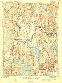
 1921 Charlestown1921 Print · USGSThe Rhode Island coastline near Charlestown is shown in the early twentieth century before modern development altered the barrier beaches. Trace family history through the inland rail junctions and schools like R.I. Agricultural College and Wood River Junction.
 - 1921 Map of Stonington
 1921 Stonington1921 Print · USGSCoastal Connecticut and Rhode Island meet here between the wars, where river and rail drive the regional economy. Genealogists can trace family footprints in North Stonington and Westerly, or locate the Silex Mine and the Light House at Stonington.
 - 1942 Map of Block Island, 1943 Print
 1942 Block Island1943 Print · USGSThe coastal borderlands of Rhode Island and Connecticut are captured here during the wartime years, documenting a landscape defined by rail and sea. Researchers can trace the NY NH & H RR through historic mill villages or locate landmarks like the Silex Mine and Indian Burying Hill.2 unique versions available
 - 1943 Map of Voluntown
 1943 Voluntown1943 Print · USGSThe Connecticut and Rhode Island borderlands are shown here during the early 1940s, capturing the rural character of New London and Washington Counties. Researchers can trace ancestral locations at Rockville and Voluntown, or locate historic sites like Wylie Sch and the Rockville Cem.4 unique versions available
 - 1943 Map of Ashaway
 1943 Ashaway1943 Print · USGSThe Rhode Island-Connecticut borderlands during the early 1940s are defined here by textile-mill settlements and old turnpikes. Genealogists can trace family names and sites from Stillmanville to Potter Hill, including landmarks like Oak Grove Cem and St Michael Cem.2 unique versions available
 - 1943 Map of Hope Valley
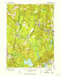
 1943 Hope Valley1943 Print · USGSSouthern Rhode Island’s rural mill villages and inland waterways are preserved here in the early nineteen-forties. Genealogists and historians can trace the foundations of local life through the Barber Cem, the Old Bates Sch, and the industrial cluster at Hope Valley.2 unique versions available
 - 1943 Map of Carolina
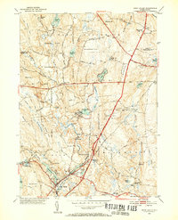
 1943 Carolina1943 Print · USGSInland Washington County villages thrive along the rail lines and river bends during the early 1940s. Local researchers can trace family landmarks like Burdick Cem, explore the layout of Wood River Junction, and locate the Pawcatuck Valley Sch.2 unique versions available
 - 1943 Map of Putnam, 1944 Print
 1943 Putnam1944 Print · USGSThe Connecticut and Rhode Island borderlands are captured here during the wartime era, showing a landscape defined by textile river towns and sprawling state forests. Trace the industrial rail corridor of the New York New Haven and Hartford through Putnam, Danielson, and Moosup.
 - 1947 Map of Providence, 1948 Print
 1947 Providence1948 Print · USGSSouthern New England is captured in the mid-1940s, showing a landscape defined by busy industrial ports and expanding military installations. Researchers can trace the rail lines of the N.Y. N.H. & H. RR or locate coastal defenses like Fort Adams and Quonset Point.5 unique versions available
 - 1948 Map of Providence, 1951 Print
 1948 Providence1951 Print · USGSSouthern New England’s coastal reaches are captured here in the late 1940s, from the industrial heart of Providence to the tip of Provincetown. Genealogists and historians can trace rail lines like the Central Vermont Railway and locate active military sites such as Otis Air Force Base and Fort Rodman.
 - 1953 Map of Carolina
 1953 Carolina1953 Print · USGSCoastal Washington County villages and early transit corridors are captured here in the mid-fifties. Genealogists and historians can trace family plots at White Brook Cemetery or explore the rail hubs of Carolina Station and Wood River Junction.7 unique versions available
 - 1953 Map of Voluntown, 1954 Print
 1953 Voluntown1954 Print · USGSThe Connecticut and Rhode Island borderlands come alive in the 1950s, showing a landscape defined by timber, state forests, and glacial ponds. Researchers can trace family names and landmarks from Voluntown to Rockville, or find sites like Sawmill Pond and Stepstone Falls.5 unique versions available
 - 1953 Map of Ashaway, 1955 Print
 1953 Ashaway1955 Print · USGSThe borderlands of Connecticut and Rhode Island are captured here in the mid-1950s, centered on the river-powered mill towns of the Pawcatuck Valley. Researchers can trace historic industrial sites and neighborhood roots in Westerly, Ashaway, and the riverside hamlet of Potter Hill.5 unique versions available
 - 1953 Map of Hope Valley, 1955 Print
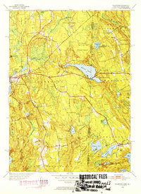
 1953 Hope Valley1955 Print · USGSThe rural valleys of western Rhode Island are captured here in the early 1950s, centered on the thriving mill villages of Hope Valley and Wyoming. Genealogists can trace family landmarks and rural institutions from the West Exeter Ch to the Barber Cem and the West Greenwich Sch.8 unique versions available
 - 1957 Map of Providence
 1957 Providence1957 Print · USGSCoastal New England at the height of the mid-century era shows a landscape shaped by maritime industry and Cold War defense. Genealogists and historians can trace the reach of the New York, New Haven & Hartford RR and locate legacy sites like Fort Adams and Quonset Point Naval Air Station.
 - 1958 Map of Providence
 1958 Providence1958 Print · USGSThe Rhode Island and Massachusetts coastlines are shown in detail during the late 1950s, from the urban cores to the tips of the islands. Researchers can trace the mid-century footprint of Quonset Point Naval Air Station, the defense works at Fort Adams, and the rail network of the New York, New Haven and Hartford RR.
Showing maps 1-25 of 53
Top cities near Hopkinton
- Groton historical maps
- Coventry historical maps
- West Warwick historical maps
- South Kingstown historical maps
- North Kingstown historical maps
- Southold historical maps
See more
Top neighborhoods of Hopkinton
- Ashaway historical maps
- Rockville historical maps
- Hope Valley historical maps
- Woodville historical maps
- Barberville historical maps
- Bethel historical maps
See more
Frequently asked questions
- What are the different types of historical maps available for Hopkinton?
- What is the oldest map of Hopkinton?
- Where can I purchase historical maps of Hopkinton for my home or office?
- Where can I download high-res historical maps of Hopkinton?
- Are there historical topographic maps available for Hopkinton?
- Is there historical aerial imagery available for Hopkinton?
- Where are historical maps of Hopkinton sourced from?