Old Maps of Earlscourt Historic District, Narragansett for Genealogy
Trace your family roots with 18 historic maps of Earlscourt Historic District. These high-res maps reveal old neighborhoods, homesites, landmarks, and streets — helping you uncover where your ancestors lived and how the area evolved over time.
- Explore historic neighborhoods: Identify where your relatives may have lived in the 1800s or 1900s.
- Compare maps over time: Trace the changes in streets, buildings, and landmarks for multi-generational research.
- Perfect for genealogy & ancestry research: Used by family historians and researchers to map out lineage and migration.
These maps are an incredible resource for exploring your personal connection to Earlscourt Historic District's past.
Earlscourt Historic District, Narragansett maps
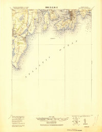
(18)- 1889 Map of Newport
 1889 Newport1889 Print · USGSCovers Earlscourt Historic District, including South Kingstown, North Kingstown, and other nearby areas
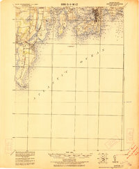
 - 1894 Map of Newport
 1894 Newport1894 Print · USGSCovers Earlscourt Historic District, including South Kingstown, North Kingstown, and other nearby areas3 unique versions available
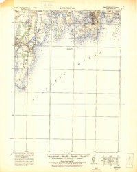
 - 1904 Map of Newport, 1912 Print
 1904 Newport1912 Print · USGSCovers Earlscourt Historic District, including South Kingstown, North Kingstown, and other nearby areas
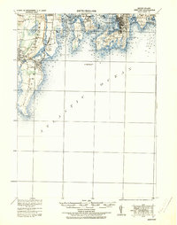
 - 1920 Map of Newport
 1920 Newport1920 Print · USGSCovers Earlscourt Historic District, including South Kingstown, North Kingstown, and other nearby areas2 unique versions available
 - 1922 Map of Newport
 1922 Newport1922 Print · USGSCovers Earlscourt Historic District, including South Kingstown, North Kingstown, and other nearby areas
 - 1931 Map of Newport
 1931 Newport1931 Print · USGSCovers Earlscourt Historic District, including South Kingstown, North Kingstown, and other nearby areas
 - 1935 Map of Newport
 1935 Newport1935 Print · USGSCovers Earlscourt Historic District, including South Kingstown, North Kingstown, and other nearby areas
 - 1942 Map of Newport
 1942 Newport1942 Print · USGSCovers Earlscourt Historic District, including South Kingstown, North Kingstown, and other nearby areas2 unique versions available
 - 1942 Map of Narragansett Pier, 1957 Print
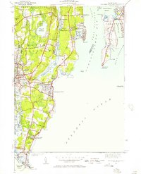 1942 Narragansett Pier1957 Print · USGSCovers Earlscourt Historic District, including South Kingstown, North Kingstown, and other nearby areas
 - 1944 Map of Narragansett Pier
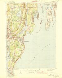 1944 Narragansett Pier1944 Print · USGSCovers Earlscourt Historic District, including South Kingstown, North Kingstown, and other nearby areas3 unique versions available
 - 1947 Map of Providence, 1948 Print
 1947 Providence1948 Print · USGSCovers Earlscourt Historic District, including Providence, New Bedford, and other nearby areas5 unique versions available
 - 1948 Map of Providence, 1951 Print
 1948 Providence1951 Print · USGSCovers Earlscourt Historic District, including Providence, New Bedford, and other nearby areas
 - 1957 Map of Providence
 1957 Providence1957 Print · USGSCovers Earlscourt Historic District, including Providence, New Bedford, and other nearby areas
 - 1957 Map of Narragansett Pier, 1959 Print
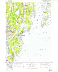 1957 Narragansett Pier1959 Print · USGSCovers Earlscourt Historic District, including South Kingstown, North Kingstown, and other nearby areas5 unique versions available
 - 1958 Map of Providence
 1958 Providence1958 Print · USGSCovers Earlscourt Historic District, including Providence, New Bedford, and other nearby areas
 - 1963 Map of Providence
 1963 Providence1963 Print · USGSCovers Earlscourt Historic District, including Providence, New Bedford, and other nearby areas
 - 1984 Map of Block Island
 1984 Block Island1984 Print · USGSCovers Earlscourt Historic District, including Groton, South Kingstown, and other nearby areas
 - 2024 Map of Narragansett Pier, 2024 Print
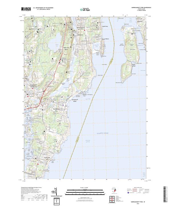 2024 Narragansett Pier2024 Print · USGSCovers Earlscourt Historic District, including South Kingstown, North Kingstown, and other nearby areas
End of results
Showing maps 1-18 of 18
Frequently asked questions
- What are the different types of historical maps available for Earlscourt Historic District?
- What is the oldest map of Earlscourt Historic District?
- Where can I purchase historical maps of Earlscourt Historic District for my home or office?
- Where can I download high-res historical maps of Earlscourt Historic District?
- Are there historical topographic maps available for Earlscourt Historic District?
- Is there historical aerial imagery available for Earlscourt Historic District?
- Where are historical maps of Earlscourt Historic District sourced from?