Old Maps of Beaufort County, South Carolina
Explore 53 old maps of Beaufort County, spanning from 1918 to today. These high-resolution historic maps reveal how streets, neighborhoods, landmarks, and natural features evolved over time — perfect for genealogy, metal detecting, research, and local history exploration.
What you can do with these maps:
- See how Beaufort County changed over time: Compare historical maps to modern-day views to trace roads, homesites, rail lines & more.
- View detailed metadata: Each map includes creators, publishers, year, scale, and archive source.
- Overlay maps with satellite & LiDAR: Visualize the past alongside modern tools to explore terrain & human change.
- Trusted historical sources: Maps sourced from the USGS, Library of Congress, and other archives.
- Access maps your way: View online, download high-res files, or order prints for personal or research use.
Start exploring old maps of Beaufort County to uncover forgotten places, hidden landmarks, and the deep history beneath your feet.
Beaufort County, SC maps
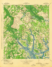
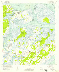
(53)- 1918 Map of Green Pond
 1918 Green Pond1918 Print · USGSCovers Beaufort County, including Beaufort, Ashepoo Siding, and other nearby areas3 unique versions available
 - 1918 Map of Yemassee
 1918 Yemassee1918 Print · USGSCovers Beaufort County, including Beaufort, Ridgeland, and other nearby areas2 unique versions available
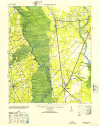
 - 1920 Map of Hardeeville
 1920 Hardeeville1920 Print · USGSCovers Beaufort County, including Rincon, Bluffton, and other nearby areas
 - 1920 Map of Okatie
 1920 Okatie1920 Print · USGSCovers Beaufort County, including Hilton Head Island, Beaufort, and other nearby areas
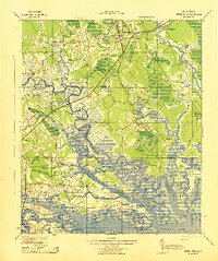
 - 1920 Map of St. Helena Sound
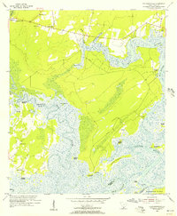
 1920 St. Helena Sound1920 Print · USGSCovers Beaufort County, including Edisto Beach, Cedar Reef Villas, and other nearby areas
 - 1920 Map of Hilton Head
 1920 Hilton Head1920 Print · USGSCovers Beaufort County, including Hilton Head Island, Indigo Run, and other nearby areas
 - 1920 Map of Bluffton
 1920 Bluffton1920 Print · USGSCovers Beaufort County, including Hilton Head Island, Wilmington Island, and other nearby areas
 - 1942 Map of Savannah
 1942 Savannah1942 Print · USGSCovers Beaufort County, including Savannah, Pooler, and other nearby areas
 - 1942 Map of Okatie
 1942 Okatie1942 Print · USGSCovers Beaufort County, including Hilton Head Island, Beaufort, and other nearby areas
 - 1943 Map of Hardeeville
 1943 Hardeeville1943 Print · USGSCovers Beaufort County, including Rincon, Bluffton, and other nearby areas
 - 1943 Map of Yemassee
 1943 Yemassee1943 Print · USGSCovers Beaufort County, including Beaufort, Ridgeland, and other nearby areas3 unique versions available
 - 1943 Map of Green Pond
 1943 Green Pond1943 Print · USGSCovers Beaufort County, including Beaufort, Ashepoo Siding, and other nearby areas2 unique versions available
 - 1944 Map of Fort Fremont
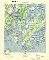 1944 Fort Fremont1944 Print · USGSCovers Beaufort County, including Hilton Head Island, Beaufort, and other nearby areas
 - 1945 Map of Bluffton
 1945 Bluffton1945 Print · USGSCovers Beaufort County, including Hilton Head Island, Wilmington Island, and other nearby areas
 - 1945 Map of Hilton Head
 1945 Hilton Head1945 Print · USGSCovers Beaufort County, including Hilton Head Island, Indigo Run, and other nearby areas
 - 1947 Map of Savannah
 1947 Savannah1947 Print · USGSCovers Beaufort County, including Charleston, Savannah, and other nearby areas
 - 1948 Map of St. Helena Sound
 1948 St. Helena Sound1948 Print · USGSCovers Beaufort County, including Edisto Beach, Cedar Reef Villas, and other nearby areas2 unique versions available
 - 1948 Map of Savannah
 1948 Savannah1948 Print · USGSCovers Beaufort County, including Charleston, Savannah, and other nearby areas
 - 1953 Map of Hardeeville
 1953 Hardeeville1953 Print · USGSCovers Beaufort County, including Rincon, Bluffton, and other nearby areas
 - 1955 Map of Pritchardville, 1956 Print
 1955 Pritchardville1956 Print · USGSCovers Beaufort County, including Bluffton, Good Hope Landing, and other nearby areas3 unique versions available
 - 1955 Map of Savannah Beach North, 1956 Print
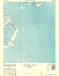
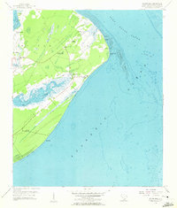
 1955 Savannah Beach North1956 Print · USGSCovers Beaufort County, including Hilton Head Island, Tybee Island, and other nearby areas3 unique versions available
 - 1955 Map of Fort Pulaski, 1957 Print
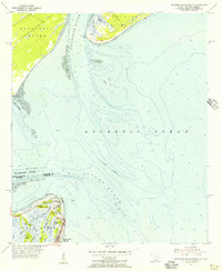
 1955 Fort Pulaski1957 Print · USGSCovers Beaufort County, including Wilmington Island, Tybee Island, and other nearby areas2 unique versions available
 - 1955 Map of Limehouse, 1957 Print
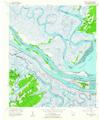
 1955 Limehouse1957 Print · USGSCovers Beaufort County, including Bluffton, Hardeeville, and other nearby areas2 unique versions available
 - 1956 Map of Frogmore, 1957 Print
 1956 Frogmore1957 Print · USGSCovers Beaufort County, including Beaufort, Ashdale, and other nearby areas3 unique versions available
 - 1956 Map of Hilton Head, 1957 Print
 1956 Hilton Head1957 Print · USGSCovers Beaufort County, including Hilton Head Island, Indigo Run, and other nearby areas3 unique versions available
Showing maps 1-25 of 53
Top cities of Beaufort County
- Hilton Head Island historical maps
- Beaufort historical maps
- Port Royal historical maps
- Bluffton historical maps
Frequently asked questions
- What are the different types of historical maps available for Beaufort County?
- What is the oldest map of Beaufort County?
- Where can I purchase historical maps of Beaufort County for my home or office?
- Where can I download high-res historical maps of Beaufort County?
- Are there historical topographic maps available for Beaufort County?
- Is there historical aerial imagery available for Beaufort County?
- Where are historical maps of Beaufort County sourced from?