1950s Maps of Cutter Court, Hilton Head Island
Explore 2 historic maps of Cutter Court from the 1950s. These maps offer a rare glimpse into what life looked like during the 1950s — showing old roads, neighborhoods, homes, and landmarks that have changed or disappeared over time.
Whether you're researching your family's past, planning a metal detecting trip, or studying how Cutter Court's landscape evolved across the 1950s, these high-resolution maps are a powerful tool for exploring the history of this region.
- Focus on a specific era: All maps on this page are from the 1950s, giving you a focused view of this time period.
- See what’s changed: Compare century-old streets, trails, and buildings to today's modern landscape using overlays and satellite layers.
- Research with precision: Use these maps for genealogy, historical research, land use analysis, or educational projects.
- View, download, or print: Maps are fully viewable online in high resolution, and can be downloaded or printed for your own records.
Start exploring Cutter Court's history through authentic maps from the 1950s. This is your window into the past.
Cutter Court, Hilton Head Island maps
(2)- 1956 Map of Bluffton, 1957 Print
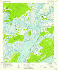 1956 Bluffton1957 Print · USGSThe South Carolina Lowcountry of the mid-fifties is a network of tidal reaches and quiet sea islands before the arrival of modern resorts. Trace ancestral sites and early infrastructure through the State Ferry Dock, Mikey Riley Sch, and the Baynard Ruins.5 unique versions available
 - 1957 Map of Savannah, 1967 Print
 1957 Savannah1967 Print · USGSThe Lowcountry and Georgia coastal plain are shown here in the late fifties, prior to modern expansion. Researchers can trace the rail-and-river economy through the Central of Georgia lines and the Ogeechee River wetlands.4 unique versions available
End of results
Showing maps 1-2 of 2
Frequently asked questions
- What are the different types of historical maps available for Cutter Court?
- What is the oldest map of Cutter Court?
- Where can I purchase historical maps of Cutter Court for my home or office?
- Where can I download high-res historical maps of Cutter Court?
- Are there historical topographic maps available for Cutter Court?
- Is there historical aerial imagery available for Cutter Court?
- Where are historical maps of Cutter Court sourced from?