Old Maps of Hilton Head Plantation, Hilton Head Island for Academic Research
Study the evolution of Hilton Head Plantation with 14 high-resolution historic maps. Whether you're teaching, researching, or modeling changes in land use, these maps provide essential visual documentation of urban, environmental, and geographic change.
- Analyze long-term change: Track patterns in development, transportation, and natural features.
- Ideal for environmental or urban studies: Support academic projects with primary historical map data.
- Use in the classroom or lab: Educators and researchers rely on these maps to bring historical context to life.
These maps are a powerful tool for teaching, research, and visualizing how Hilton Head Plantation has changed over the decades.
Hilton Head Plantation, Hilton Head Island maps
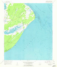
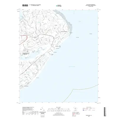
(14)- 1920 Map of Hilton Head
 1920 Hilton Head1920 Print · USGSCoastal Beaufort County appears here as it was just after the Great War, before the bridges and modern development arrived. Genealogists and maritime historians can trace the early settlement of Hilton Head and locate landmarks like the L.H. and Broad Creek.
 - 1945 Map of Hilton Head
 1945 Hilton Head1945 Print · USGSCoastal South Carolina remains largely rural in the mid-1940s, showing the island long before its modern resort era. Genealogists can trace early community hubs like First Africian Ch, Oak Grove Ch, and the small settlement of Hilton Head.
 - 1947 Map of Savannah
 1947 Savannah1947 Print · USGSCoastal Georgia and South Carolina are captured here in the mid-forties, showing the rail-and-river networks of the Lowcountry. Genealogists and researchers can trace old crossroads and river towns from Statesboro to Beaufort, alongside military sites like Camp Stewart and Parris Island.
 - 1948 Map of Savannah
 1948 Savannah1948 Print · USGSThe Georgia and South Carolina Lowcountry comes alive in this post-war survey of the coast and its river-fed hinterlands. Genealogists and historians can trace rail lines like the Central of Georgia RR and find established settlements such as Isle of Hope and Sylvania.
 - 1956 Map of Hilton Head, 1957 Print
 1956 Hilton Head1957 Print · USGSHilton Head Island is captured in the mid-1950s, showing a quiet maritime landscape before its transition into a major resort destination. Genealogists and historians can locate family landmarks like Drayton Cem or explore sites of local heritage including First African Ch and Fort Walker Ruin.4 unique versions available
 - 1957 Map of Savannah, 1967 Print
 1957 Savannah1967 Print · USGSThe Lowcountry and Georgia coastal plain are shown here in the late fifties, prior to modern expansion. Researchers can trace the rail-and-river economy through the Central of Georgia lines and the Ogeechee River wetlands.4 unique versions available
 - 1960 Map of Savannah
 1960 Savannah1960 Print · USGSCoastal Georgia and the South Carolina Lowcountry are captured in the late fifties, showcasing the intricate web of islands and tidal rivers before modern expansion. Researchers can trace the rail lines of the Atlantic Coast Line or locate sites like Parris Island, Beaufort, and the Tybee Lighthouse.
 - 1961 Map of Savannah
 1961 Savannah1961 Print · USGSThe Georgia and South Carolina Lowcountry comes alive in this mid-century survey of coastal marshes, barrier islands, and river networks. Genealogists and historians can trace the paths of the Seaboard Air Line RR, locate family sites near Isle of Hope, or study the grounds of Fort Stewart Military Reservation.2 unique versions available
 - 1978 Map of Beaufort
 1978 Beaufort1978 Print · USGSCoastal South Carolina and Georgia come to life in this detailed bathymetric study from the late seventies, featuring the intricate Sea Islands and the Savannah River mouth. Researchers can trace military history at Parris Island or locate inland settlements like Switzerland and Old Sheldon.2 unique versions available
 - 2011 Map of Hilton Head, 2011 Print
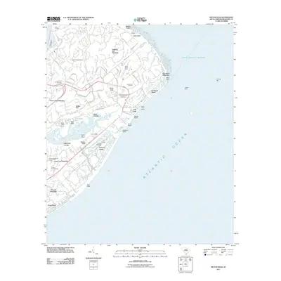 2011 Hilton Head2011 Print · USGSCovers Hilton Head Plantation, including Hilton Head Island, Palmetto Dunes, and other nearby areas
 - 2014 Map of Hilton Head, 2014 Print
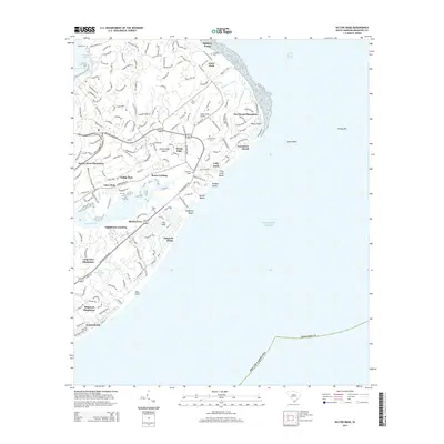 2014 Hilton Head2014 Print · USGSCovers Hilton Head Plantation, including Hilton Head Island, Palmetto Dunes, and other nearby areas
 - 2017 Map of Hilton Head, 2017 Print
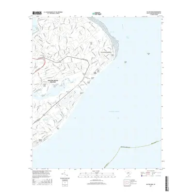 2017 Hilton Head2017 Print · USGSCovers Hilton Head Plantation, including Hilton Head Island, Palmetto Dunes, and other nearby areas
 - 2020 Map of Hilton Head, 2020 Print
 2020 Hilton Head2020 Print · USGSCovers Hilton Head Plantation, including Hilton Head Island, Palmetto Dunes, and other nearby areas
 - 2024 Map of Hilton Head, 2024 Print
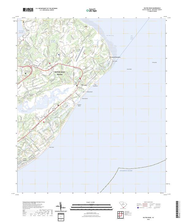 2024 Hilton Head2024 Print · USGSHilton Head Island is shown in its modern era, where sophisticated resort developments meet historical plantation-era landmarks. Trace lineage at the Zion Chapel Church Graveyard or locate old burial sites like Talbird Cem and Joe Pope Cem.
End of results
Showing maps 1-14 of 14
Top cities near Hilton Head Plantation
- Hilton Head Island historical maps
- Beaufort historical maps
- Port Royal historical maps
- Bluffton historical maps
- Tybee Island historical maps
- Hardeeville historical maps
Frequently asked questions
- What are the different types of historical maps available for Hilton Head Plantation?
- What is the oldest map of Hilton Head Plantation?
- Where can I purchase historical maps of Hilton Head Plantation for my home or office?
- Where can I download high-res historical maps of Hilton Head Plantation?
- Are there historical topographic maps available for Hilton Head Plantation?
- Is there historical aerial imagery available for Hilton Head Plantation?
- Where are historical maps of Hilton Head Plantation sourced from?