Old Maps of Myrtle Beach, South Carolina for Metal Detecting
Plan your next treasure hunt with 28 historic maps of Myrtle Beach. Find old homesites, ghost towns, trails, and gathering spots that may be lost to time — perfect for identifying promising metal detecting locations.
- Locate forgotten sites: Uncover places like long-lost settlements, abandoned rail lines, or gathering spots.
- Plan better hunts: Use map overlays combined with LiDAR or satellite views to narrow in on historically rich areas.
- Made for detectorists: Thousands of hobbyists use these maps to discover relics, coins, and hidden history.
Use these historic maps to boost your research and find new opportunities beneath the surface of Myrtle Beach.
Myrtle Beach, SC maps
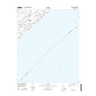
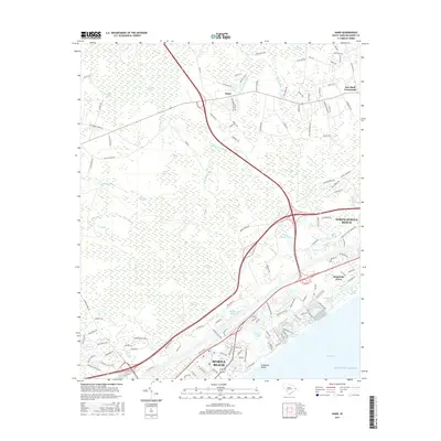
(28)- 1937 Map of Myrtle Beach
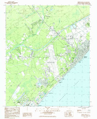
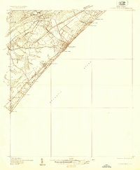 1937 Myrtle Beach1937 Print · USGSThe Grand Strand is seen here in the late 1930s as a developing coastal corridor transitioning from swampy lowlands to a vacation destination. Trace early infrastructure including the Intracoastal Waterway, Myrtle Beach State Park, and the CCC Camp.3 unique versions available
 - 1937 Map of Nixonville
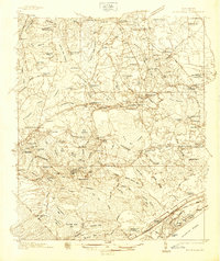 1937 Nixonville1937 Print · USGSCoastal South Carolina is depicted just before the war as a landscape of river landings and rural schoolhouses. Researchers can locate family landmarks like Graham Cem, identify the location of the Chain Gang Shanty, and trace the path of the Atlantic Coast Line.2 unique versions available
 - 1940 Map of Myrtle Beach
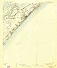 1940 Myrtle Beach1940 Print · USGSBefore the rise of modern resorts, the Grand Strand was a network of swashes and small coastal outposts. Genealogists and historians can trace the early footprints of Socastee, Myrtle Ridge, and the Ocean Forest Club along the historic Kings Highway.3 unique versions available
 - 1942 Map of Nixonville
 1942 Nixonville1942 Print · USGSCoastal South Carolina was a landscape of river landings and remote wetlands in the late thirties. Researchers can trace family roots through numerous local landmarks like Hickory Grove Sch, Mt Calvary Ch, and Reeves Log along the Waccamaw River.2 unique versions available
 - 1949 Map of Georgetown, 1953 Print
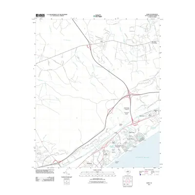
 1949 Georgetown1953 Print · USGSThe South Carolina coast and North Carolina borderlands appear here in the mid-century, prior to the major modern development of the Grand Strand. Genealogists and historians can trace the rail networks of the Seaboard Air Line Railroad and locate coastal landmarks from Fort Caswell to McClellanville.
 - 1967 Map of Georgetown
 1967 Georgetown1967 Print · USGSThe South Carolina Lowcountry and Grand Strand meet in the late sixties, showcasing a coastal landscape transitioning from river-based industry to seaside tourism. Researchers can trace the Intracoastal Waterway past Georgetown or locate historical sites like Fort Fisher and Murrells Inlet.
 - 1974 Map of Georgetown, 1978 Print
 1974 Georgetown1978 Print · USGSThe Carolina coast and Pee Dee region are shown here in the mid-seventies, just as the Grand Strand was maturing into a premier destination. Researchers can trace the inland rail corridors of the Seaboard Coast Line Railroad or explore the coastal reaches of the Cape Romain National Wildlife Refuge and Myrtle Beach State Park.2 unique versions available
 - 1984 Map of Ocean Forest
 1984 Ocean Forest1984 Print · USGSCoastal South Carolina shows its expanding residential and resort footprint in the 1980s as Myrtle Beach moves north. Genealogists and historians can trace neighborhood development near Ocean Forest, find local institutions like Coastal Academy, or locate landmarks such as Memorial Stadium.2 unique versions available
 - 1984 Map of Hand
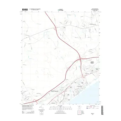
 1984 Hand1984 Print · USGSCoastal South Carolina in the mid-eighties shows a unique intersection of rural swamp country and the expanding resort culture of the Grand Strand. Genealogists and local historians can trace family locations near Hand, Star Bluff Crossroads, and Sharon Ch.2 unique versions available
 - 1984 Map of Myrtle Beach, 1985 Print
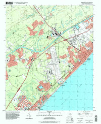
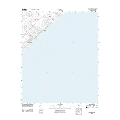
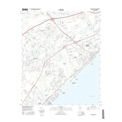
 1984 Myrtle Beach1985 Print · USGSThe Grand Strand in the early eighties shows a fascinating mix of military activity and vacation development. Researchers can trace the massive footprint of the Myrtle Beach Air Force Base or locate local landmarks like the Springmaid Beach Pier and Socastee.
 - 1986 Map of Myrtle Beach
 1986 Myrtle Beach1986 Print · USGSThe Grand Strand and Brunswick County coast are captured in the mid-eighties before the late-century development boom. Researchers can trace the footprint of the Myrtle Beach Air Force Base and old coastal settlements like Atlantic Beach and Socastee.
 - 1990 Map of Myrtle Beach
 1990 Myrtle Beach1990 Print · USGSThe Grand Strand and the North Carolina borderlands are captured here in the decade before the base closure. Genealogists and historians can trace the development of Myrtle Beach and North Myrtle Beach alongside rural landmarks like Star Bluff Crossroads and Fort Caswell.
 - 1994 Map of Myrtle Beach, 1999 Print
 1994 Myrtle Beach1999 Print · USGSCoastal Horry County appears in the mid-1990s as the tourism economy and residential sprawl reshaped the Grand Strand. Genealogists and local historians can trace the footprint of the Myrtle Beach International Airport or locate family sites at Mt Carmel Ch and Socastee.
 - 2011 Map of Myrtle Beach, 2011 Print
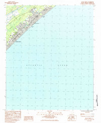
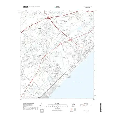
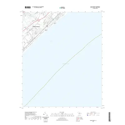
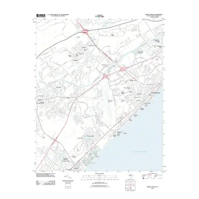 2011 Myrtle Beach2011 Print · USGSCovers Myrtle Beach, including Surfside Beach, Deerfield Plantation, and other nearby areas
 - 2011 Map of Hand, 2011 Print
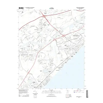
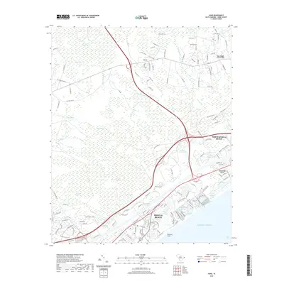
 2011 Hand2011 Print · USGSCovers Myrtle Beach, including North Myrtle Beach, Briarcliffe Acres, and other nearby areas
 - 2011 Map of Ocean Forest, 2011 Print
 2011 Ocean Forest2011 Print · USGSCovers Myrtle Beach, including Horry County, United States, and other nearby areas
 - 2014 Map of Hand, 2014 Print
 2014 Hand2014 Print · USGSCovers Myrtle Beach, including North Myrtle Beach, Briarcliffe Acres, and other nearby areas
 - 2014 Map of Myrtle Beach, 2014 Print
 2014 Myrtle Beach2014 Print · USGSCovers Myrtle Beach, including Surfside Beach, Deerfield Plantation, and other nearby areas
 - 2014 Map of Ocean Forest, 2014 Print
 2014 Ocean Forest2014 Print · USGSCovers Myrtle Beach, including Horry County, United States, and other nearby areas
 - 2017 Map of Hand, 2017 Print
 2017 Hand2017 Print · USGSCovers Myrtle Beach, including North Myrtle Beach, Briarcliffe Acres, and other nearby areas
 - 2017 Map of Myrtle Beach, 2017 Print
 2017 Myrtle Beach2017 Print · USGSCovers Myrtle Beach, including Surfside Beach, Deerfield Plantation, and other nearby areas
 - 2017 Map of Ocean Forest, 2017 Print
 2017 Ocean Forest2017 Print · USGSCovers Myrtle Beach, including Horry County, United States, and other nearby areas
 - 2020 Map of Myrtle Beach, 2020 Print
 2020 Myrtle Beach2020 Print · USGSCovers Myrtle Beach, including Surfside Beach, Deerfield Plantation, and other nearby areas
 - 2020 Map of Ocean Forest, 2020 Print
 2020 Ocean Forest2020 Print · USGSCovers Myrtle Beach, including Horry County, United States, and other nearby areas
 - 2020 Map of Hand, 2020 Print
 2020 Hand2020 Print · USGSCovers Myrtle Beach, including North Myrtle Beach, Briarcliffe Acres, and other nearby areas
Showing maps 1-25 of 28
Top cities near Myrtle Beach
- Conway historical maps
- Carolina Forest historical maps
- North Myrtle Beach historical maps
- Garden City Beach historical maps
- Murrells Inlet historical maps
- Surfside Beach historical maps
See more
Top neighborhoods of Myrtle Beach
- Market Common District historical maps
- Grande Dunes historical maps
- Back Gate historical maps
- Balmoral historical maps
- Belle Harbor historical maps
- Bent Oak Estates historical maps
See more
Frequently asked questions
- What are the different types of historical maps available for Myrtle Beach?
- What is the oldest map of Myrtle Beach?
- Where can I purchase historical maps of Myrtle Beach for my home or office?
- Where can I download high-res historical maps of Myrtle Beach?
- Are there historical topographic maps available for Myrtle Beach?
- Is there historical aerial imagery available for Myrtle Beach?
- Where are historical maps of Myrtle Beach sourced from?