1980s Maps of Bay Hill Cove, Boiling Springs
Explore 4 historic maps of Bay Hill Cove from the 1980s. These maps offer a rare glimpse into what life looked like during the 1980s — showing old roads, neighborhoods, homes, and landmarks that have changed or disappeared over time.
Whether you're researching your family's past, planning a metal detecting trip, or studying how Bay Hill Cove's landscape evolved across the 1980s, these high-resolution maps are a powerful tool for exploring the history of this region.
- Focus on a specific era: All maps on this page are from the 1980s, giving you a focused view of this time period.
- See what’s changed: Compare century-old streets, trails, and buildings to today's modern landscape using overlays and satellite layers.
- Research with precision: Use these maps for genealogy, historical research, land use analysis, or educational projects.
- View, download, or print: Maps are fully viewable online in high resolution, and can be downloaded or printed for your own records.
Start exploring Bay Hill Cove's history through authentic maps from the 1980s. This is your window into the past.
Bay Hill Cove, Boiling Springs maps
(4)- 1983 Map of Inman
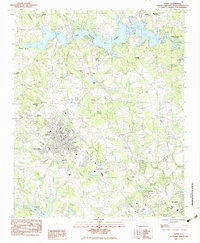 1983 Inman1983 Print · USGSInman and the surrounding Spartanburg County textile corridor are captured here during the early eighties. Researchers can trace family roots through numerous sites like Inman Mills, Chapman High Sch, and the Ridgeville Ch Cem.
 - 1983 Map of Valley Falls
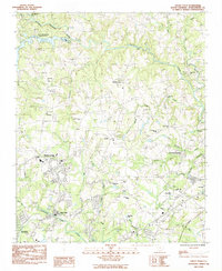 1983 Valley Falls1983 Print · USGSSpartanburg County's rolling Piedmont landscape is captured here in the early eighties, showing the growth of Boiling Springs and Valley Falls. Local historians can trace old community centers like Cherokee Springs, find family-named landmarks like Holden Chapel, and locate the South Pacolet River Reservoir No 1.
 - 1986 Map of Hendersonville
 1986 Hendersonville1986 Print · USGSThe Blue Ridge foothills of North and South Carolina are documented here in the mid-eighties as modern highways began to reshape mountain travel. Local historians can trace the paths of the Southern Railway through Hendersonville or locate landmarks like Looking Glass Rock and Inman Mills.2 unique versions available
 - 1986 Map of Gastonia
 1986 Gastonia1986 Print · USGSThe Carolina Piedmont in the mid-eighties shows a landscape shaped by Revolutionary War history and the textile industry. Trace the footprints of early battles at Kings Mountain National Military Park and locate depots along the Southern Railway in Shelby and Gastonia.
End of results
Showing maps 1-4 of 4
Frequently asked questions
- What are the different types of historical maps available for Bay Hill Cove?
- What is the oldest map of Bay Hill Cove?
- Where can I purchase historical maps of Bay Hill Cove for my home or office?
- Where can I download high-res historical maps of Bay Hill Cove?
- Are there historical topographic maps available for Bay Hill Cove?
- Is there historical aerial imagery available for Bay Hill Cove?
- Where are historical maps of Bay Hill Cove sourced from?