1900s (20th Century) Maps of Kingston Ridge, Spartanburg County
Explore 13 historic maps of Kingston Ridge from the 1900s (20th Century). These maps offer a rare glimpse into what life looked like during the 1900s — showing old roads, neighborhoods, homes, and landmarks that have changed or disappeared over time.
Whether you're researching your family's past, planning a metal detecting trip, or studying how Kingston Ridge's landscape evolved across the 1900s, these high-resolution maps are a powerful tool for exploring the history of this region.
- Focus on a specific era: All maps on this page are from the 1900s, giving you a focused view of this time period.
- See what’s changed: Compare century-old streets, trails, and buildings to today's modern landscape using overlays and satellite layers.
- Research with precision: Use these maps for genealogy, historical research, land use analysis, or educational projects.
- View, download, or print: Maps are fully viewable online in high resolution, and can be downloaded or printed for your own records.
Start exploring Kingston Ridge's history through authentic maps from the 1900s. This is your window into the past.
Kingston Ridge, Spartanburg County maps
(13)- 1953 Map of Charlotte, 1968 Print
 1953 Charlotte1968 Print · USGSThe North Carolina Piedmont and South Carolina borderlands are shown in detail during a period of significant growth and reservoir development. Trace the rail corridors of the Southern Railway or find family roots in towns like China Grove, Misenheimer, and Lincolnton.3 unique versions available
 - 1954 Map of Charlotte
 1954 Charlotte1954 Print · USGSThe North Carolina Piedmont in the mid-1950s shows a region of rapid growth and industrial expansion centered around Charlotte. Trace the era's infrastructure through the Southern railroad lines and locate significant landmarks like the Charlotte Naval Ammunition Depot and Lake Norman.2 unique versions available
 - 1959 Map of Cowpens, 1961 Print
 1959 Cowpens1961 Print · USGSThe borderlands of the Carolinas are shown here in the late fifties, featuring a mix of textile mill towns and rural farming communities. Researchers can trace family roots through numerous local landmarks like Cannons Camp Ground, Gaffney Chapel, and Cooley Springs.2 unique versions available
 - 1960 Map of Charlotte
 1960 Charlotte1960 Print · USGSMid-century North Carolina and South Carolina meet in this 1960 survey of the Piedmont's industrial and textile heartland. Trace the growth of Charlotte alongside historic landmarks like Kings Mountain National Military Park and the Charlotte Naval Ammunition Depot.2 unique versions available
 - 1962 Map of Charlotte
 1962 Charlotte1962 Print · USGSThe North Carolina Piedmont in the early sixties showcases a landscape transformed by massive reservoirs and industrial growth. Researchers can trace the development of Lake Norman, locate the Charlotte Naval Ammunition Depot, or find family landmarks like Wesley Chapel and Brown & Norcott Mills.
 - 1975 Map of Cowpens NW, 1979 Print
 1975 Cowpens NW1979 Print · USGSThe South Carolina and North Carolina borderlands come into focus in the mid-1970s, showing the rural landscape along the Broad River. Genealogists and local historians can trace the roads and homesteads surrounding Cooley Springs, Harris, and Fingerville.
 - 1975 Map of Cowpens NE, 1979 Print
 1975 Cowpens NE1979 Print · USGSThe borderlands of the Carolinas come into focus during the mid-seventies in this detailed orthophoto. Researchers can trace the rural layouts of Chesnee and Cliffside while identifying family farmsteads along the Broad River.
 - 1983 Map of Fingerville East
 1983 Fingerville East1983 Print · USGSThe borderlands of the Carolinas in the early 1980s show a rural network of small crossroads and river crossings. Genealogists and local historians can trace family roots through numerous sites like Alverson Grove Ch, Brooklyn Cem, and the settlement of Fingerville.
 - 1983 Map of Chesnee
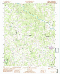
 1983 Chesnee1983 Print · USGSThe Carolina borderlands near Chesnee and Cliffside are captured here in the early eighties as the textile and agricultural landscape evolved. Genealogists and local historians can locate many rural landmarks, from the Cowpens National Battlefield to Jerusalem Ch and Chase High Sch.
 - 1986 Map of Gastonia
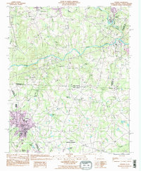
 1986 Gastonia1986 Print · USGSThe Carolina Piedmont in the mid-eighties shows a landscape shaped by Revolutionary War history and the textile industry. Trace the footprints of early battles at Kings Mountain National Military Park and locate depots along the Southern Railway in Shelby and Gastonia.
 - 1991 Map of Gastonia
 1991 Gastonia1991 Print · USGSThe Piedmont region along the North Carolina and South Carolina border shows a bustling industrial and transit corridor in the early nineties. Researchers can trace the sprawling footprints of Gastonia and Shelby or explore the grounds of Kings Mountain National Military Park and Lake Wylie.
 - 1993 Map of Fingerville East, 1996 Print
 1993 Fingerville East1996 Print · USGSThe rural borderlands of South Carolina and North Carolina are captured here in the mid-nineties, showing a landscape defined by small creeks and country crossroads. Researchers can trace family roots through numerous local landmarks like Cedar Grove Ch, Cooley Springs, and McKinney Bridge.
 - 1993 Map of Chesnee, 1996 Print
 1993 Chesnee1996 Print · USGSThe Carolina borderlands come alive in this early 1990s survey, showing the landscape before recent regional expansion. Genealogists and historians can trace local family roots at County Memorial Cem or locate community hubs like Hicks Grove Ch and Chase High Sch.
End of results
Showing maps 1-13 of 13
Frequently asked questions
- What are the different types of historical maps available for Kingston Ridge?
- What is the oldest map of Kingston Ridge?
- Where can I purchase historical maps of Kingston Ridge for my home or office?
- Where can I download high-res historical maps of Kingston Ridge?
- Are there historical topographic maps available for Kingston Ridge?
- Is there historical aerial imagery available for Kingston Ridge?
- Where are historical maps of Kingston Ridge sourced from?