Old Maps of Rivermill, Spartanburg County
Explore 28 old maps of Rivermill, spanning from 1935 to today. These high-resolution historic maps reveal how streets, neighborhoods, landmarks, and natural features evolved over time — perfect for genealogy, metal detecting, research, and local history exploration.
What you can do with these maps:
- See how Rivermill changed over time: Compare historical maps to modern-day views to trace roads, homesites, rail lines & more.
- View detailed metadata: Each map includes creators, publishers, year, scale, and archive source.
- Overlay maps with satellite & LiDAR: Visualize the past alongside modern tools to explore terrain & human change.
- Trusted historical sources: Maps sourced from the USGS, Library of Congress, and other archives.
- Access maps your way: View online, download high-res files, or order prints for personal or research use.
Start exploring old maps of Rivermill to uncover forgotten places, hidden landmarks, and the deep history beneath your feet.
Rivermill, Spartanburg County maps
(28)- 1935 Map of Greer
 1935 Greer1935 Print · USGSThe industrial textile hubs and rural communities of the South Carolina Piedmont thrive along the rail lines during the mid-thirties. Genealogists and local historians can trace family locations near Victor Mills, Hanson Academy, and numerous country churches like Woods Chapel.
 - 1938 Map of Greer
 1938 Greer1938 Print · USGSUpstate South Carolina during the mid-1930s was a landscape of bustling textile centers and quiet rural crossroads. Genealogists and historians can trace family roots through numerous local landmarks like Woods Chapel, Jackson Mill, and the CCC Camp near Switzer.3 unique versions available
 - 1941 Map of Spartanburg
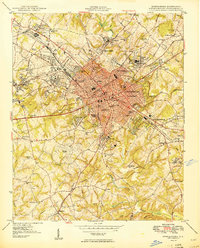
 1941 Spartanburg1941 Print · USGSSouth Carolina’s Piedmont and Sandhills regions are shown here during the mid-century peak of the rail era. Researchers can trace the sprawling Fort Jackson Military Reservation and the industrial growth of hubs like Spartanburg and Rock Hill.
 - 1947 Map of Spartanburg, 1969 Print
 1947 Spartanburg1969 Print · USGSSpartanburg and its surrounding mill towns are captured here in the late 1940s, a period defined by rail commerce and military presence. Researchers can trace family roots through numerous local landmarks like Hammett Grove Ch, Glenn Springs, and the sprawling grounds of Camp Croft.
 - 1949 Map of Spartanburg
 1949 Spartanburg1949 Print · USGSSpartanburg was a thriving railroad and industrial center in the late 1940s, defined by its textile mills and historic colleges. Trace the legacy of early local institutions and family names at Wofford College, Lincoln Memorial Cem, and Hayne Sta.3 unique versions available
 - 1949 Map of Spartanburg
 1949 Spartanburg1949 Print · USGSSpartanburg and its surrounding mill villages are captured here during the post-war industrial era. Genealogists can trace family roots through numerous rural landmarks like Hammett Grove Ch, Stone Station, and the sprawling grounds of Camp Croft.
 - 1953 Map of Spartanburg, 1966 Print
 1953 Spartanburg1966 Print · USGSMid-century South Carolina comes into focus through this survey of the Piedmont and the Sand Hills at a time of significant reservoir expansion. Researchers can trace the legacy of industrial transit and resource extraction from the Haile Gold Mine to the rail hubs of the Seaboard Air Line.4 unique versions available
 - 1954 Map of Greenville, 1965 Print
 1954 Greenville1965 Print · USGSThe Upstate and Northeast Georgia are captured here during a decade of massive transformation as new reservoirs reshaped the Piedmont. Genealogists and hikers can trace the Appalachian Trail over Brasstown Bald or locate old community centers like Demorest, Westminster, and Royston.3 unique versions available
 - 1957 Map of Greer, 1959 Print
 1957 Greer1959 Print · USGSThe Upstate South Carolina textile corridor comes to life in this mid-century survey of the Tyger River valleys. Researchers can trace the industrial footprint of Victor Mills, locate early country churches like Old Pilgrim Ch, and explore the residential growth around Greer and Lyman.2 unique versions available
 - 1958 Map of Greenville
 1958 Greenville1958 Print · USGSThe Piedmont and Blue Ridge foothills come alive in this mid-century survey of the Upstate and Northeast Georgia. Trace the regional rail-and-river economy through the Southern Railway corridors and early reservoir developments like Lake Sidney Lanier.
 - 1960 Map of Spartanburg
 1960 Spartanburg1960 Print · USGSThe South Carolina Piedmont and North Carolina borderlands come alive in this mid-century survey of the region between Spartanburg and Columbia. Researchers can trace the Seaboard Air Line railroad and explore landmarks like Anderson Quarry, Lake Murray, and Mount Croghan.2 unique versions available
 - 1963 Map of Spartanburg
 1963 Spartanburg1963 Print · USGSMid-century South Carolina comes alive in this survey, showing the rail-linked corridor between the Upstate and the Midlands. Genealogists can trace family lands near old hubs like Union and Lancaster, or along the banks of the Broad River and Pee Dee River.
 - 1964 Map of Spartanburg
 1964 Spartanburg1964 Print · USGSMid-century South Carolina comes alive in this survey of the Piedmont and Upcountry, stretching from the Blue Ridge foothills to the Sandhills. Genealogists and historians can trace the rail-and-river economy through Monarch Mills, Glenn Springs, and the Southern Railway corridor.
 - 1983 Map of Spartanburg
 1983 Spartanburg1983 Print · USGSSpartanburg during the early 1980s reveals a bustling Piedmont city anchored by its prestigious colleges and industrial suburbs. Researchers can trace the development of the city's residential districts like Converse Heights or locate family sites near Lincoln Memorial Gardens and Drayton.2 unique versions available
 - 1983 Map of Wellford
 1983 Wellford1983 Print · USGSSpartanburg County's industrial river valleys are captured here in the early eighties, showing the vital textile communities along the Tyger Rivers. Trace local heritage through mill sites like Jackson Mill, family-named cemeteries such as Penny-McMillan Cem, and the tracks of the Southern railroad.
 - 1984 Map of Greenville
 1984 Greenville1984 Print · USGSThe South Carolina Upstate undergoes rapid suburban growth in the mid-eighties as modern interstates begin to reshape the landscape. Researchers can trace historic rail lines like the Greenville and Northern Railway and locate local landmarks such as Clemson University and Paris Mountain State Park.
 - 1986 Map of Spartanburg
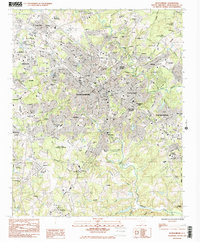
 1986 Spartanburg1986 Print · USGSUpstate South Carolina is captured here in the mid-1980s, showcasing the region's transition from a textile-driven rail corridor to a modern interstate hub. Researchers can trace the legacy of the SOUTHERN railroad through mill towns like Glendale or explore the wooded reaches of the Sumter National Forest.2 unique versions available
 - 1991 Map of Greenville
 1991 Greenville1991 Print · USGSThe South Carolina Upstate was a landscape of rapid growth and engineering in the early nineties. Researchers can trace the expansion of Greenville and Spartanburg, find Clemson University, or study the massive reservoirs of Hartwell Lake and Lake Keowee.
 - 2011 Map of Spartanburg, 2011 Print
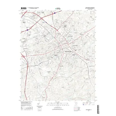
 2011 Spartanburg2011 Print · USGSCovers Rivermill, including Spartanburg, Roebuck, and other nearby areas
 - 2011 Map of Wellford, 2011 Print
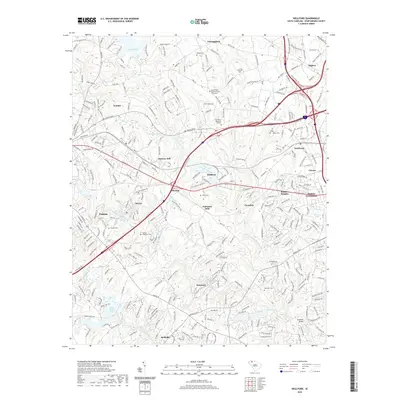
 2011 Wellford2011 Print · USGSCovers Rivermill, including Lyman, Duncan, and other nearby areas
 - 2014 Map of Spartanburg, 2014 Print
 2014 Spartanburg2014 Print · USGSCovers Rivermill, including Spartanburg, Roebuck, and other nearby areas
 - 2014 Map of Wellford, 2014 Print
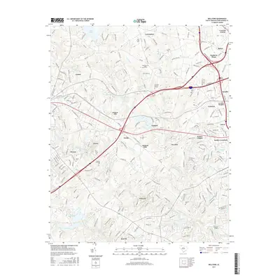
 2014 Wellford2014 Print · USGSCovers Rivermill, including Lyman, Duncan, and other nearby areas
 - 2017 Map of Wellford, 2017 Print
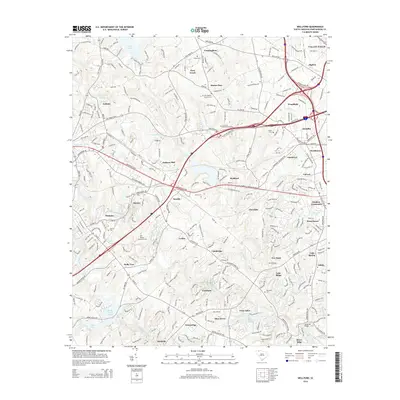
 2017 Wellford2017 Print · USGSCovers Rivermill, including Lyman, Duncan, and other nearby areas
 - 2017 Map of Spartanburg, 2017 Print
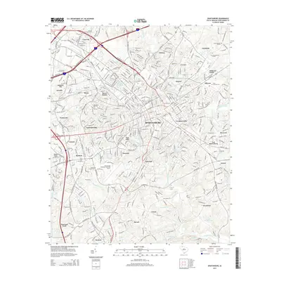
 2017 Spartanburg2017 Print · USGSCovers Rivermill, including Spartanburg, Roebuck, and other nearby areas
 - 2020 Map of Wellford, 2020 Print
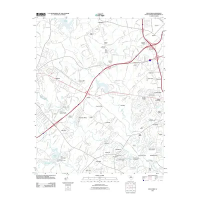
 2020 Wellford2020 Print · USGSCovers Rivermill, including Lyman, Duncan, and other nearby areas
Showing maps 1-25 of 28
Frequently asked questions
- What are the different types of historical maps available for Rivermill?
- What is the oldest map of Rivermill?
- Where can I purchase historical maps of Rivermill for my home or office?
- Where can I download high-res historical maps of Rivermill?
- Are there historical topographic maps available for Rivermill?
- Is there historical aerial imagery available for Rivermill?
- Where are historical maps of Rivermill sourced from?