Old Maps of Brookings County, South Dakota
Explore 150 old maps of Brookings County, spanning from 1953 to today. These high-resolution historic maps reveal how streets, neighborhoods, landmarks, and natural features evolved over time — perfect for genealogy, metal detecting, research, and local history exploration.
What you can do with these maps:
- See how Brookings County changed over time: Compare historical maps to modern-day views to trace roads, homesites, rail lines & more.
- View detailed metadata: Each map includes creators, publishers, year, scale, and archive source.
- Overlay maps with satellite & LiDAR: Visualize the past alongside modern tools to explore terrain & human change.
- Trusted historical sources: Maps sourced from the USGS, Library of Congress, and other archives.
- Access maps your way: View online, download high-res files, or order prints for personal or research use.
Start exploring old maps of Brookings County to uncover forgotten places, hidden landmarks, and the deep history beneath your feet.
Brookings County, SD maps
(150)- 1953 Map of Watertown, 1968 Print
 1953 Watertown1968 Print · USGSEastern South Dakota and the Minnesota borderlands are captured here during the mid-twentieth century as the region's agricultural and rail-service centers thrived. Genealogists and local historians can trace family-named sites across the Coteau des Prairies and find landmarks in Watertown, De Smet, and Brookings.3 unique versions available
 - 1958 Map of Watertown
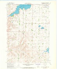
 1958 Watertown1958 Print · USGSThe eastern South Dakota prairie and the Minnesota borderlands are captured here in the late fifties, showcasing a landscape of terminal moraine lakes and burgeoning rail hubs. Genealogists and historians can trace the early paths of the Chicago and North Western railroad or locate family roots in Watertown, Clark, or the Sisseton Indian Reservation.2 unique versions available
 - 1964 Map of Brookings, 1965 Print
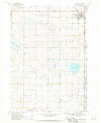
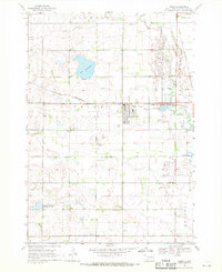
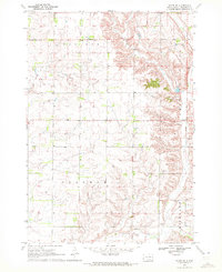
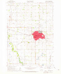 1964 Brookings1965 Print · USGSBrookings and the surrounding prairie townships appear here in the mid-1960s as a thriving regional center of education and industry. Genealogists and local historians can trace the town's expansion near South Dakota State University, locating Greenwood Cemetery and the Chicago and North Western rail line.2 unique versions available
 - 1964 Map of Medary, 1965 Print
 1964 Medary1965 Print · USGSThe Brookings and Moody County borderlands are seen here in the mid-1960s, centered on the river-cut prairies of eastern South Dakota. Genealogists and researchers can locate several rural schools and landmarks like Lake Campbell Cem, Galla Sch, and the historic settlement of Medary.4 unique versions available
 - 1964 Map of Flandreau NW, 1965 Print
 1964 Flandreau NW1965 Print · USGSThe Brookings and Moody county line comes alive in the mid-1960s, showing a prairie landscape shaped by the Big Sioux River. Genealogists and historians can locate rural landmarks like Wellman Sch, Riverview Cem, and Coleman Sch.
 - 1964 Map of Aurora, 1965 Print
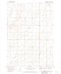
 1964 Aurora1965 Print · USGSEastern South Dakota’s prairie landscape was shaped by rail lines and section-line farming in the mid-1960s. Researchers can trace local genealogy and land use through landmarks like Bushnell, Trail Sch, and the Chicago and North Western railroad.
 - 1967 Map of Lake Benton NW, 1968 Print
 1967 Lake Benton NW1968 Print · USGSThe prairie lake country of Lincoln County is documented here in the late sixties, just as modern conservation areas were becoming established. Researchers can locate family landmarks like Trulock Cem and New Grove Ch or trace the Chicago and North Western rail line.2 unique versions available
 - 1967 Map of Lake Benton SW, 1969 Print
 1967 Lake Benton SW1969 Print · USGSThe Minnesota and South Dakota border comes into focus in the late sixties, capturing a quiet agricultural landscape of prairie townships. Genealogists and local historians can locate Stolz Cem, trace the path of Medary Creek, and find several mid-century Gravel Pits.
 - 1967 Map of Hendricks, 1969 Print
 1967 Hendricks1969 Print · USGSThe Minnesota-South Dakota borderlands come into focus in the late 1960s as a landscape of prairie lakes and pioneer congregations. Trace family roots at the Singsaas Ch Cem or Bohemian Cem, and follow the Chicago and North Western tracks into Hendricks.
 - 1967 Map of Elkton, 1978 Print
 1967 Elkton1978 Print · USGSElkton sits at a bustling prairie rail junction on the South Dakota and Minnesota border during the late sixties. Genealogists and local researchers can locate St Marys Cem, trace the C & N W line, or follow the winding course of Medary Creek.
 - 1968 Map of Lake Sinai, 1970 Print
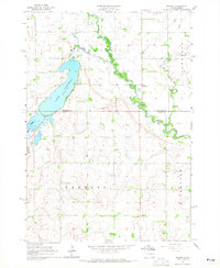
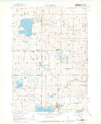
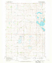
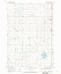
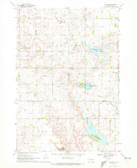
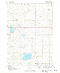 1968 Lake Sinai1970 Print · USGSBrookings County, South Dakota, is captured here in the late 1960s as a landscape of prairie lakes and developing rail lines. Researchers can trace local roots at the Bangor Cem, find the settlement of Ahnberg, and follow the path of the Chicago and North Western railroad.
 - 1968 Map of Brookings NE, 1970 Print
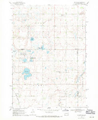
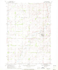
 1968 Brookings NE1970 Print · USGSBrookings County at the end of the 1960s shows a landscape of prairie townships and vital river corridors. Genealogists can trace family roots at St Petri Cem or locate local landmarks like the Sterling Ch and the Townhall.2 unique versions available
 - 1968 Map of Bruce, 1970 Print
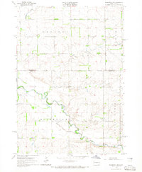
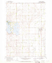 1968 Bruce1970 Print · USGSThe Brookings County plains come into focus in the late 1960s, showing the intersection of rail and river near the town of Bruce. Researchers can trace the Chicago and North Western tracks or locate family plots in the Bruce Cem and explore the shoreline of Lake Tetonkaha.
 - 1968 Map of Arlington, 1970 Print
 1968 Arlington1970 Print · USGSKingsbury County agriculture and rail transit converge in the late sixties at the busy junction of the Great Northern and C & N W railroads. Researchers can trace ancestral roots at Nordland Cem or locate rural landmarks like Lake Whitewood Ch and the Townhall.2 unique versions available
 - 1968 Map of Volga, 1970 Print
 1968 Volga1970 Print · USGSEastern South Dakota’s prairie landscape is documented here in the late sixties, centered on the growing community of Volga. Researchers can trace local heritage through several pioneer burial grounds like Trinity Cem or locate the Townhall near Bethania Cem.
 - 1968 Map of Arlington NE, 1970 Print
 1968 Arlington NE1970 Print · USGSThe glacial lake country of eastern South Dakota is captured here in the late sixties, showing the intersection of Laketon and Preston townships. Genealogists and researchers can locate Oakwood Zion Cem, Moe Slough, and Johnson Lake.
 - 1968 Map of Sinai, 1970 Print
 1968 Sinai1970 Print · USGSThe prairie wetlands of Brookings and Lake Counties are captured here in the late sixties as agricultural life centered on the local rail line. Genealogists and historians can trace the foundations of Sinai and Nunda, locating rural landmarks like Ash Grove Cem and the central Townhall.
 - 1968 Map of Badger, 1970 Print
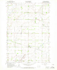
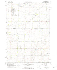
 1968 Badger1970 Print · USGSKingsbury County agriculture and rail transit are captured here in the late sixties as small-town life centered around the local tracks. Genealogists can trace family names through Badger Cem and Hetland Cem or locate the old Landing Field and Radio Tower.
 - 1968 Map of Madison NW, 1971 Print
 1968 Madison NW1971 Print · USGSLake County and Kingsbury County are captured in the late sixties at the height of their rail-and-water prairie character. Researchers can trace the Milwaukee Road rail line and locate St Anns Cem near the shores of Lake Badus.
 - 1968 Map of Rutland NW, 1971 Print
 1968 Rutland NW1971 Print · USGSEastern South Dakota’s agricultural and wetland landscape is captured here in the late sixties, where the border of Lake and Brookings Counties meets. Genealogists can locate family landmarks such as Oslo Ch, Prairie Queen Cem, and the Townhall.2 unique versions available
 - 1969 Map of Lake Norden, 1971 Print
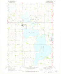 1969 Lake Norden1971 Print · USGSHamlin County and its neighbors are seen here in the late sixties, a landscape defined by prairie lakes and the Burlington Northern line. Researchers can trace rural genealogy through South Trinity Cem, Apostolic Cem, and the settlement at Alsville.
 - 1969 Map of Lake Poinsett, 1972 Print
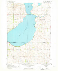 1969 Lake Poinsett1972 Print · USGSLakeside recreation and rural life meet at the Hamlin and Brookings county line in the late sixties. Researchers can trace local landmarks like Bakke Cem, the Stone Bridge crossing, and the early developments at Arlington Beach.
 - 1970 Map of White NE, 1972 Print
 1970 White NE1972 Print · USGSEastern Brookings County at the start of the 1970s shows a landscape of established townships and prairie waterways. Researchers can trace land boundaries near Oak Lake, locate the local Townhall, and study the shoreline of Lake Hendricks.
 - 1970 Map of Astoria, 1972 Print
 1970 Astoria1972 Print · USGSThe town of Astoria sits at a crossroads of rail and prairie at the start of the 1970s. Genealogists and historians can trace the Chicago and North Western tracks, locate Bethlehem Cem, and explore the conservation lands around Oak Lake.
 - 1970 Map of White, 1972 Print
 1970 White1972 Print · USGSBrookings County at the dawn of the seventies reveals a landscape of structured townships and prairie homesteads. Genealogists can trace family roots through sites like St Pauls Cem, Pioneer Ch, and the distinct path of an Old Railroad Grade.
Showing maps 1-25 of 150
Top cities of Brookings County
Frequently asked questions
- What are the different types of historical maps available for Brookings County?
- What is the oldest map of Brookings County?
- Where can I purchase historical maps of Brookings County for my home or office?
- Where can I download high-res historical maps of Brookings County?
- Are there historical topographic maps available for Brookings County?
- Is there historical aerial imagery available for Brookings County?
- Where are historical maps of Brookings County sourced from?