
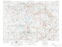
1953 Map of Watertown
USGS Topo · Published 1968About this map
The glacial lakes of the Coteau des Prairies define this mid-century landscape, where the prairie of eastern South Dakota meets the Minnesota border. At the heart of the region, Watertown sits between the prominent shores of Lake Kampeska and Pelican Lake. To the south, large bodies of water such as Lake Poinsett, Lake Preston, and Lake Thompson are interspersed with smaller prairie towns like De Smet and Arlington.
Find a feature on this map
189 named features on this map. Tap any name to fly to it.
Don’t see what you’re looking for? This feature index may not catch every label — zoom into the map to look around manually.
Map Details
Editions of this 1953 Watertown Map
3 editions found
Other maps of this area

1894 · Conde
USGS Topo · 1:62,500

1895 · Byron
USGS Topo · 1:125,000

1895 · Aberdeen
USGS Topo · 1:125,000

1898 · Huron
USGS Topo · 1:125,000

1899 · Mitchell
USGS Topo · 1:125,000

1899 · Alexandria
USGS Topo · 1:125,000

1899 · De Smet
USGS Topo · 1:125,000

1953 · Bellingham
USGS Topo · 1:62,500

1953 · Milbank
USGS Topo · 1:250,000

1953 · Huron
USGS Topo · 1:250,000