
1895 Map of Aberdeen
USGS Topo · Published 1895About this map
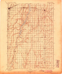
The James River snakes through the heart of this late nineteenth-century South Dakota landscape, defining the agricultural and rail development of the James River Valley. As a primary regional hub, Aberdeen serves as a critical junction where multiple rail lines converge, including the Great Northern R. R. Aberdeen & Ellendale Line and the Chicago Milwaukee and St. Paul R. R. The map illustrates a meticulously surveyed grid of townships and prairies, such as Garden Prairie and La Prairie, reflecting the rapid settlement and systematic organization of the Dakota Territory just years after statehood.
Find a feature on this map
38 named features on this map. Tap any name to fly to it.
Don’t see what you’re looking for? This feature index may not catch every label — zoom into the map to look around manually.
Map Details
Editions of this 1895 Aberdeen Map
4 editions found
Other maps of this area

1894 · Conde
USGS Topo · 1:62,500

1894 · Columbia
USGS Topo · 1:62,500

1895 · Byron
USGS Topo · 1:125,000

1896 · Columbia
USGS Topo · 1:125,000

1899 · Ellendale
USGS Topo · 1:125,000

1899 · Northville
USGS Topo · 1:125,000

1899 · Redfield
USGS Topo · 1:125,000

1952 · Huffton
USGS Topo · 1:24,000

1952 · Columbia
USGS Topo · 1:24,000

1952 · Ordway
USGS Topo · 1:24,000