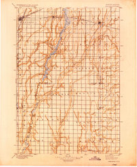
1895 Map of Aberdeen
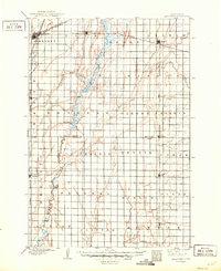
USGS Topo · Published 1933About this map
The Aberdeen rail hub serves as the primary focal point of this 1893 survey, where three major lines converge to shape the early development of Brown and Spink counties. The James River snakes through the center of the sheet, bordered by expansive flatlands like Garden Prairie and La Prairie. The landscape is defined by a rigid section-line grid that dictates the placement of emerging prairie towns along the steel corridors, including Groton on the eastern edge and Mellette to the southwest.
Find a feature on this map
38 named features on this map. Tap any name to fly to it.
Don’t see what you’re looking for? This feature index may not catch every label — zoom into the map to look around manually.
Map Details
Editions of this 1895 Aberdeen Map
4 editions found

Other maps of this area

1894 · Conde
USGS Topo · 1:62,500

1894 · Columbia
USGS Topo · 1:62,500

1895 · Byron
USGS Topo · 1:125,000

1895 · Aberdeen
USGS Topo · 1:125,000

1896 · Columbia
USGS Topo · 1:125,000

1899 · Ellendale
USGS Topo · 1:125,000

1899 · Northville
USGS Topo · 1:125,000

1899 · Redfield
USGS Topo · 1:125,000

1952 · Huffton
USGS Topo · 1:24,000
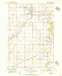
1952 · Columbia
USGS Topo · 1:24,000
Featured Places
- Aberdeen, Aberdeen Township
- Groton, Groton Township
- Bath, Bath Township
- Warner, Warner Township
- Mellette, Mellette Township