
1894 Map of Columbia
USGS Topo · Published 1894About this map
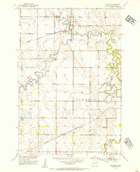
The James River meanders through the heart of Brown County, forming a complex water system that includes Sand Lake and Lake Columbia. This 1894 landscape shows a region defined by the convergence of early rail lines and riparian settlements. The village of Columbia sits at a strategic bend in the river, while Westport and Ordway anchor the western and central prairies.
Find a feature on this map
22 named features on this map. Tap any name to fly to it.
Don’t see what you’re looking for? This feature index may not catch every label — zoom into the map to look around manually.
Map Details
Editions of this 1894 Columbia Map
This is the sole edition of this map. No revisions or reprints were ever made.
Other maps of this area

1894 · Ellendale
USGS Topo · 1:62,500

1894 · Hecla
USGS Topo · 1:62,500

1894 · Savo
USGS Topo · 1:62,500

1895 · Aberdeen
USGS Topo · 1:125,000

1896 · Columbia
USGS Topo · 1:125,000

1899 · Ellendale
USGS Topo · 1:125,000

1899 · Northville
USGS Topo · 1:125,000
1952 · Columbia
USGS Topo · 1:24,000

1952 · Ordway
USGS Topo · 1:24,000

1952 · Columbia NE
USGS Topo · 1:24,000
Featured Places
- Aberdeen, Aberdeen Township
- Ordway, Ordway Township
- Columbia, Columbia Township
- Westport, Westport Township
- Prairie Wood Village Addition, Ordway Township