Old Maps of Blue Bell, South Dakota for Hiking & Exploration
Hike through history with 9 historic maps of Blue Bell. Explore old trails, ghost towns, and forgotten backroads — perfect for outdoor adventurers and local explorers.
- Rediscover forgotten places: Map out old mining camps, roads, and footpaths that no longer exist on modern maps.
- Layer with modern tools: Combine with LiDAR or satellite views to plan hikes through historical terrain.
- Made for exploration: Popular among hikers, overlanders, and local history lovers.
Use these maps to find adventure and explore the hidden past of Blue Bell.
Blue Bell, SD maps
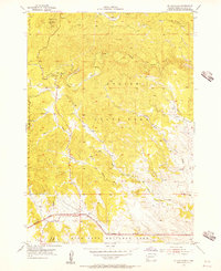
(9)- 1894 Map of Hermosa
 1894 Hermosa1894 Print · USGSThe Black Hills gold and ranching frontier comes into focus during the late nineteenth century as mining camps and rail lines began to anchor the territory. Genealogists and historians can trace early families in Keystone, Rockerville, and around the Etta Mine.2 unique versions available
 - 1901 Map of Hermosa
 1901 Hermosa1901 Print · USGSThe Black Hills frontier comes alive in this survey of Pennington and Custer counties during the height of the regional mining boom. Researchers can trace the early footprints of Keystone, Rockerville, and Wind Cave, along with vanished industrial sites like Etta Mill.4 unique versions available
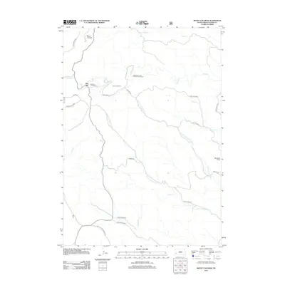
 - 1955 Map of Mt. Coolidge, 1956 Print
 1955 Mt. Coolidge1956 Print · USGSThe Black Hills wilderness of the mid-1950s is captured here as conservation boundaries were maturing around Mt Coolidge. Researchers can trace the early layout of Custer State Park and locate historic landmarks like the Lookout Tower and Blue Bell.5 unique versions available
 - 1955 Map of Hot Springs, 1958 Print
 1955 Hot Springs1958 Print · USGSThe Black Hills and South Dakota badlands are captured here in the mid-fifties, during a peak of military and industrial activity. Researchers can locate the Black Hills Ordnance Depot, early Uranium Mines, and historic rail stops like Pringle or Oglala.5 unique versions available
 - 1977 Map of Mount Rushmore, 1978 Print
 1977 Mount Rushmore1978 Print · USGSThe Black Hills landscape of the late 1970s is shown here at a moment when historic mining and modern tourism converged. Genealogists and researchers can trace the rail lines of the Burlington Northern and find sites like Spokane Mine or the town of Pringle.2 unique versions available
 - 2012 Map of Mount Coolidge, 2012 Print
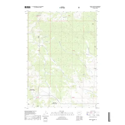
 2012 Mount Coolidge2012 Print · USGSCovers Blue Bell, including Custer County, United States, and other nearby areas
 - 2015 Map of Mount Coolidge, 2015 Print
 2015 Mount Coolidge2015 Print · USGSCovers Blue Bell, including Custer County, United States, and other nearby areas
 - 2017 Map of Mount Coolidge, 2017 Print
 2017 Mount Coolidge2017 Print · USGSCovers Blue Bell, including Custer County, United States, and other nearby areas
 - 2021 Map of Mount Coolidge, 2021 Print
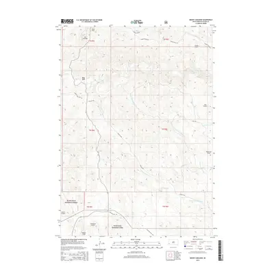
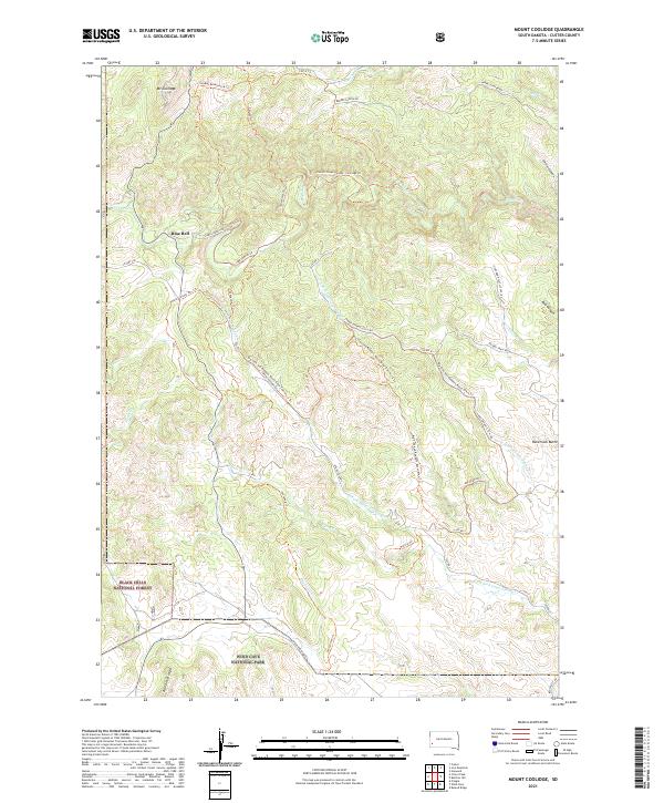 2021 Mount Coolidge2021 Print · USGSCuster County's rugged Black Hills terrain is meticulously documented in the early 2020s, highlighting the intersection of national forest and park lands. Researchers can trace remote backcountry routes like Lame Johnny Rd and locate landmarks such as Mt Coolidge and Racetrack Butte.
End of results
Showing maps 1-9 of 9
Top cities near Blue Bell
- Custer historical maps
- Hill City historical maps
- Keystone historical maps
- Buffalo Gap historical maps
- Pringle historical maps
Frequently asked questions
- What are the different types of historical maps available for Blue Bell?
- What is the oldest map of Blue Bell?
- Where can I purchase historical maps of Blue Bell for my home or office?
- Where can I download high-res historical maps of Blue Bell?
- Are there historical topographic maps available for Blue Bell?
- Is there historical aerial imagery available for Blue Bell?
- Where are historical maps of Blue Bell sourced from?