2020s Maps of Union Township, South Dakota
Explore 4 historic maps of Union Township from the 2020s. These maps offer a rare glimpse into what life looked like during the 2020s — showing old roads, neighborhoods, homes, and landmarks that have changed or disappeared over time.
Whether you're researching your family's past, planning a metal detecting trip, or studying how Union Township's landscape evolved across the 2020s, these high-resolution maps are a powerful tool for exploring the history of this region.
- Focus on a specific era: All maps on this page are from the 2020s, giving you a focused view of this time period.
- See what’s changed: Compare century-old streets, trails, and buildings to today's modern landscape using overlays and satellite layers.
- Research with precision: Use these maps for genealogy, historical research, land use analysis, or educational projects.
- View, download, or print: Maps are fully viewable online in high resolution, and can be downloaded or printed for your own records.
Start exploring Union Township's history through authentic maps from the 2020s. This is your window into the past.
Union Township, SD maps
(4)- 2021 Map of Old Stickney Lake, 2021 Print
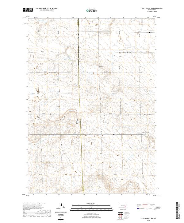 2021 Old Stickney Lake2021 Print · USGSDavison County, South Dakota, is captured here in the early twenty-first century, showing a landscape defined by its rigid section-line grid. Genealogists can locate family sites near Metzgerville, Zion Lutheran Cem, and Old Stickney Lake.
 - 2021 Map of Mitchell SW, 2021 Print
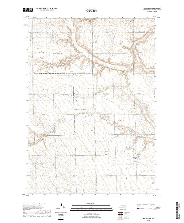 2021 Mitchell SW2021 Print · USGSDavison County agriculture and drainage are documented here in the early twenty-first century. Genealogists and local historians can locate rural burial sites such as the Church of God Cemetery and Emsley Cemetery along the banks of Twelvemile Creek.
 - 2021 Map of Betts, 2021 Print
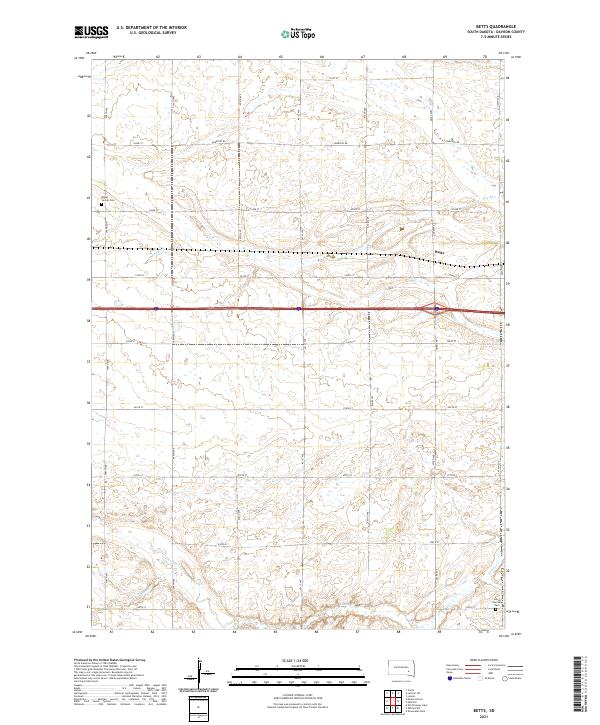 2021 Betts2021 Print · USGSDavison County at the start of the 2020s shows a landscape of steady agricultural continuity and quiet rural centers. Genealogists and local historians can locate several important sites including Mount Vernon Cem, Lisbon Township Cem, and the settlement of Betts.
 - 2021 Map of Mount Vernon, 2021 Print
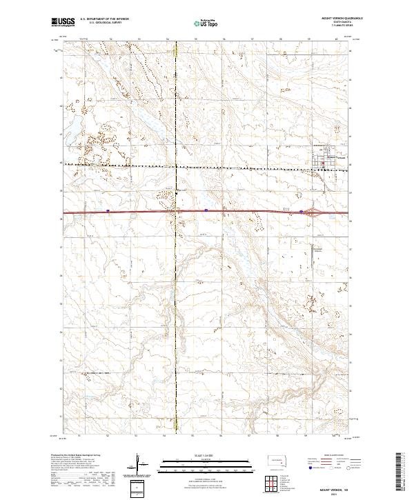 2021 Mount Vernon2021 Print · USGSMount Vernon and the surrounding farm country are captured here in a period of modern agricultural stability. Researchers can trace the path of Enemy Cr and locate historical landmarks like Quaker Cem or the Nicolaisen Airport.
End of results
Showing maps 1-4 of 4
Top cities near Union Township
- Mitchell historical maps
- Corsica historical maps
- Plankinton historical maps
- Mount Vernon historical maps
- Stickney historical maps
Frequently asked questions
- What are the different types of historical maps available for Union Township?
- What is the oldest map of Union Township?
- Where can I purchase historical maps of Union Township for my home or office?
- Where can I download high-res historical maps of Union Township?
- Are there historical topographic maps available for Union Township?
- Is there historical aerial imagery available for Union Township?
- Where are historical maps of Union Township sourced from?