Old Maps of Crandall, South Dakota for Genealogy
Trace your family roots with 8 historic maps of Crandall. These high-res maps reveal old neighborhoods, homesites, landmarks, and streets — helping you uncover where your ancestors lived and how the area evolved over time.
- Explore historic neighborhoods: Identify where your relatives may have lived in the 1800s or 1900s.
- Compare maps over time: Trace the changes in streets, buildings, and landmarks for multi-generational research.
- Perfect for genealogy & ancestry research: Used by family historians and researchers to map out lineage and migration.
These maps are an incredible resource for exploring your personal connection to Crandall's past.
Crandall, SD maps
(8)- 1953 Map of Milbank, 1958 Print
 1953 Milbank1958 Print · USGSThe tri-state border region of South Dakota, North Dakota, and Minnesota is shown here during the early fifties, a landscape defined by glacial lakes and the Sisseton Indian Reservation. Researchers can trace the legacy of the western railroads, locating old stops along the Great Northern and settlements like Milbank, Webster, and Sisseton.3 unique versions available
 - 1958 Map of Milbank
 1958 Milbank1958 Print · USGSThe northern Great Plains in the late fifties show a landscape of glacial lakes and reservation lands shaped by the Great Northern railroad. Genealogists and local historians can trace the grid of settlements from Britton to Milbank and locate landmarks like Enemy Swim Lake and the Sisseton Indian Reservation.
 - 1958 Map of Crandall, 1960 Print
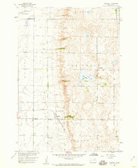 1958 Crandall1960 Print · USGSThe rural prairie of Day County is captured here in the late fifties, centered on the rail-fed town of Crandall. Genealogists and historians can trace the locations of School No 4, Sweetwater Lake, and the local Crandall Cemetery.
 - 1985 Map of Webster
 1985 Webster1985 Print · USGSNortheastern South Dakota in the mid-eighties reveals a landscape of prairie potholes and rail-line towns centered on the Webster region. Genealogists and historians can trace rail-town development along the Burlington Northern and find early conservation boundaries like the Waubay National Wildlife Refuge.2 unique versions available
 - 2012 Map of Crandall, 2012 Print
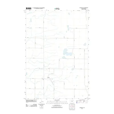 2012 Crandall2012 Print · USGSCovers Crandall, including Bates Township, Olean Township, and other nearby areas
 - 2015 Map of Crandall, 2015 Print
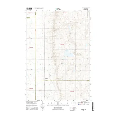 2015 Crandall2015 Print · USGSCovers Crandall, including Bates Township, Olean Township, and other nearby areas
 - 2017 Map of Crandall, 2017 Print
 2017 Crandall2017 Print · USGSCovers Crandall, including Bates Township, Olean Township, and other nearby areas
 - 2021 Map of Crandall, 2021 Print
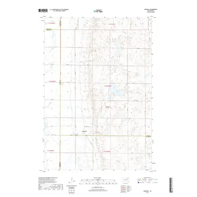
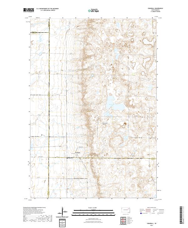 2021 Crandall2021 Print · USGSDay County and the surrounding prairie lands are captured here during the early twenty-first century. Researchers can trace the layout of Crandall and locate the Crandall Cem or the waters of Sweetwater Lake along the glacial Coteau des Prairies.
End of results
Showing maps 1-8 of 8
Top cities near Crandall
Frequently asked questions
- What are the different types of historical maps available for Crandall?
- What is the oldest map of Crandall?
- Where can I purchase historical maps of Crandall for my home or office?
- Where can I download high-res historical maps of Crandall?
- Are there historical topographic maps available for Crandall?
- Is there historical aerial imagery available for Crandall?
- Where are historical maps of Crandall sourced from?