1900s (20th Century) Maps of Pleasant Township, South Dakota
Explore 7 historic maps of Pleasant Township from the 1900s (20th Century). These maps offer a rare glimpse into what life looked like during the 1900s — showing old roads, neighborhoods, homes, and landmarks that have changed or disappeared over time.
Whether you're researching your family's past, planning a metal detecting trip, or studying how Pleasant Township's landscape evolved across the 1900s, these high-resolution maps are a powerful tool for exploring the history of this region.
- Focus on a specific era: All maps on this page are from the 1900s, giving you a focused view of this time period.
- See what’s changed: Compare century-old streets, trails, and buildings to today's modern landscape using overlays and satellite layers.
- Research with precision: Use these maps for genealogy, historical research, land use analysis, or educational projects.
- View, download, or print: Maps are fully viewable online in high resolution, and can be downloaded or printed for your own records.
Start exploring Pleasant Township's history through authentic maps from the 1900s. This is your window into the past.
Pleasant Township, SD maps
(7)- 1955 Map of Sioux Falls, 1967 Print
 1955 Sioux Falls1967 Print · USGSThe eastern South Dakota and western Minnesota borderlands come alive in the mid-fifties, showing the vital rail-to-river connections of the era. Genealogists can trace family footprints across townships like Madison and Pipestone, while following the paths of the Big Sioux River and the Chicago and North Western line.3 unique versions available
 - 1958 Map of Sioux Falls
 1958 Sioux Falls1958 Print · USGSThe tri-state borderlands of South Dakota, Minnesota, and Iowa are captured here during the mid-century peak of the regional rail network. Genealogists and historians can trace local landmarks like Augustana Academy, the St Marys Cem, and the path of the Illinois Central through Rock Rapids.
 - 1973 Map of Spencer SW, 1978 Print
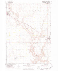
 1973 Spencer SW1978 Print · USGSHanson County is captured here in the early 1970s, focused on the rail-side community of Emery and the surrounding townships. Researchers can trace family history through several local burial sites like St Martins Cem and Elfert Cem or follow the path of the Chicago Milwaukee St Paul and Pacific railroad.
 - 1973 Map of Farmer, 1978 Print
 1973 Farmer1978 Print · USGSHanson County in the mid-1970s is shown here as a landscape of structured townships and dual rail lines. Genealogists and local historians can locate the community of Farmer, trace the Chicago and North Western railroad, and find St Peter Cem.
 - 1973 Map of Bridgewater West, 1978 Print
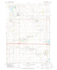
 1973 Bridgewater West1978 Print · USGSThis South Dakota prairie landscape in the 1970s reveals the intersection of the railroad and rural life along the Hanson and McCook County line. Researchers can locate family sites like Rasmussen Cem or trace the path of the Chicago Milwaukee St Paul and Pacific railroad.
 - 1973 Map of Spencer, 1978 Print
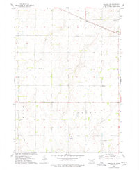
 1973 Spencer1978 Print · USGSSpencer and the surrounding prairie townships are captured here in the early 1970s, showcasing a landscape of rail-fed commerce and extensive waterfowl conservation. Researchers can locate family landmarks like Lakeside Cem, the local QUARRY, and the Chicago and North Western rail corridor.
 - 1985 Map of Salem
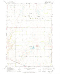
 1985 Salem1985 Print · USGSEastern South Dakota’s prairie landscape is showcased in the mid-eighties, highlighting a region defined by agricultural colonies and rail-linked towns. Genealogists and historians can trace the foundations of Rosedale Colony, the Buffalo Trading Post, and early hubs like Salem.
End of results
Showing maps 1-7 of 7
Top cities near Pleasant Township
- Alexandria historical maps
- Bridgewater historical maps
- Emery historical maps
- Spencer historical maps
- Milltown historical maps
- Fulton historical maps
See more
Top neighborhoods of Pleasant Township
Frequently asked questions
- What are the different types of historical maps available for Pleasant Township?
- What is the oldest map of Pleasant Township?
- Where can I purchase historical maps of Pleasant Township for my home or office?
- Where can I download high-res historical maps of Pleasant Township?
- Are there historical topographic maps available for Pleasant Township?
- Is there historical aerial imagery available for Pleasant Township?
- Where are historical maps of Pleasant Township sourced from?