1970s Maps of Jones County, South Dakota
Explore 14 historic maps of Jones County from the 1970s. These maps offer a rare glimpse into what life looked like during the 1970s — showing old roads, neighborhoods, homes, and landmarks that have changed or disappeared over time.
Whether you're researching your family's past, planning a metal detecting trip, or studying how Jones County's landscape evolved across the 1970s, these high-resolution maps are a powerful tool for exploring the history of this region.
- Focus on a specific era: All maps on this page are from the 1970s, giving you a focused view of this time period.
- See what’s changed: Compare century-old streets, trails, and buildings to today's modern landscape using overlays and satellite layers.
- Research with precision: Use these maps for genealogy, historical research, land use analysis, or educational projects.
- View, download, or print: Maps are fully viewable online in high resolution, and can be downloaded or printed for your own records.
Start exploring Jones County's history through authentic maps from the 1970s. This is your window into the past.
Jones County, SD maps
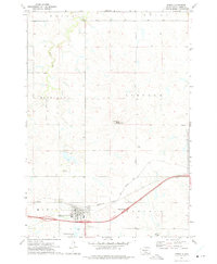
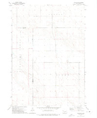
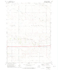
(14)- 1970 Map of Vivian SW, 1972 Print
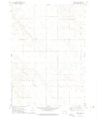
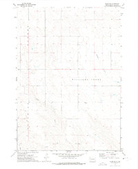 1970 Vivian SW1972 Print · USGSJones County's rural landscape is captured here in the early seventies, showing a region defined by its watercourses and section lines. Researchers can trace the paths of Williams Creek, identify the Flowing Well, and locate the distinct terrain of Zickrick.
 - 1972 Map of Pierre 3 SW, 1975 Print
 1972 Pierre 3 SW1975 Print · USGSJones County ranching country is captured here in the early 1970s, showcasing the open terrain of the South Dakota plains. Researchers can trace the drainage of East Branch War Creek and identify the rural boundaries of Virgil and Richland.2 unique versions available
 - 1972 Map of Draper, 1975 Print
 1972 Draper1975 Print · USGSDraper and the surrounding Jones County plains are shown in the early 1970s, at the intersection of rail and prairie life. Researchers can trace land tracts near Draper Cem or follow the path of the Chicago Milwaukee St Paul and Pacific railroad.
 - 1972 Map of Pierre 3 SE, 1975 Print
 1972 Pierre 3 SE1975 Print · USGSCentral South Dakota terrain at the start of the 1970s reveals a landscape etched with historical surveying lines and natural landmarks. Genealogists and historians can trace the Old Indian Treaty Boundary and the topography surrounding Stony Butte and Richland Valley.2 unique versions available
 - 1972 Map of Murdo, 1975 Print
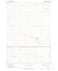
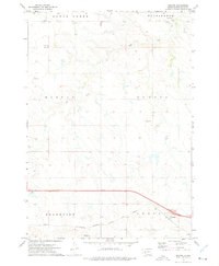
 1972 Murdo1975 Print · USGSMurdo at the start of the 1970s shows a classic High Plains transport hub during the transition to the interstate era. Researchers can trace the Milwaukee Road rail line, Murdo Cem, and landmarks like White Clay Butte.
 - 1972 Map of Okaton, 1975 Print
 1972 Okaton1975 Print · USGSJones County at the start of the 1970s shows the persistent influence of the railroad on prairie settlement. Genealogists and local historians can trace the townsite of Okaton, the local Reformed Ch, and the route of the Chicago Milwaukee St Paul and Pacific railroad.
 - 1972 Map of Vivian, 1975 Print
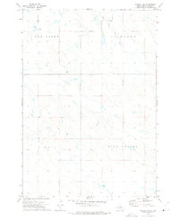
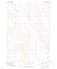
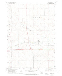 1972 Vivian1975 Print · USGSVivian was a vital crossroads in the early 1970s, where the Missouri Plateau's rail and highway networks met. Researchers can trace the layout of the Chicago Milwaukee St Paul and Pacific line and find local landmarks like the Smith Brothers Landing Strip and Vivian Cem.
 - 1972 Map of Okaton NE, 1975 Print
 1972 Okaton NE1975 Print · USGSJones County townships were shaped by the path of the railroad in the early seventies, a period of transition for this prairie landscape. Genealogists and historians can trace the bounds of Scovil and Highland or follow the Ash Draw drainage.
 - 1972 Map of Wendte SE, 1975 Print
 1972 Wendte SE1975 Print · USGSJones County ranchlands are documented here in the early seventies, showing a landscape defined by water and territory. Researchers can trace the path of Herd Camp Creek and identify regional markers such as Banner and Kolls.
 - 1972 Map of Wendte SW, 1975 Print
 1972 Wendte SW1975 Print · USGSJones County, South Dakota, is captured here in the early 1970s, showcasing a landscape of vast townships and seasonal waterways. Genealogists and researchers can locate the Immanuel Ch and trace the meandering paths of White Clay Creek and Herd Camp Creek.
 - 1972 Map of Stamford, 1975 Print
 1972 Stamford1975 Print · USGSJones County's prairie landscape in the early seventies centers on the rail-aligned community of Stamford. Local historians can trace land patterns across the Jackson County line and locate landmarks like St Peter Ch and the Cem.
 - 1972 Map of Pierre 3 NE, 1975 Print
 1972 Pierre 3 NE1975 Print · USGSCentral South Dakota ranching country is captured here in the early seventies, showing the sparse but organized landscape of the Missouri River plateau. Genealogists and historians can trace the bounds of Richland and Rowe or locate the remote Landing Strip near Cedar Creek.2 unique versions available
 - 1972 Map of Vivian SE, 1975 Print
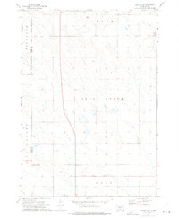
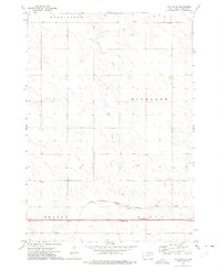
 1972 Vivian SE1975 Print · USGSThe South Dakota prairie at the edge of the Missouri Plateau is captured here in the early seventies, spanning the border of Lyman County and Jones County. Researchers can trace old section lines and property boundaries near the Sioux Sch and the banks of Williams Creek.
 - 1972 Map of Vivian NW, 1975 Print
 1972 Vivian NW1975 Print · USGSJones County, South Dakota, is captured here in the early seventies, showing a landscape defined by ranching and rail. Researchers can trace the path of the Chicago Milwaukee St Paul and Pacific railroad as it follows Medicine Creek through townships like Draper and Mussman.
End of results
Showing maps 1-14 of 14
Top cities of Jones County
Frequently asked questions
- What are the different types of historical maps available for Jones County?
- What is the oldest map of Jones County?
- Where can I purchase historical maps of Jones County for my home or office?
- Where can I download high-res historical maps of Jones County?
- Are there historical topographic maps available for Jones County?
- Is there historical aerial imagery available for Jones County?
- Where are historical maps of Jones County sourced from?