1900s (20th Century) Maps of Grand Meadow Township, South Dakota
Explore 8 historic maps of Grand Meadow Township from the 1900s (20th Century). These maps offer a rare glimpse into what life looked like during the 1900s — showing old roads, neighborhoods, homes, and landmarks that have changed or disappeared over time.
Whether you're researching your family's past, planning a metal detecting trip, or studying how Grand Meadow Township's landscape evolved across the 1900s, these high-resolution maps are a powerful tool for exploring the history of this region.
- Focus on a specific era: All maps on this page are from the 1900s, giving you a focused view of this time period.
- See what’s changed: Compare century-old streets, trails, and buildings to today's modern landscape using overlays and satellite layers.
- Research with precision: Use these maps for genealogy, historical research, land use analysis, or educational projects.
- View, download, or print: Maps are fully viewable online in high resolution, and can be downloaded or printed for your own records.
Start exploring Grand Meadow Township's history through authentic maps from the 1900s. This is your window into the past.
Grand Meadow Township, SD maps
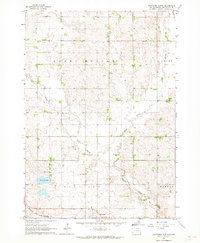
(8)- 1955 Map of Sioux Falls, 1967 Print
 1955 Sioux Falls1967 Print · USGSThe eastern South Dakota and western Minnesota borderlands come alive in the mid-fifties, showing the vital rail-to-river connections of the era. Genealogists can trace family footprints across townships like Madison and Pipestone, while following the paths of the Big Sioux River and the Chicago and North Western line.3 unique versions available
 - 1958 Map of Sioux Falls
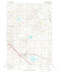
 1958 Sioux Falls1958 Print · USGSThe tri-state borderlands of South Dakota, Minnesota, and Iowa are captured here during the mid-century peak of the regional rail network. Genealogists and historians can trace local landmarks like Augustana Academy, the St Marys Cem, and the path of the Illinois Central through Rock Rapids.
 - 1962 Map of Hartford North, 1964 Print
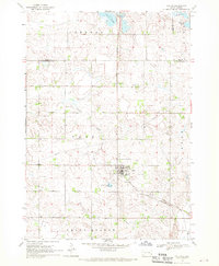
 1962 Hartford North1964 Print · USGSMinnehaha County in the early 1960s shows a landscape of productive farmsteads and rural schools near Hartford. Trace the Chicago and North Western rail line or locate local landmarks like Scotts Slough and McLeod Sch.
 - 1964 Map of Humboldt, 1966 Print
 1964 Humboldt1966 Print · USGSHumboldt and the surrounding prairie of Minnehaha County are captured here in the mid-1960s as Interstate 90 began to reshape the landscape. Local historians can trace family roots through sites like Mt Pleasant Sch, the town Cem, and the busy Chicago and North Western rail line.
 - 1968 Map of Colton, 1970 Print
 1968 Colton1970 Print · USGSMinnehaha and Lake counties are shown here in the late sixties as the agricultural landscape of southeastern South Dakota continued its steady growth. Researchers can find numerous family-history sites like Taopi Cem and Huntimer or trace the Great Northern rail line.
 - 1968 Map of Buffalo Trading Post, 1970 Print
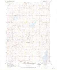 1968 Buffalo Trading Post1970 Print · USGSThe prairie lake country of Lake and Minnehaha counties is captured here in the late sixties, showing a landscape of rural homesteads and glacial waters. Genealogists can locate family landmarks like St Jacobs Cem, Bethany Cem, and the historic Buffalo Trading Post.
 - 1985 Map of Sioux Falls
 1985 Sioux Falls1985 Print · USGSIn the mid-1980s, the borderlands of South Dakota, Minnesota, and Iowa reveal a landscape shaped by the Big Sioux River and a growing urban hub. Researchers can trace the development of Sioux Falls and locate smaller communities like Dell Rapids, Garretson, and Valley Springs.2 unique versions available
 - 1985 Map of Salem
 1985 Salem1985 Print · USGSEastern South Dakota’s prairie landscape is showcased in the mid-eighties, highlighting a region defined by agricultural colonies and rail-linked towns. Genealogists and historians can trace the foundations of Rosedale Colony, the Buffalo Trading Post, and early hubs like Salem.
End of results
Showing maps 1-8 of 8
Top cities near Grand Meadow Township
- Sioux Falls historical maps
- Hartford historical maps
- Dell Rapids historical maps
- Crooks historical maps
- Baltic historical maps
- Lyons historical maps
See more
Frequently asked questions
- What are the different types of historical maps available for Grand Meadow Township?
- What is the oldest map of Grand Meadow Township?
- Where can I purchase historical maps of Grand Meadow Township for my home or office?
- Where can I download high-res historical maps of Grand Meadow Township?
- Are there historical topographic maps available for Grand Meadow Township?
- Is there historical aerial imagery available for Grand Meadow Township?
- Where are historical maps of Grand Meadow Township sourced from?