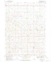
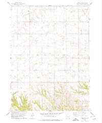
1900s (20th Century) Maps of Yankton County, South Dakota
Explore 28 historic maps of Yankton County from the 1900s (20th Century). These maps offer a rare glimpse into what life looked like during the 1900s — showing old roads, neighborhoods, homes, and landmarks that have changed or disappeared over time.
Whether you're researching your family's past, planning a metal detecting trip, or studying how Yankton County's landscape evolved across the 1900s, these high-resolution maps are a powerful tool for exploring the history of this region.
- Focus on a specific era: All maps on this page are from the 1900s, giving you a focused view of this time period.
- See what’s changed: Compare century-old streets, trails, and buildings to today's modern landscape using overlays and satellite layers.
- Research with precision: Use these maps for genealogy, historical research, land use analysis, or educational projects.
- View, download, or print: Maps are fully viewable online in high resolution, and can be downloaded or printed for your own records.
Start exploring Yankton County's history through authentic maps from the 1900s. This is your window into the past.
Yankton County, SD maps
(28)- 1955 Map of Sioux City, 1959 Print
 1955 Sioux City1959 Print · USGSThe Missouri River valley in the mid-fifties is captured here during a time of major engineering and social transition. Genealogists and historians can trace the foundations of Gavins Point Dam, tribal boundaries on the Santee Sioux Indian Reservation, and local landmarks like the Norfolk State Hospital.4 unique versions available
 - 1955 Map of Sioux Falls, 1967 Print
 1955 Sioux Falls1967 Print · USGSThe eastern South Dakota and western Minnesota borderlands come alive in the mid-fifties, showing the vital rail-to-river connections of the era. Genealogists can trace family footprints across townships like Madison and Pipestone, while following the paths of the Big Sioux River and the Chicago and North Western line.3 unique versions available
 - 1957 Map of Gayville, 1958 Print
 1957 Gayville1958 Print · USGSYankton and Clay counties come alive in the mid-1950s, showing a landscape of small prairie towns and school districts tied together by the Missouri River Basin development. Trace the routes of two major railroads or locate rural landmarks like Zion Ch and Saybrook Sch (Abandoned).2 unique versions available
 - 1957 Map of Mayfield, 1958 Print
 1957 Mayfield1958 Print · USGSSouth Dakota's prairie townships come alive in the late fifties, showing a rural landscape of section-line roads and family-named schools. Locate old community centers like St Columba Ch, Mayfield, and the Walshtown Cem.
 - 1957 Map of Midway, 1958 Print
 1957 Midway1958 Print · USGSSoutheastern South Dakota in the late fifties is captured here as a landscape of section-line roads and prairie townships. Researchers can trace rural genealogy through numerous family-named landmarks and local institutions like Ulmer Cem, Bender Sch, and Bethlehem Ch.2 unique versions available
 - 1957 Map of Mission Hill, 1958 Print
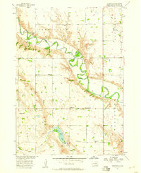
 1957 Mission Hill1958 Print · USGSYankton County's river-and-rail landscape is captured here in the late fifties, centered on the village of Mission Hill. Researchers can locate numerous country schools like Howard Sch and De Vol Sch or trace the early paths of the James River.2 unique versions available
 - 1957 Map of Menno, 1958 Print
 1957 Menno1958 Print · USGSHutchinson County agriculture and river life are captured here in the mid-1950s as the regional rail network still anchored local trade. Researchers can locate numerous rural schools and churches, including Norway Sch, Ebenezer Ch, and the town of Menno.
 - 1957 Map of Jamesville, 1958 Print
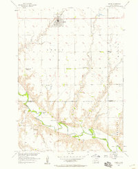
 1957 Jamesville1958 Print · USGSYankton County's rural townships are captured here in the late fifties, showing a landscape defined by the winding James River and its protective levee. Genealogists can locate numerous country schools and churches, including Anderson Sch, Martinus Ch, and Vedin Corner.
 - 1957 Map of Scotland, 1959 Print
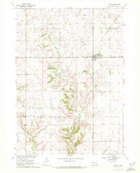
 1957 Scotland1959 Print · USGSSoutheast South Dakota in the late fifties was a landscape of river-valley settlements and rural school districts. Genealogists and historians can trace the foundations of Scotland, locate Rose Hill Cem, and find vanished landmarks like Lakeview Sch or Maxwell Colony.2 unique versions available
 - 1958 Map of Sioux City
 1958 Sioux City1958 Print · USGSThe Missouri River valley in the late fifties was a bustling intersection of tribal lands, rail corridors, and river towns. Genealogists can trace family roots through specific rural sites like Daisy Valley School, St Johns Church and School, and Yankton State Hospital.
 - 1958 Map of Sioux Falls
 1958 Sioux Falls1958 Print · USGSThe tri-state borderlands of South Dakota, Minnesota, and Iowa are captured here during the mid-century peak of the regional rail network. Genealogists and historians can trace local landmarks like Augustana Academy, the St Marys Cem, and the path of the Illinois Central through Rock Rapids.
 - 1959 Map of Sioux City
 1959 Sioux City1959 Print · USGSThe tri-state region surrounding the Missouri River is captured here in the late fifties, showing the convergence of Nebraska, South Dakota, and Iowa. Researchers can trace rural lineages through numerous country schoolhouses like Cemetery School and the many numbered Washington School districts.
 - 1968 Map of Tabor SE, 1970 Print
 1968 Tabor SE1970 Print · USGSKnox County, Nebraska, and Yankton County, South Dakota, meet here at the edge of the Missouri River in the late sixties. Researchers can trace rural landmarks like Frankfort Cem, the West Blyville Sch, and the Fort Yankton Historic Site.2 unique versions available
 - 1968 Map of St. Helena, 1971 Print
 1968 St. Helena1971 Print · USGSThe Nebraska-South Dakota borderlands along the Missouri River come alive in the late sixties, showing the river's path around St Helena Island. Genealogists can trace local roots at Bow Valley Mills, St Marys Sch, and St Helena Cem.
 - 1968 Map of Gavins Point Dam, 1971 Print
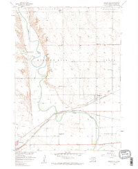
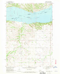
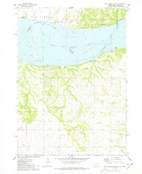
 1968 Gavins Point Dam1971 Print · USGSYankton and the Missouri River borderlands are captured in the late sixties as the region adjusted to the massive Gavins Point dam project. Researchers can locate the Gavins Point National Fish Hatchery, the Fort Yankton Historic Site, and rural landmarks like Aten Cem and School No 87.2 unique versions available
 - 1968 Map of Menominee, 1971 Print
 1968 Menominee1971 Print · USGSCrossing the Nebraska and South Dakota border in the late sixties, this area shows the winding Missouri River valley and its rural farm communities. Genealogists can locate family landmarks such as St Helena Chapel, Joy Hill Sch, and the cemetery near Menominee.2 unique versions available
 - 1970 Map of Turkey Ridge, 1972 Print
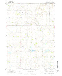
 1970 Turkey Ridge1972 Print · USGSThe Turner and Yankton county lines meet at the dawn of the 1970s in this detailed survey of South Dakota's farm country. Researchers can trace rural life through a network of one-room school sites like Lowell Sch and local burial grounds such as Bang Cem.
 - 1970 Map of Irene, 1972 Print
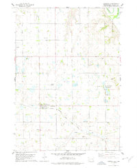
 1970 Irene1972 Print · USGSIrene and the surrounding townships of Turner and Yankton counties are captured in the early 1970s during a period of steady agricultural tradition. Researchers can trace local history through landmarks like Trondhjem Ch, Salem Cem, and the Burlington Northern rail line.
 - 1970 Map of Center Point, 1972 Print
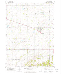
 1970 Center Point1972 Print · USGSThe Turner and Yankton County line in the early seventies reveals a landscape of rural schoolhouses and family cemeteries. Genealogists can trace the history of Center Point and locate several burial sites including Meldal Cemetery and Evergreen Cemetery.
 - 1974 Map of Bon Homme Colony, 1979 Print
 1974 Bon Homme Colony1979 Print · USGSThe Missouri River and Lewis and Clark Lake define this borderland during the mid-seventies, spanning the South Dakota and Nebraska state line. Researchers can trace the Bon Homme Colony, locate the Holy Faith Cem, and explore the topography of the Santee Indian Reservation.
 - 1978 Map of Tabor NE, 1979 Print
 1978 Tabor NE1979 Print · USGSYankton County's agricultural heartland is documented here in the late seventies, showing the rural settlements and rail infrastructure of the era. Researchers can trace family history through several local burial sites like Polish Cem and Nedved Cem, or follow the Chicago Milwaukee St Paul and Pacific line to Utica.
 - 1978 Map of Kloucek Lake, 1979 Print
 1978 Kloucek Lake1979 Print · USGSBon Homme and Yankton counties appear in the late 1970s as a well-ordered landscape of section-line roads and family farms. Researchers can trace the legacy of early settlers at Ebenezer Cem and Reform Cem, or follow the diagonal route of the Chicago Milwaukee St Paul and Pacific railroad.
 - 1978 Map of Lesterville, 1979 Print
 1978 Lesterville1979 Print · USGSLesterville and the surrounding Yankton County prairie are shown here in the late seventies as the region maintained its agricultural and rail-dependent character. Researchers can trace historic family burial sites like Odessa Cem and Beadleston Cem or follow the Chicago Milwaukee St Paul and Pacific line.
 - 1978 Map of Yankton, 1979 Print
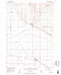
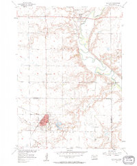
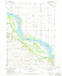
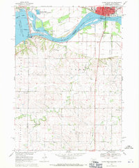
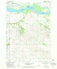
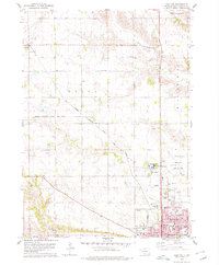 1978 Yankton1979 Print · USGSYankton and its northern hinterlands are captured here in the late seventies, showing a period of steady growth along the Missouri River valley. Genealogists and local historians can trace school sites like Beadle Sch or the grounds of Yankton College and the Sacred Heart Cem.
 - 1978 Map of Tabor, 1979 Print
 1978 Tabor1979 Print · USGSThe town of Tabor is captured in the late 1970s at the intersection of prairie agriculture and the Milwaukee Road railroad. Researchers can locate family landmarks like Hvezda Zapadu Cem, Ptaks National Cem, and the shores of Kubal Lake.
Showing maps 1-25 of 28
Top cities of Yankton County
Frequently asked questions
- What are the different types of historical maps available for Yankton County?
- What is the oldest map of Yankton County?
- Where can I purchase historical maps of Yankton County for my home or office?
- Where can I download high-res historical maps of Yankton County?
- Are there historical topographic maps available for Yankton County?
- Is there historical aerial imagery available for Yankton County?
- Where are historical maps of Yankton County sourced from?