Old Maps of Bledsoe County, Tennessee for Metal Detecting
Plan your next treasure hunt with 160 historic maps of Bledsoe County. Find old homesites, ghost towns, trails, and gathering spots that may be lost to time — perfect for identifying promising metal detecting locations.
- Locate forgotten sites: Uncover places like long-lost settlements, abandoned rail lines, or gathering spots.
- Plan better hunts: Use map overlays combined with LiDAR or satellite views to narrow in on historically rich areas.
- Made for detectorists: Thousands of hobbyists use these maps to discover relics, coins, and hidden history.
Use these historic maps to boost your research and find new opportunities beneath the surface of Bledsoe County.
Bledsoe County, TN maps
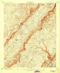
(160)- 1887 Map of Kingston
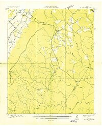
 1887 Kingston1887 Print · USGSCentral Tennessee in the late nineteenth century was a world of river landings and new rail lines. Genealogists can trace family roots through riverside sites like Sevier's Ferry or rural hubs like Bogges X Roads and Ten Mile Stand.
 - 1888 Map of Chattanooga
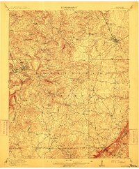
 1888 Chattanooga1888 Print · USGSSoutheast Tennessee in the late nineteenth century was a landscape of river ferries and mountain mining. Trace family roots and vanished landmarks near Chattanooga, from the Aetna Mines to historic river crossings like Harrison Ferry.
 - 1891 Map of Kingston
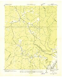
 1891 Kingston1891 Print · USGSEastern Tennessee in the 1890s reveals a river-driven economy at the edge of the Cumberland Plateau. Genealogists can trace early crossings and landings such as Mc Elwee's Ferry and Pinhook Landing, or locate vanished crossroads like Kemmers Old Stand.2 unique versions available
 - 1892 Map of Pikeville
 1892 Pikeville1892 Print · USGSThe Cumberland Plateau in the 1890s shows a rugged landscape of early river ferries and mountain gaps. Genealogists and historians can trace the paths between Sparta and Crossville, locating landmarks like Hodge Ferry and the Rock House tavern.
 - 1893 Map of Chattanooga
 1893 Chattanooga1893 Print · USGSSoutheast Tennessee is shown here in the 1890s, when river ferries and coal mines defined the landscape around the booming hub of Chattanooga. Genealogists and researchers can trace family lands near Eldridge Landing, the Mc Nabb Mines, or old settlements like Ooltewah.9 unique versions available
 - 1893 Map of Kingston, 1905 Print
 1893 Kingston1905 Print · USGSEastern Tennessee at the end of the nineteenth century is a landscape of mountain gaps and vital river landings. Researchers can trace early river crossings like Jackson Ferry, the path of the Cincinnati Southern Railroad, and settlements like Rhea Springs and Kingston.5 unique versions available
 - 1895 Map of Pikeville
 1895 Pikeville1895 Print · USGSThe Cumberland Plateau was a landscape of mountain settlements and critical gaps in the 1890s. Genealogists can trace family roots through upland communities like Pomona and Lantana, or locate old landmarks like Hale Chapel and Hodge Ferry along the river.7 unique versions available
 - 1909 Map of Sequatchie Valley, 1955 Print
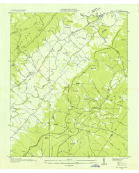
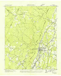
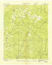
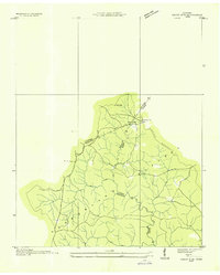
 1909 Sequatchie Valley1955 Print · USGSBledsoe County at the turn of the century shows a landscape of river-valley agriculture and rugged plateau crossings. Genealogists can locate family homesteads near landmarks like Mansfield Mill, Smyrna Church, or the Melvine Post Office.
 - 1910 Map of Pikeville
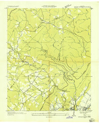
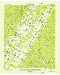
 1910 Pikeville1910 Print · USGSBledsoe County at the turn of the century shows a landscape of valley farms and mountain gaps connected by the Nashville Chattanooga and St Louis RR. Researchers can locate early milling sites like Hembree Mill and rural landmarks such as Melvine PO and Saratoga Springs.2 unique versions available
 - 1912 Map of Crossville
 1912 Crossville1912 Print · USGSCumberland County at the start of the twentieth century was a landscape of plateau settlements and developing rail lines. Genealogists and historians can trace early community hubs like Crossville, rural school sites such as Flynn School, and creek-side features like Hinch Mill.2 unique versions available
 - 1935 Map of Melvine
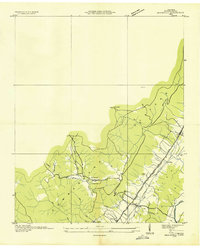
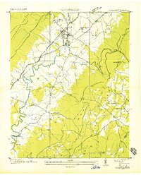
 1935 Melvine1935 Print · USGSBledsoe County’s rural mountain life is preserved here in the mid-1930s, as the valley floor and plateaus were still defined by family-named hollows and gaps. Researchers can locate remote community landmarks like Sunny Meadow Sch, the Lida Thurman Cem, and the village of Melvine.
 - 1935 Map of Morgan Springs
 1935 Morgan Springs1935 Print · USGSWalden Ridge and the Tennessee valley transition are documented here in the mid-1930s, showing a landscape of small schools and plateau settlements. Researchers can trace the Cumberland Escarpment to find Henderson Mill, Morgan Springs, and the Incline railroad.
 - 1935 Map of Soddy
 1935 Soddy1935 Print · USGSThe Cumberland Escarpment meets the industrial valley floor north of Chattanooga in the mid-1930s. Researchers can trace family roots at Hotwater Cem or locate the old Rathburn Station along the Southern Railway.
 - 1935 Map of Pennine
 1935 Pennine1935 Print · USGSRhea County is captured here in the mid-1930s, showing the intersection of ridge-top settlements and valley transport corridors. Genealogists can locate family landmarks such as Milo Post Office, the Rector Mine, and Pleasant Hill Cemetery.
 - 1935 Map of Brockdell
 1935 Brockdell1935 Print · USGSBledsoe County is captured in the mid-1930s as the Tennessee Valley Authority began modernizing the Cumberland Plateau. Genealogists can locate family landmarks like Gragle Cem and Lusk Sch, or trace the original Nashville Transmission Line.
 - 1935 Map of Billingsley Gap
 1935 Billingsley Gap1935 Print · USGSBledsoe County at the onset of the Tennessee Valley Authority era shows a landscape defined by the steep descent from the plateau to the river valley. Genealogists can trace family landmarks and rural hubs like Iron Hill Cem, Mt Zion Sch, and the Emery Mill.
 - 1935 Map of Brayton
 1935 Brayton1935 Print · USGSWalden Ridge was undergoing a rapid transformation in the mid-1930s as new electrical infrastructure reached into the plateau settlements. Researchers can locate the Brayton Sch, Hickory Grove Cem, and long-standing family locations like Hendon and McGill.2 unique versions available
 - 1935 Map of Mount Airy
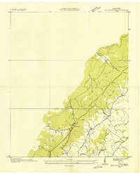
 1935 Mount Airy1935 Print · USGSBledsoe County is documented here in the mid-1930s, showing the agricultural valley between the plateau and the ridge. You can trace early family sites like Ewtonville Siding, Walkers Ford, and Sunny Side Sch along the river and rail lines.
 - 1935 Map of Vandever
 1935 Vandever1935 Print · USGSCumberland County saw significant changes in the 1930s as federal projects and new highways reshaped the plateau. Local historians can trace the early layout of Cumberland Homesteads and find landmarks like Hale Chapel and New Era Sch.
 - 1935 Map of Pikeville
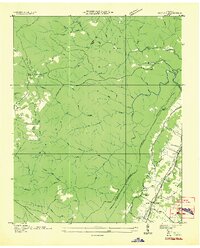
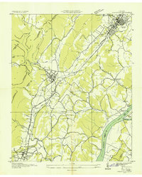
 1935 Pikeville1935 Print · USGSBledsoe County is documented here in the mid-1930s as the New Deal began reshaping the Sequatchie Valley. Researchers can trace ancestral locations through Shoemate Cem, locate the CCC Camp Sam Houston No 1466, or follow the Alvin C York Highway.
 - 1935 Map of Graysville
 1935 Graysville1935 Print · USGSRhea and Hamilton counties are shown in detail during the mid-1930s, caught between the ridge-and-valley terrain and the river. Genealogists can locate family landmarks like Welch Cem, trace the historic Blythe Ferry, or find CCC Camp No 3470.
 - 1935 Map of Smart Mountain
 1935 Smart Mountain1935 Print · USGSThe Cumberland Plateau highlands are captured here in the mid-1930s at the junction of Van Buren, Bledsoe, and Sequatchie counties. Local historians can trace the foundations of the community at the Hitchcock Sch and Hitchcock Cem near Smart Mtn.
 - 1936 Map of Henson Gap
 1936 Henson Gap1936 Print · USGSThe Tennessee highlands near Henson Gap are captured in the mid-1930s as the TVA modernization began to reach these rural ridges. Genealogists and local historians can trace family land near Lewis Chapel Sch, Davis Chapel Ch, and the banks of Soddy Creek.
 - 1936 Map of Grassy Cove
 1936 Grassy Cove1936 Print · USGSCumberland County life in the mid-1930s is defined by the unique karst geology of the plateau and its isolated mountain settlements. Researchers can pinpoint rural landmarks like Jewett Ch, the Linary Sch, and the high mountain pass at Key Reed Gap.
 - 1936 Map of Savage Point
 1936 Savage Point1936 Print · USGSThe high Cumberland Plateau meets the Sequatchie Valley during the mid-1930s, showing the early reach of regional power lines. Researchers can find family burial sites like Mc Laughlin Cem, the local Fredona Sch, and Travis Mill on the creek.
Showing maps 1-25 of 160
Top cities of Bledsoe County
Frequently asked questions
- What are the different types of historical maps available for Bledsoe County?
- What is the oldest map of Bledsoe County?
- Where can I purchase historical maps of Bledsoe County for my home or office?
- Where can I download high-res historical maps of Bledsoe County?
- Are there historical topographic maps available for Bledsoe County?
- Is there historical aerial imagery available for Bledsoe County?
- Where are historical maps of Bledsoe County sourced from?