1930s Maps of Maryville, Tennessee
Explore 6 historic maps of Maryville from the 1930s. These maps offer a rare glimpse into what life looked like during the 1930s — showing old roads, neighborhoods, homes, and landmarks that have changed or disappeared over time.
Whether you're researching your family's past, planning a metal detecting trip, or studying how Maryville's landscape evolved across the 1930s, these high-resolution maps are a powerful tool for exploring the history of this region.
- Focus on a specific era: All maps on this page are from the 1930s, giving you a focused view of this time period.
- See what’s changed: Compare century-old streets, trails, and buildings to today's modern landscape using overlays and satellite layers.
- Research with precision: Use these maps for genealogy, historical research, land use analysis, or educational projects.
- View, download, or print: Maps are fully viewable online in high resolution, and can be downloaded or printed for your own records.
Start exploring Maryville's history through authentic maps from the 1930s. This is your window into the past.
Maryville, TN maps
(6)- 1935 Map of Binfield
 1935 Binfield1935 Print · USGSBlount County in the mid-1930s is a landscape of rural schoolhouses and family-named ridges organized around the Louisville and Nashville Railroad. Researchers can trace the early layout of Brick Mill, locate the Carpenter Camp Ground, or find family roots at Seceded Cem.2 unique versions available
 - 1935 Map of Knoxville
 1935 Knoxville1935 Print · USGSKnoxville and its southern Blount County neighbors appear here in the mid-1930s as the TVA era begins. Researchers can trace family roots through Mt Olive Cem, locate the old Eastern State Hospital, or study the early layout of Sequoyah Hills.
 - 1935 Map of Maryville
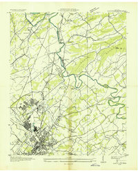 1935 Maryville1935 Print · USGSBlount County in the mid-1930s reveals a unique mix of industrial expansion and traditional rural life. Researchers can trace the early footprint of Alcoa and Maryville College, or locate family landmarks like Beech Grove Ch and Bungalow Town.
 - 1935 Map of Blockhouse
 1935 Blockhouse1935 Print · USGSBlount County appears here in the mid-1930s, just as the national park was taking shape along the Chilhowee ridgeline. Genealogists can locate family landmarks like Sixmile Cem, Old Piney Ch, and the historic resort grounds at Montvale Springs.2 unique versions available
 - 1936 Map of Louisville
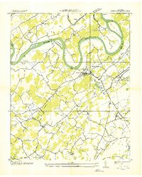 1936 Louisville1936 Print · USGSBlount County and the winding Tennessee River are captured here in the mid-thirties, showing a landscape defined by river bends and railroad stops. Genealogists can trace family roots through landmarks like Holston College, Lowe Ferry, and the settlement at Miser.
 - 1936 Map of Friendship
 1936 Friendship1936 Print · USGSEast Tennessee in the mid-1930s is documented here at a turning point for the river and rail landscape of Knox and Blount counties. Genealogists can trace family names at Mt Zion Ch, Martel Sch, and the riverside settlement of Louisville before the valley landscape was transformed.
End of results
Showing maps 1-6 of 6
Top cities near Maryville
- Knoxville historical maps
- Oak Ridge historical maps
- Farragut historical maps
- Alcoa historical maps
- Louisville historical maps
- Greenback historical maps
See more
Top neighborhoods of Maryville
- Scenic Terrace historical maps
- Sevier Heights historical maps
- Asbury Estates historical maps
- Buena Vista historical maps
- Sherwood Forest historical maps
- Creekwood historical maps
See more
Frequently asked questions
- What are the different types of historical maps available for Maryville?
- What is the oldest map of Maryville?
- Where can I purchase historical maps of Maryville for my home or office?
- Where can I download high-res historical maps of Maryville?
- Are there historical topographic maps available for Maryville?
- Is there historical aerial imagery available for Maryville?
- Where are historical maps of Maryville sourced from?