1930s Maps of Pinnacle, Tennessee
Explore 2 historic maps of Pinnacle from the 1930s. These maps offer a rare glimpse into what life looked like during the 1930s — showing old roads, neighborhoods, homes, and landmarks that have changed or disappeared over time.
Whether you're researching your family's past, planning a metal detecting trip, or studying how Pinnacle's landscape evolved across the 1930s, these high-resolution maps are a powerful tool for exploring the history of this region.
- Focus on a specific era: All maps on this page are from the 1930s, giving you a focused view of this time period.
- See what’s changed: Compare century-old streets, trails, and buildings to today's modern landscape using overlays and satellite layers.
- Research with precision: Use these maps for genealogy, historical research, land use analysis, or educational projects.
- View, download, or print: Maps are fully viewable online in high resolution, and can be downloaded or printed for your own records.
Start exploring Pinnacle's history through authentic maps from the 1930s. This is your window into the past.
Pinnacle, TN maps
(2)- 1931 Map of Ridgetop, 1957 Print
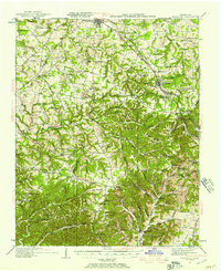 1931 Ridgetop1957 Print · USGSUpper Middle Tennessee in the early thirties reveals a landscape of ridge-top towns and deep hollows. Genealogists can trace family footprints through dozens of rural landmarks like St Michaels Ch, Gordons Store, and the old Ridgetop Sta.2 unique versions available
 - 1935 Map of Ridgetop
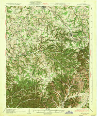 1935 Ridgetop1935 Print · USGSNorthern Tennessee's ridge country is captured here between the mid-twenties and early thirties, showing a landscape tied to the Louisville and Nashville railroad. Genealogists can trace family roots through numerous local landmarks like Bethlehem Sch, Gordons Store, and St Michaels Ch.2 unique versions available
End of results
Showing maps 1-2 of 2
Top cities near Pinnacle
- Nashville historical maps
- North Nashville historical maps
- Goodlettsville historical maps
- Springfield historical maps
- White House historical maps
- Millersville historical maps
See more
Frequently asked questions
- What are the different types of historical maps available for Pinnacle?
- What is the oldest map of Pinnacle?
- Where can I purchase historical maps of Pinnacle for my home or office?
- Where can I download high-res historical maps of Pinnacle?
- Are there historical topographic maps available for Pinnacle?
- Is there historical aerial imagery available for Pinnacle?
- Where are historical maps of Pinnacle sourced from?